Much of the Northern Territory’s Top End has had a drier than normal wet season so far but is likely to end it in a wet way.
Showers and thunderstorms become an increased chance over the next few days as a pulse of moist, unstable air moves in from the east. Showers and storms become a chance each day for almost all locations in the Top End from mid-this week until mid-next week.
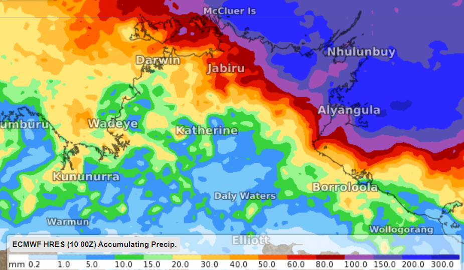
The wettest area is expected to be Arnhem where instability and moisture should be greatest and where a tropical low is a chance to form.
Seven-day rainfall has the potential to exceed 200 millimetres in eastern Arnhem and amount to 50-100mm for most of the remainder of the Top End, including the Darwin area.

Image: ECMWF forecast rainfall for the period Monday 11th April to Tuesday 19th April.
A tropical low may form in Arafura Sea on the weekend, however there is a very low chance that this system will intensify into a cyclone. For more information on Weatherzone’s rainfall, storm and tropical cyclone forecasts, please contact us at business@weatherzone.com.au.


