Ex-Tropical Cyclone Charlotte is bringing some much-needed rain to parts of WA, with more potentially heavy falls on its way. Moisture associated with Ex-Tropical Cyclone Charlotte caused widespread showers across the western inland and parts of the western and southern coasts in WA on the weekend.
The Wheat Belt saw the largest totals over the weekend with Kalannie recording 78mm in the 24 hours leading up to 9am on Sunday, March 27. This rain is set to continue this week as Charlotte lingers off the coast and another low pressure system develops to the south of Christmas Island, which will continue to feed tropical moisture over WA.
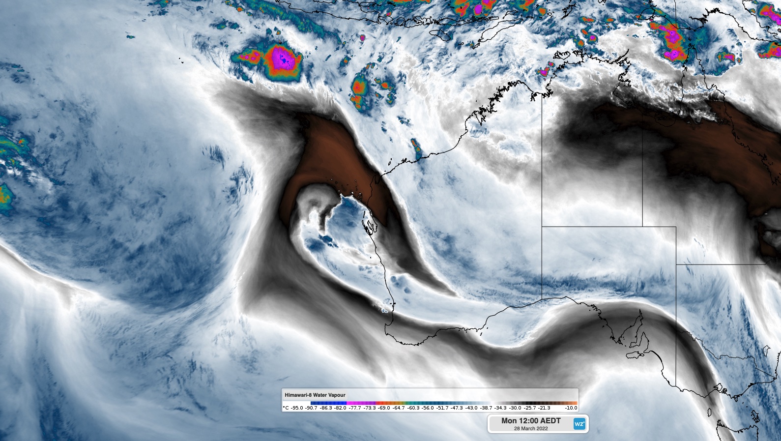
Severe thunderstorms and heavy rainfall have already affected parts of the Central West District on Monday morning, March 28, with Carnamah East recording 20mm of rainfall in the 30 minutes leading up to 6:30am on Monday. The image below shows showers and Thunderstorms moving over the Central West on Monday Morning.

Rain and thunderstorms will develop across a broad area of WA from Monday to Wednesday a tropical moisture feeds across the state. The map below shows the predicted accumulated rain over these three days combines.

Looking further ahead, another tropical low may develop to the south of Christmas Island during the next 48 hours. The system is likely to track south to southeast and could come close to the Pilbara and Gascoyne coasts, increasing rainfall in this region later in the week.
Most models are indicating that the low will remain below tropical cyclone strength, but it is still likely to enhance shower and storm activity in far northwest WA from Thursday. Warnings will be issued later in the week if this developing low is expected to cause severe weather in WA. For more information on Weatherzone’s tropical cyclone, heavy rainfall and thunderstorm forecasting, please contact us at business@weatherzone.com.au.


