
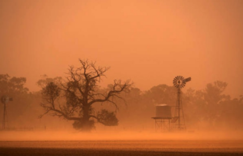
Weatherzone’s Blast Dispersion Modelling is a comprehensive weather, environmental and alerting system, enabling you to run simulations days in advance.
Entirely customised to your mining site, our dispersion services take precise weather forecasts, topography, pollutants and legislative requirements into account, leaving no stone unturned.
As simulations are run, you can visualise the trajectory and intensity of pollutants in relation to the local forecast and pre-set thresholds. Dust monitors and Tapered Element Oscillating Microbalance (TEOM) heighten forecast accuracy. With a clear, projected outcome you can pin-point the best day to blast.
Our cloud-based, fully auditable report trails assist you in fulfilling your license and legislative requirements. As blasts are executed supervisors and managers can add their pre and post blast observations to ensure requirements are met.
Let us help you make your critical decisions on when to blast, simple.

When in-depth consideration of the surrounding towns and environment is required, you need to be precise in your projections. Powered by Opticast™, Weatherzone’s advanced nowcasting and forecasting system, you can rest assured that reliability and accuracy are the bedrock for our dispersion modelling. Results are globally proven to give you peace of mind.
Environmental and weather monitoring are brought to you by the experts in meteorology, with a globally proven track record.
All data for your environmental observations and blast simulations are intelligently presented to keep full comprehension simple.
Clean and informative reports on both blast simulations and executed blasts give you an auditable trail, keeping you compliant.

An integrated Fume Management Zone (FMZ) tool adds to the depth of your blast planning. A logical traffic light system indicates whether your simulated blast creates pollutants that are above or below pre-set thresholds at any ‘virtual’ or existing monitors. You can create FMZs within the system, making it simple to plan and mitigate against risk. All these details are easily visualised in clean and informative reports, allowing you to justify your decision making on when to blast.
Your needs are as individual as your business, and we collaborate with you to bring ease to your every day. Our teams of meteorologists and data scientists are there, every step of the way, to help you navigate your challenges.
We don’t do status quo, choosing instead to lead with next-generation science and a service tailored to you.

The Bureau of Meteorology has officially declared El Niño over and the El Niño Southern Oscillation (ENSO) is now inactive for the first time since 2021, meaning there is no immediate sign of either an El Niño or a La Niña event. “El Niño has ended and the El Niño–Southern Oscillation (ENSO) has returned to neutral. Climate models […]
A rare sight of fog graced Kalgoorlie in the early hours of Sunday morning, starting from around 5am, peaking just after 6am as the sun rose, and lifting by 7am as winds started to pick up. Images (west-facing) on Sunday, April 14 AWST: (Top)- Kalgoorlie at 6:09am, and (Bottom) – Kalgoorlie at 7:14am (Bureau […]
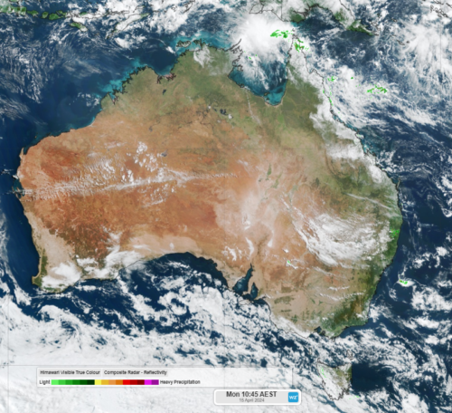
Solar output across large areas of Australia should peak this week, with many areas not expected to receive a drop of rain. The dry week across WA, parts of the NT, SA and Vic this week comes as blocking high pressure systems prevent any major cold fronts from impacting the regions this week. The satellite […]

New data released overnight gives La Niña nearly a 90% chance of returning this spring, as the ocean continues to cool in the tropical eastern Pacific. The Pacific Ocean has been in an El Niño phase since September 2023, peaking between November to December 2023 at about 2°C, which is classified as a strong event. […]
