The monsoon trough is deepening over northern Australia and is set to bring heavy rainfall and frequent gusty thunderstorms across this week.
The deepening monsoon trough and associated convective activity have already caused and increase in rain and allowed a couple of low pressure systems to develop.
One of these low pressure systems developed to the north of the Kimberley late last week. While there were indications that this low could become a tropical cyclone, this now looks unlikely, with the low’s proximity to land restricting its development. This low is expected to weaken on Monday and has a very low chance of developing into a tropical cyclone.
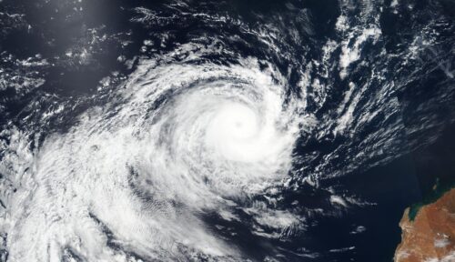
The satellite image below shows another tropical low to the northwest of the Cocos Islands on Monday morning. This low may briefly move into Australia’s Western Region on Tuesday, before moving west again out of the region. This system will pose no direct threat the mainland of Australia and is also unlikely to develop into a tropical cyclone.
Image: The satellite image shows another low to the northwest of the Cocos Islands, the green circle is highlighting its location.
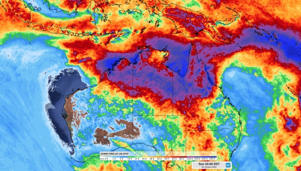
However, while tropical cyclones look unlikely this week, the lows and monsoonal trough are likely to enhance rainfall and bring severe storms to a broad area of northern Australia extending from the Kimberley, across the northern NT and into eastern tropical QLD.
The image below shows this week’s forecast accumulated rainfall, with large rainfall totals expected across northern Australia. With active periods of the monsoon, widespread weekly rainfall totals will likely be more than 100 millimeters, with some places likely to see several hundred millimeters by the end of this week.
Image: ECMWF weekly accumulated forecast rainfall to 11pm Sunday, January 30.
The main threats during this week’s monsoon burst will be heavy rain, flooding, lightning and damaging winds. For more information on Weatherzone’s tropical cyclone, heavy rainfall alerting and thunderstorm forecasting, please contact us at business@weatherzone.com.au.


