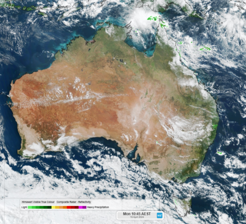
Australia’s climate varies greatly throughout the eight states and territories, which certainly keeps Australian businesses on their toes.
In some parts of Australia, winter is marked with frosts and freezing temperatures, while heatwaves and extreme temperatures are frequent in the summer months.
The huge contrast in the seasonal temperatures in Australia is a challenge for businesses in the energy market.
Accurate temperature forecasting is one of the most critical elements in electricity demand forecasting.
Of course, humidity, solar, precipitation and wind speed each play a critical role too, but extreme temperatures is where the energy market sees huge variations in demand. This is particularly true for extended heat waves that can occur in summer.
Temperature fluctuations can affect key infrastructure like transmission lines, especially extreme heat.
Solcast, a Weatherzone partner, has developed Oracle, which accurately forecasts temperature, wind, rain, cloud and lightning up to 3 hours in advance.
Before we start, let’s briefly recap on what model resolution is.
Weather models separate Earth into a three-dimensional grid, each grid cell varies in size depending on the model. The model forecasts temperature, wind, cloud etc. in each grid cell across Australia, and in some model’s case over the entire world.
A resolution of 2km means the grid size is 2km squared, which captures a higher level of detail compared to that of a 9km resolution (9km squared grid size).
The higher the resolution of the model (small grid size or resolution below 2km), the more likely it is to capture small temperature changes based on topography.
Oracle is a satellite derived gridded nowcasting system that forecasts these fields at a 1-2km resolution and updates every 5 minutes, as it is taking observations of satellite data and adapts its forecasts. Typical weather model resolution is around 9-12km, which captures far less detail than Oracle (figure 1).
The Great Dividing Range is shown clearly in Oracle’s temperature forecast (figure 1) by the cool temperature gradient at different elevations.
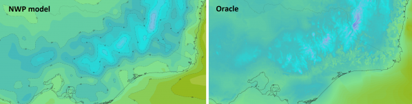
Figure 1: Model comparison of temperature forecast at 10am AEST, June 25.
The higher the resolution of the model, the more likely it is to capture small temperature variations caused by topography, rivers and sea breezes etc.
Oracle has many other fields that are useful when forecasting energy demand.
Oracle not only improves energy demand forecasting and delivers responsive forecasts that update rapidly based on observations. It also gives visibility on low or high wind, solar and extreme temperature events.
For more information on Oracle please contact us at business@weatherzone.com.au.