A cold front will cause damaging winds, large swell, thunderstorms and showers in NSW during the next 48 hours.
Sydney and Brisbane are both having a warm start to the week as northerly winds flow over eastern Australia ahead of the approaching cold front.
However, the front will bring an abrupt cool change in both cities later today and tomorrow. The cold front will also fuel rain and thunderstorms as it spreads over northeast Victoria, NSW, and the ACT on Monday, before a low-pressure system develops in the Tasman Sea on Tuesday.
This low will cause strong and gusty winds to develop along the entirety of the NSW coastline, along with large swell south of the Mid North Coast on Tuesday.
Winds
A strong and gusty south to southwesterly change is expected to move its way up the NSW coast during Monday evening and Tuesday morning with the cold front.
Ahead of this change, west to northwesterly winds are set to pick up during this afternoon and evening, with average winds exceeding 20 knots (37 km/h) during this period.
Winds will strengthen and tend southwesterly on Tuesday as a low-pressure system deepens in the Tasman Sea.
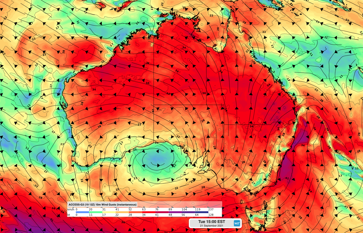
Sustained west to southwesterly winds are likely to exceed 25 knots (46 km/h) throughout the day on Tuesday at the NSW ports (figure 1). The strongest winds are likely to occur in the afternoon, when sustained winds should reach 30-35 knots (56-65 km/h) and gusts of 40-45 knots (74-83 km/h) are possible.
Thunderstorms and showers are both on the forecast in eastern NSW on Tuesday, which are likely to be gusty with possible hail.
Sustained winds exceeding 20 knots are likely to continue Wednesday morning at the NSW ports, before easing later in the day.
The deepening low pressure system will also cause wave heights to increase significantly on Tuesday and Wednesday.
Wave heights could reach around 2-4 metres along the southern and central NSW coasts, which has prompted a Hazardous Surf warning for some coastal waters.
On Wednesday, average wave heights are likely to begin at around 2-3 metres before gradually tapering off to around 1 metre by the evening.
Looking ahead, the low-pressure system is likely to move further away from the NSW coast on Wednesday, allowing conditions to improve in the middle of the week.
However, another cold front is expected to sweep over the nation’s southeast again later this week, bringing another bought of strong winds for the NSW ports on the weekend.
Weatherzone provides ports around Australia with 7-day forecasts of wind, swell and thunderstorms, which enables our clients to plan in advance. For more information, please contact us at business@weatherzone.com.au.

