A cloud of volcanic ash and gas can be seen passing over QLD today, turning the sky red and disrupting flights in the region.
A large plume of ash and gas was ejected into the atmosphere on Saturday when the Hunga Tonga Hunga Ha’apai erupted near Tonga.
Since then, the volcanic cloud has been travelling through the stratosphere towards Australia.
The satellite images below show the cloud of ash/gas passing over QLD on Monday.
Video: Visible satellite imagery showing the ash cloud move from east to west over QLD on Monday.
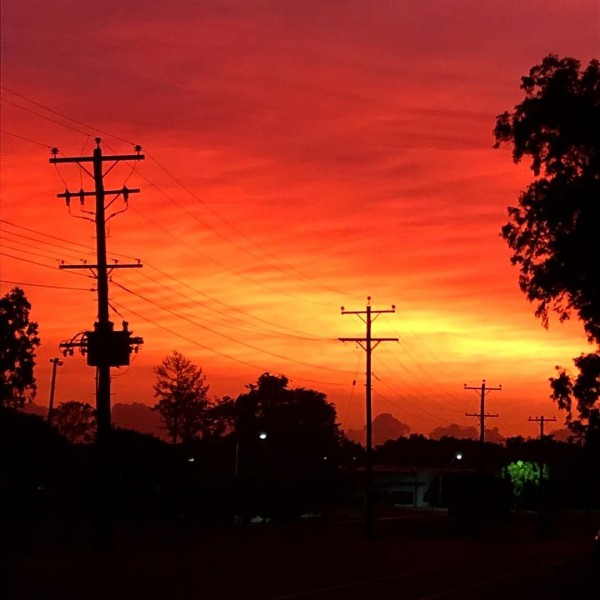
The ash cloud is travelling more than 40,000 feet (around 12km) above sea level, which means it’s too high up in the atmosphere to directly impact Queensland. The ash cloud is however causing flight disruptions in Australia and brought an eerily beautiful sunrise across Queensland on Monday morning.


Images: Volcanic sunrise in Cairns on Monday morning, as light from the rising sun illuminated the underside of a volcanic ash cloud passing over QLD. Source: Russ Reynolds (top), @gumguy_cns/Instagram (middle) and @globalgourmetqldcairns/Instagram
How does volcanic ash disrupt aviation?
Volcanic ash is composed of fine rock, minerals, glass and gas which can cause a loss of thrust and/or engine failure in aircraft. For this reason, volcanic ash can be life-threatening to aircraft passengers and pilots.
Volcanic ash warnings are issued so aircraft can avoid this deadly cloud. When the ash cloud is thick and unavoidable, aircraft can be grounded for days, causing passengers and cargo to remain stuck at their location.
Fortunately, aircraft flying across Queensland on Monday will be able to avoid the ash cloud by flying below it. Typically, domestic aircraft fly between 30,000 and 40,000 feet and the ash cloud is located between about 42,000 and 63,000 feet.
However, there may be some minor disruptions to flight schedules as restrictions are applied to certain flight levels over QLD. For more information on Weatherzone’s aviation services, please contact us at business@weatherzone.com.au.