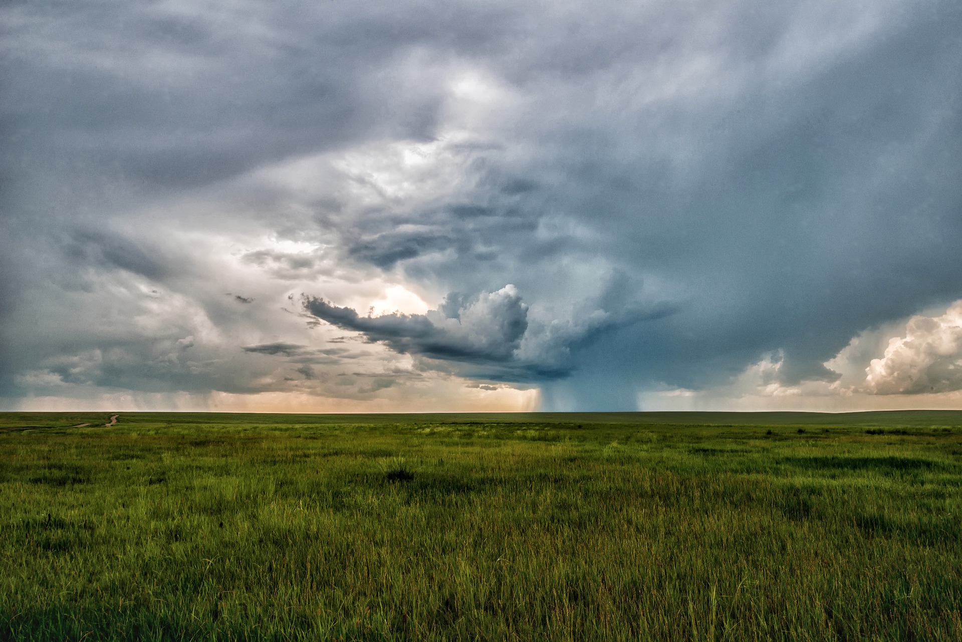
One of Australia’s lesser-known climate drivers will have a big impact on Australia’s weather during the last two months of 2021.
The Southern Annular Mode, often referred to as SAM, is an index that measures the position of a belt of westerly winds that flows around Antarctica. The position of these westerly winds can have a big influence on the weather in southern and eastern Australia.
Negative SAM
When the SAM is in a negative phase, the belt of westerly winds is located further north than usual for that time of year.
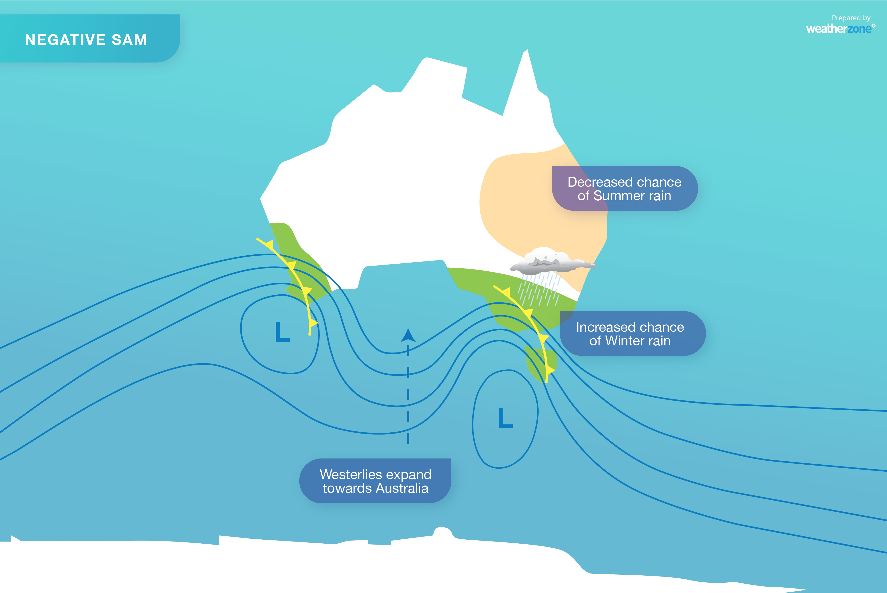
If this happens during winter, it usually causes more rain and stronger winds across southern Australia, while delivering drier-than-usual weather to eastern Australia.
However, when the SAM is negative during summer, large areas of southeastern and eastern Australia are typically drier than usual, due to an increase in winds blowing towards eastern Australia from the dry interior.
Positive SAM
When the SAM is in a positive phase, the belt of westerly winds is located further south than usual for that time of year.
A positive SAM in winter promotes dry weather and lighter winds in southern Australia, and above-average rain over Australia’s eastern states.
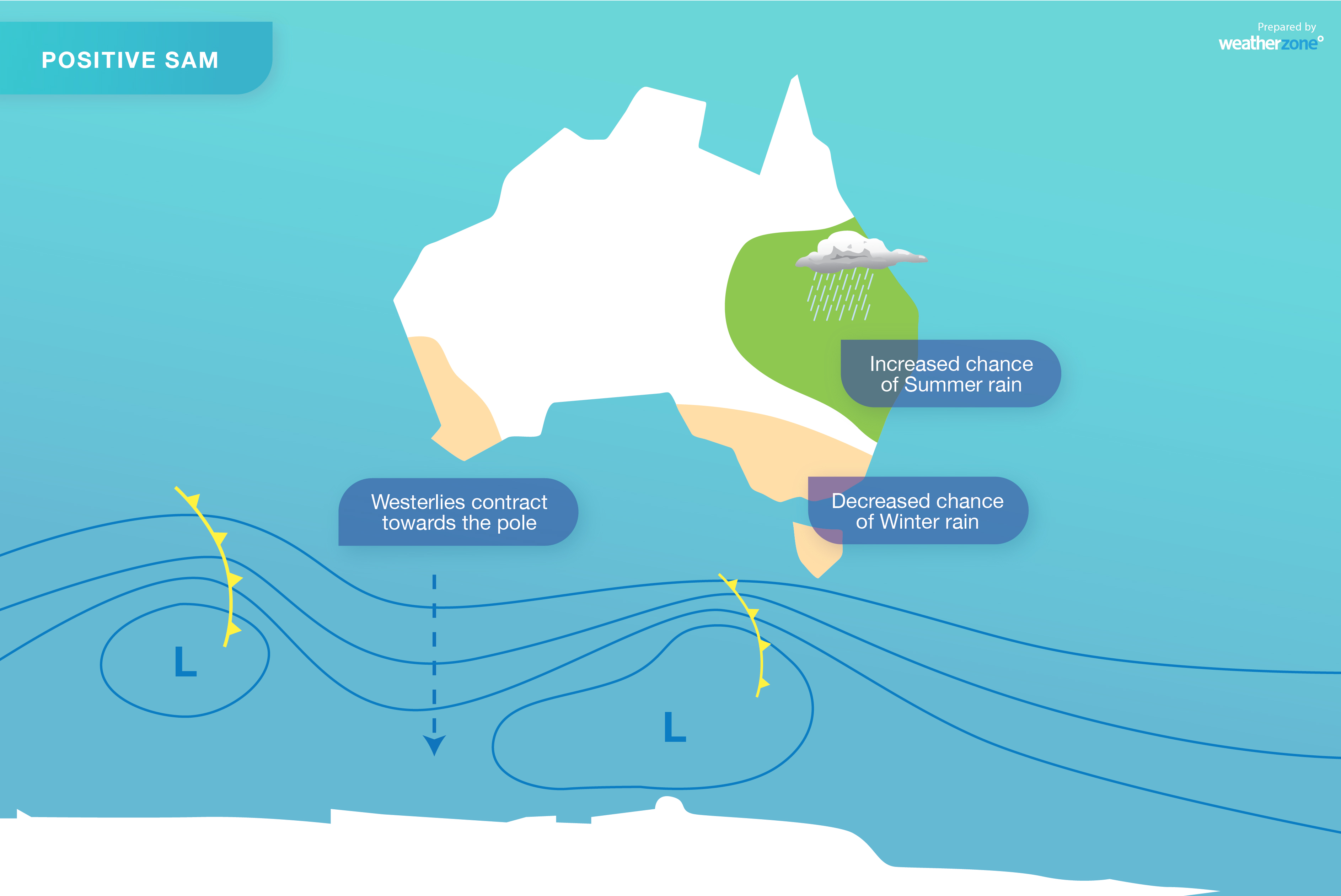
During summer (and late spring), a positive SAM often boosts rainfall across eastern and southeastern Australia, by enhancing the onshore flow of moisture-laden air from the Tasman and Coral Seas.
The SAM is currently positive phase and is expected to stay in a generally positive phase for the rest of this year. This will increase the likelihood of above-average rain over Australia’s eastern and southeastern states during November and December.
Unsurprisingly, forecast models are predicting widespread and heavy rain in QLD, NSW, the ACT, VIC and TAS during the next 10 days, along with some other areas of central and northern Australia.
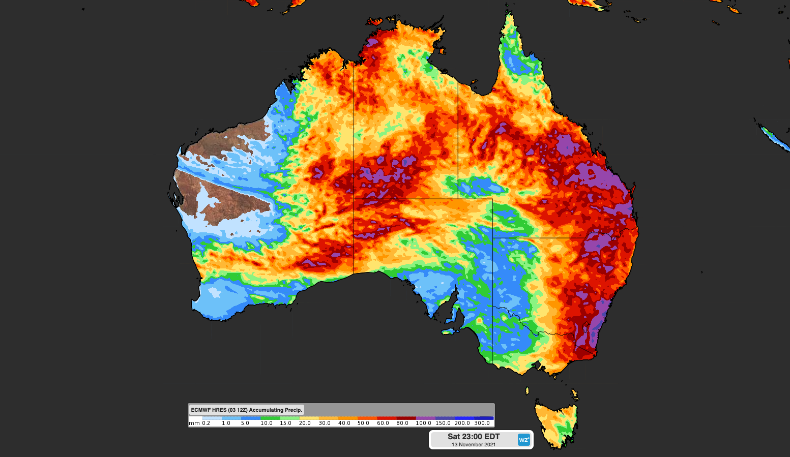
Image: Forecast accumulated rain during the 10 days ending on Saturday November 13th, 2021, according to the ECMWF-HRES model.
For more information on our wind, rain and storm forecasting, please contact us at business@weatherzone.com.au.


