What a turnaround in Melbourne weather. After the driest March in 170 years of records, Melbourne just had its heaviest day of April rain in 47 years and its wettest day in any month in a tick over four years.
- Just 2.8 mm was recorded in Melbourne’s gauge at Olympic Park during the whole of March 2024.
- In the 24 hours to 9 am this Tuesday, April 2, a total of 53.2 mm of rain was recorded.
- That made it the wettest Melbourne day in any month since March 5, 2020.
The very welcome autumn rain was widespread across Victoria on Monday and into Tuesday morning as a trough and associated cold front crossed the state.
And Melbourne was directly in the firing line. As you can see on the chart below where orange dots represent totals between 50-100 mm, the central part of Victoria received the heaviest falls.
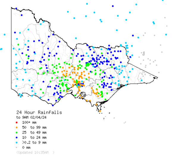
Source: BoM.
You can see even more clearly how the Melbourne area saw the heaviest precipitation from the system crossing southern Australia when you pan out the map to show the whole country.
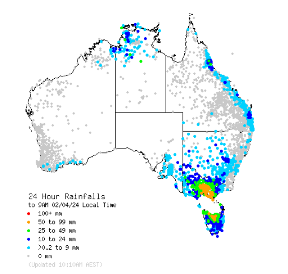
Source: BoM.
As the orange blobs reveal, northern Tasmania also received heavy rain, as did Wilsons Promontory Lighthouse with 62.2 mm, its heaviest day of April rain in 123 years.
“The Prom”, as Victorians call Wilsons Promontory, is of course mainland Australia’s southernmost point, and while it technically lies in Victoria’s West and South Gippsland forecast district, locals will tell you that the weather forecast for northern Tasmania is a more reliable indicator of Prom weather.
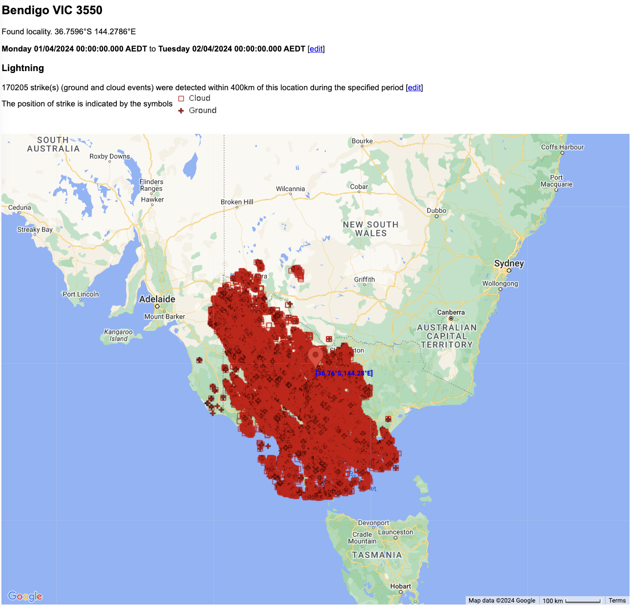
Lightning was also a factor in Sunday’s weather, with an incredible 170,205 strikes detected by Weatherzone’s Total Lightning Network. Indeed, the inevitable victory of the Geelong Cats over the Hawthorn Hawks in the AFL match at the MCG was delayed by more than 40 minutes due to lightning.
Meanwhile the trough that brought the heavy rain to Vic and Tas is currently crossing NSW, delivering light to moderate falls to parts of that state, but nothing in the magnitude of what Victoria received.
Temperatures are considerably cooler in Victoria today post-front, and the airmass will dry out throughout the working week, although showers are still possible in the next day or two, especially in coastal and mountain parts of the state.
Stormtracker is a severe weather solution that can assist you in observing, in real-time, any storm or event that has the potential to impact your business.
Embedded in Weatherzone Business’ industry interfaces, the system gives you a time advantage when monitoring conditions developing over your infrastructure and location.
Stormtracker is our Global Information System (GIS) tracking tool, providing multiple weather layers and zoom controls overlaid on a map of your location and infrastructure. You can choose a snapshot or full screen view, depending on your requirements. The maps allow you to monitor all weather, and specifically any systems likely to cause risk for your business. You also have the capacity to observe:
- real time lightning and thunderstorm alerts
- localised lightning strike frequency
- official warnings for storm, cyclone, wind, flood and fire
- sentinel hotspot fires and fire agency current incidents
Stormtracker’s radar imagery updates every 10 minutes, so you are always able to respond rapidly to changing conditions. You can customise alerting to notify you when your staff or infrastructure are under threat. With increased situational awareness, your ability to make informed decisions quickly is optimised.
Weatherzone Business’ experience and intelligence gives you a clear path through complex situations. Let us assist you, offering actionable insight when extreme weather poses risk to your business. For more information, please contact us at business@weatherzone.com.au.