
Weatherzone’s Blast Dispersion Modelling is a comprehensive weather, environmental and alerting system, enabling you to run simulations days in advance.
Entirely customised to your mining site, our dispersion services take precise weather forecasts, topography, pollutants and legislative requirements into account, leaving no stone unturned.
As simulations are run, you can visualise the trajectory and intensity of pollutants in relation to the local forecast and pre-set thresholds. Dust monitors and Tapered Element Oscillating Microbalance (TEOM) heighten forecast accuracy. With a clear, projected outcome you can pin-point the best day to blast.
Our cloud-based, fully auditable report trails assist you in fulfilling your license and legislative requirements. As blasts are executed supervisors and managers can add their pre and post blast observations to ensure requirements are met.
Let us help you make your critical decisions on when to blast, simple.

When in-depth consideration of the surrounding towns and environment is required, you need to be precise in your projections. Powered by Opticast™, Weatherzone’s advanced nowcasting and forecasting system, you can rest assured that reliability and accuracy are the bedrock for our dispersion modelling. Results are globally proven to give you peace of mind.
Environmental and weather monitoring are brought to you by the experts in meteorology, with a globally proven track record.
All data for your environmental observations and blast simulations are intelligently presented to keep full comprehension simple.
Clean and informative reports on both blast simulations and executed blasts give you an auditable trail, keeping you compliant.

An integrated Fume Management Zone (FMZ) tool adds to the depth of your blast planning. A logical traffic light system indicates whether your simulated blast creates pollutants that are above or below pre-set thresholds at any ‘virtual’ or existing monitors. You can create FMZs within the system, making it simple to plan and mitigate against risk. All these details are easily visualised in clean and informative reports, allowing you to justify your decision making on when to blast.
Your needs are as individual as your business, and we collaborate with you to bring ease to your every day. Our teams of meteorologists and data scientists are there, every step of the way, to help you navigate your challenges.
We don’t do status quo, choosing instead to lead with next-generation science and a service tailored to you.
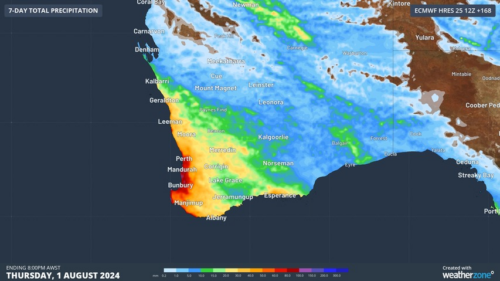
Another showery night in Perth has delivered enough rain to make this Perth’s first wetter-than-average month in more than one year. The animation below shows showers streaming over Perth and other areas of southwestern Australia late on Thursday. This wet weather was caused by persistent onshore winds along the west coast of WA, and the […]
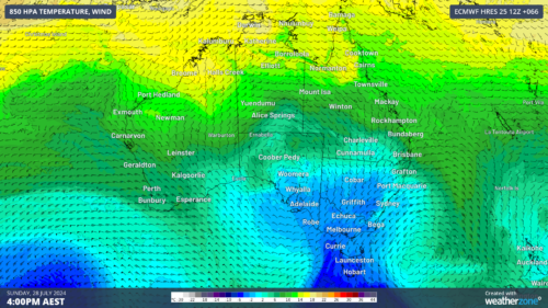
A frigid airmass originating from Antarctica is on its way to Australia on Friday, with the southeastern states expected to shiver through a prolonged cold spell. This airmass will arrive behind a cold front over the weekend and will linger over southeastern Aus well into next week. The satellite image below shows the cold front […]
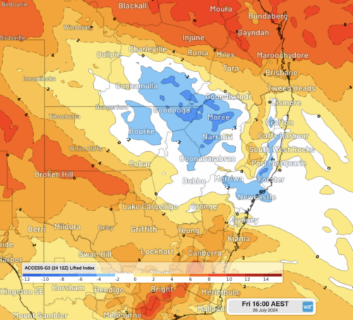
The weather is feeling quite spring-like over northern NSW and southern Queensland, with warm days, smoke from hazard reduction burns and even a chance of thunderstorms on Thursday and Friday. Northerly winds ahead of a trough and cold front are creating a very mild winter’s day, with temperatures 4-7 degrees above the July average across […]
A wet spring could be on the cards for large parts of Australia, with several models suggesting a negative Indian Ocean Dipole could develop in the Indian Ocean. A negative Indian Ocean Dipole (IOD) refers to a pattern of sea surface temperatures in the tropical Indian Ocean that causes more moisture-laden air to flow towards […]
