Heavy rainfall of up to 300mm is expected this Friday and Saturday for southeast Queensland and eastern NSW, as a powerful cut-off low and a moisture-rich coastal trough combine.
A pool of cold air currently crossing the Great Australian Bight is expected to produce an upper-level low pressure system over southeastern Australia by Thursday. This system will start by producing thunderstorms and heavy rain over inland parts of southern Qld, and northeast NSW on Thursday.
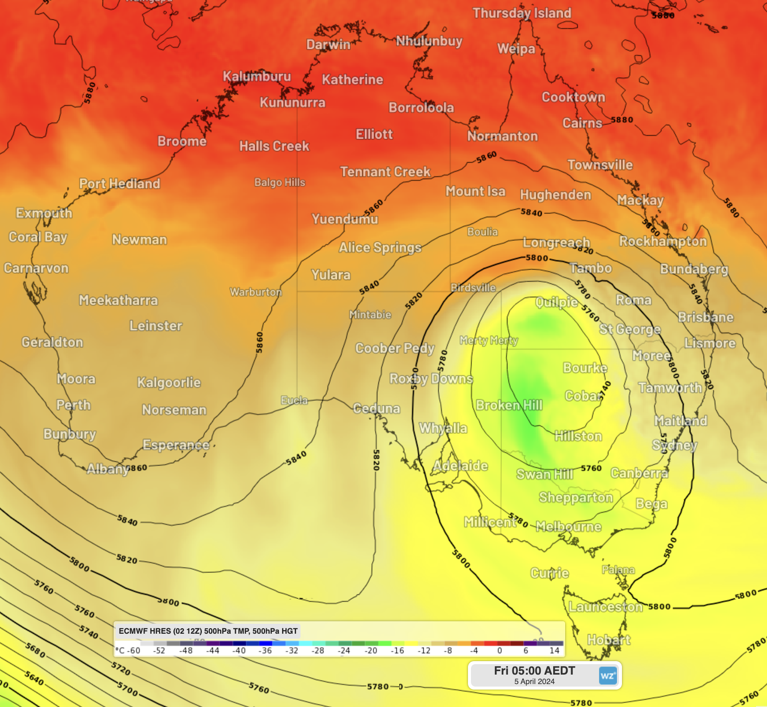
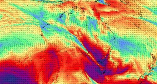
Image: Forecast temperature and height at 500hPa on Friday morning, showing a cold-core cut-off low established over NSW.
At the same time, a coastal trough will start to form off the NSW and southeast Qld coasts, spurred on by very warm ocean temperatures extending down the East Australian Current (EAC). A coastal trough funnels tropical moisture from the north, as well as moisture from EAC onto the coast, where the Great Dividing Range helps precipitate out the moisture, leading to heavy rainfall.
When a cut-off low and coastal trough interact at the same time, it is often a recipe for heavy rainfall and flooding along the east coast. The cold upper air cools down the warmer, saturated air, forcing large amounts of moisture to fall as rain. Similar conditions to these were seen numerous times in 2022, Sydney’s wettest year on record, including in February, March, July and October.
This type of event has a defined meteorological name: a ‘Black Nor’easter‘. A Black Nor’easter gets its name from the darkness of the moisture-rich clouds coming in from the northeast, that can turn the middle of the day as dark as twilight, first dubbed in the early 1800s.
How much rainfall is expected?
Friday will be the most impactful day of this combined system’s life, with widespread falls of 50 to 100 mm expected from Brisbane down to the NSW South Coast, as well as a sizeable portion of western NSW. The system will then head further south towards Victoria and eastern Tasmania over the weekend.
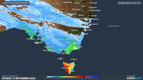
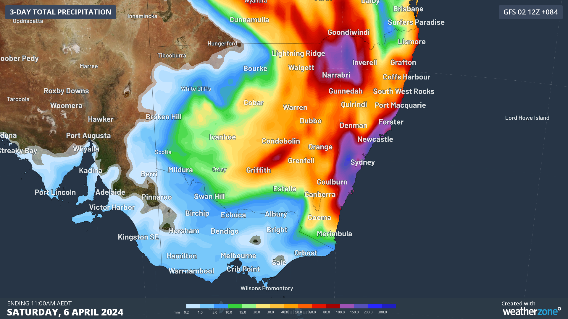
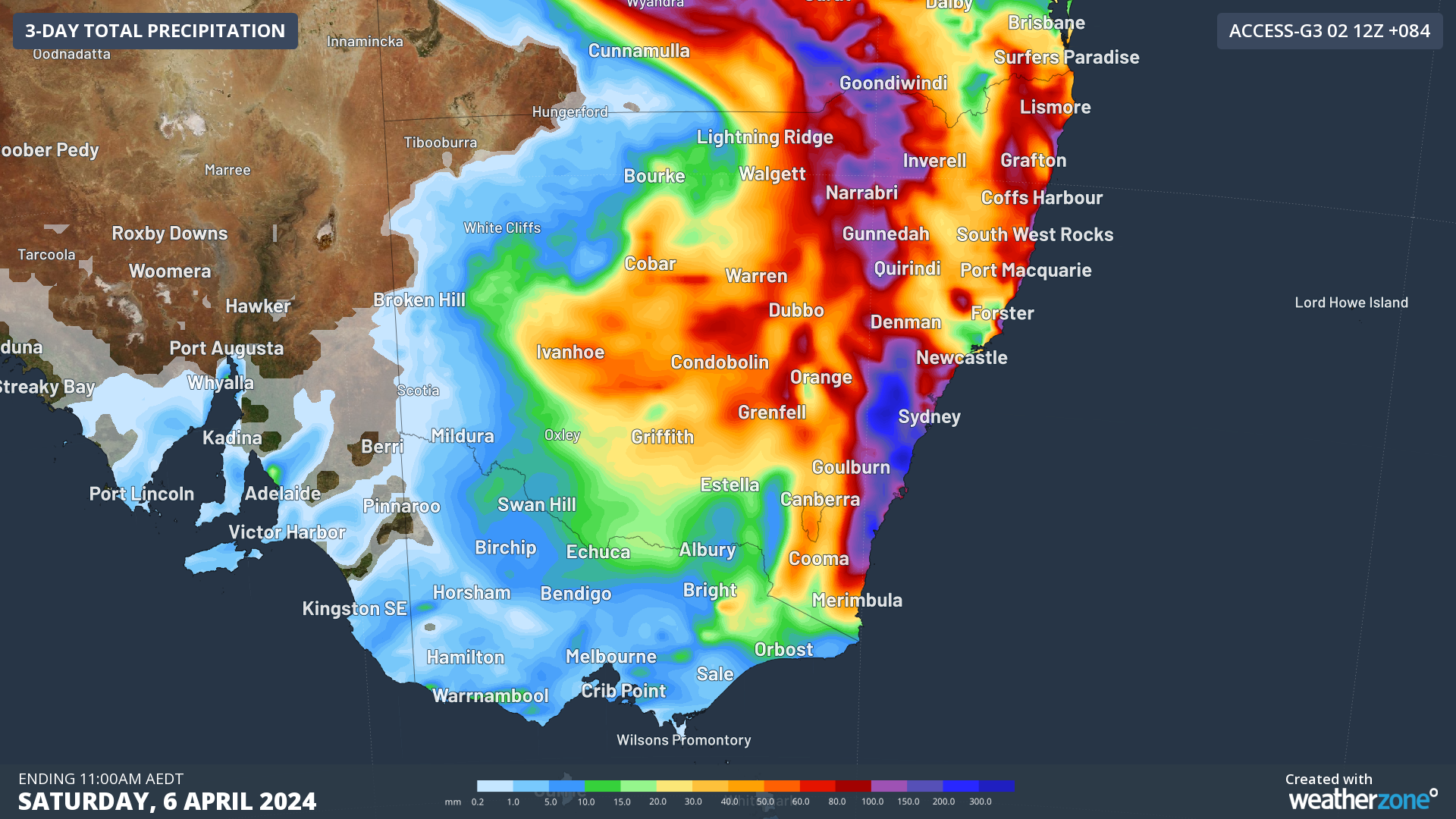
The below images show forecast 72-hour rainfall leading up to Saturday 11am from ECMWF, GFS, ACCESS-G and the UKMO models. While there is a spread on the locations of the heaviest rain, all agree on the general formation and trajectory of the system.
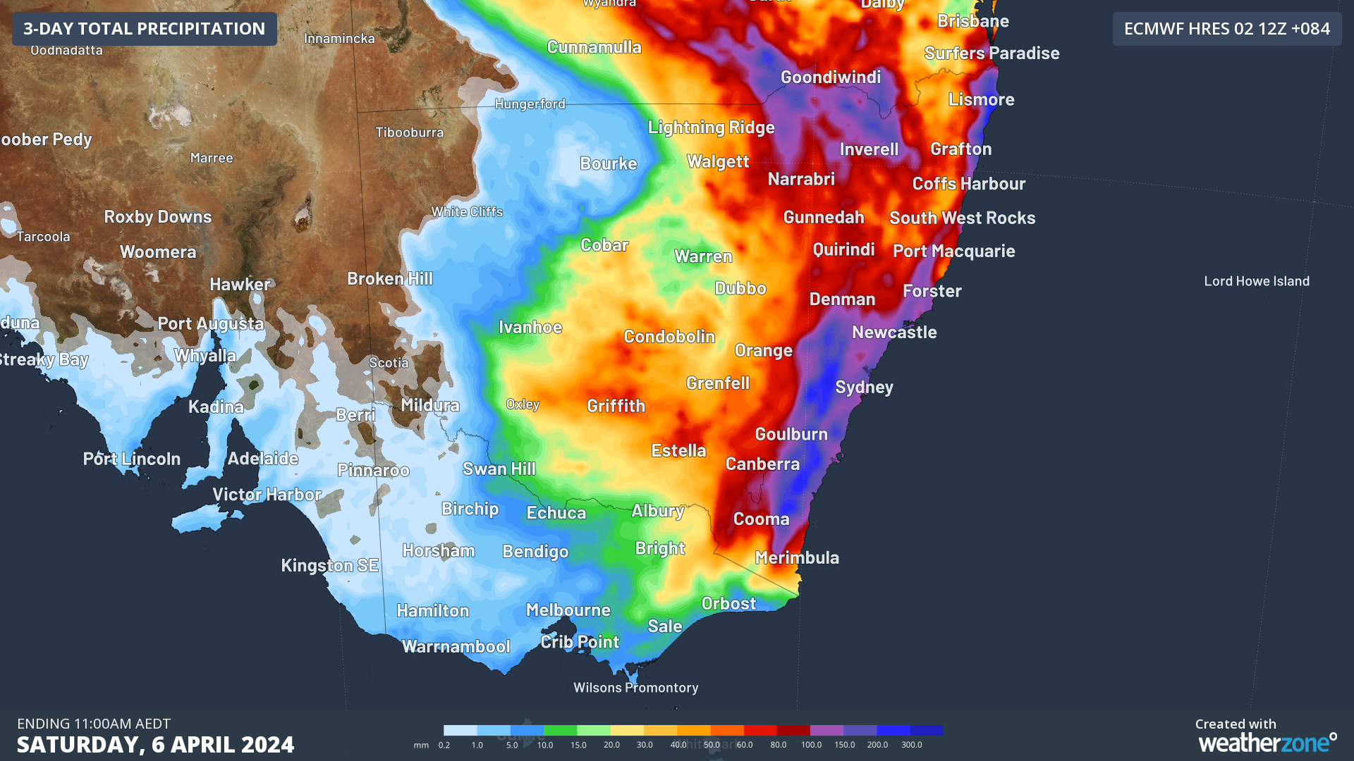
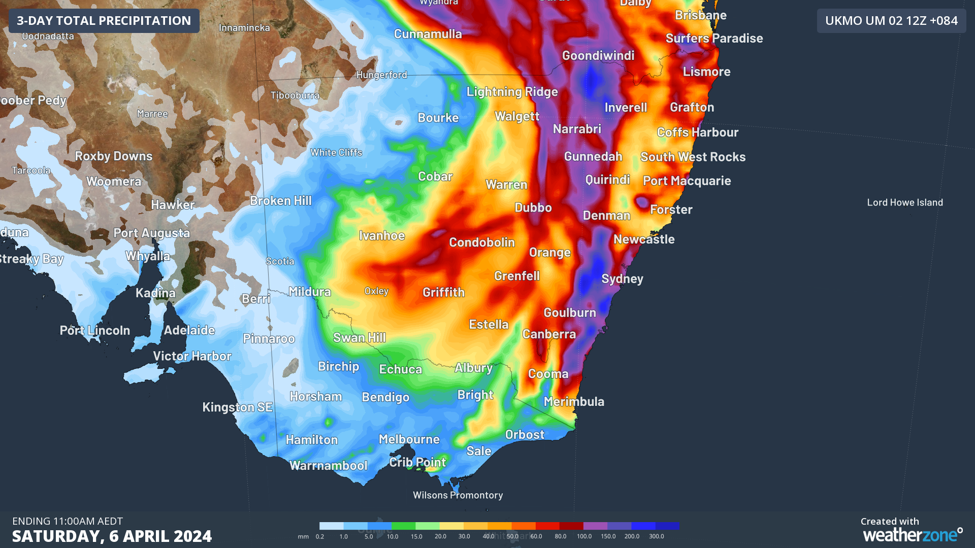
The heaviest falls could exceed 200-300 mm, most likely for Sydney, the Blue Mountains and the Illawarra. Some models are showing rainfall as high as 80-150 mm falling in just 6 hours, with severe thunderstorms possible in these regions. Similar heavy falls are also possible for the NSW Northern Tablelands, North West Slopes & Plains, and Qld’s Darling Downs and Granite Belt during Thursday and Friday mornings.
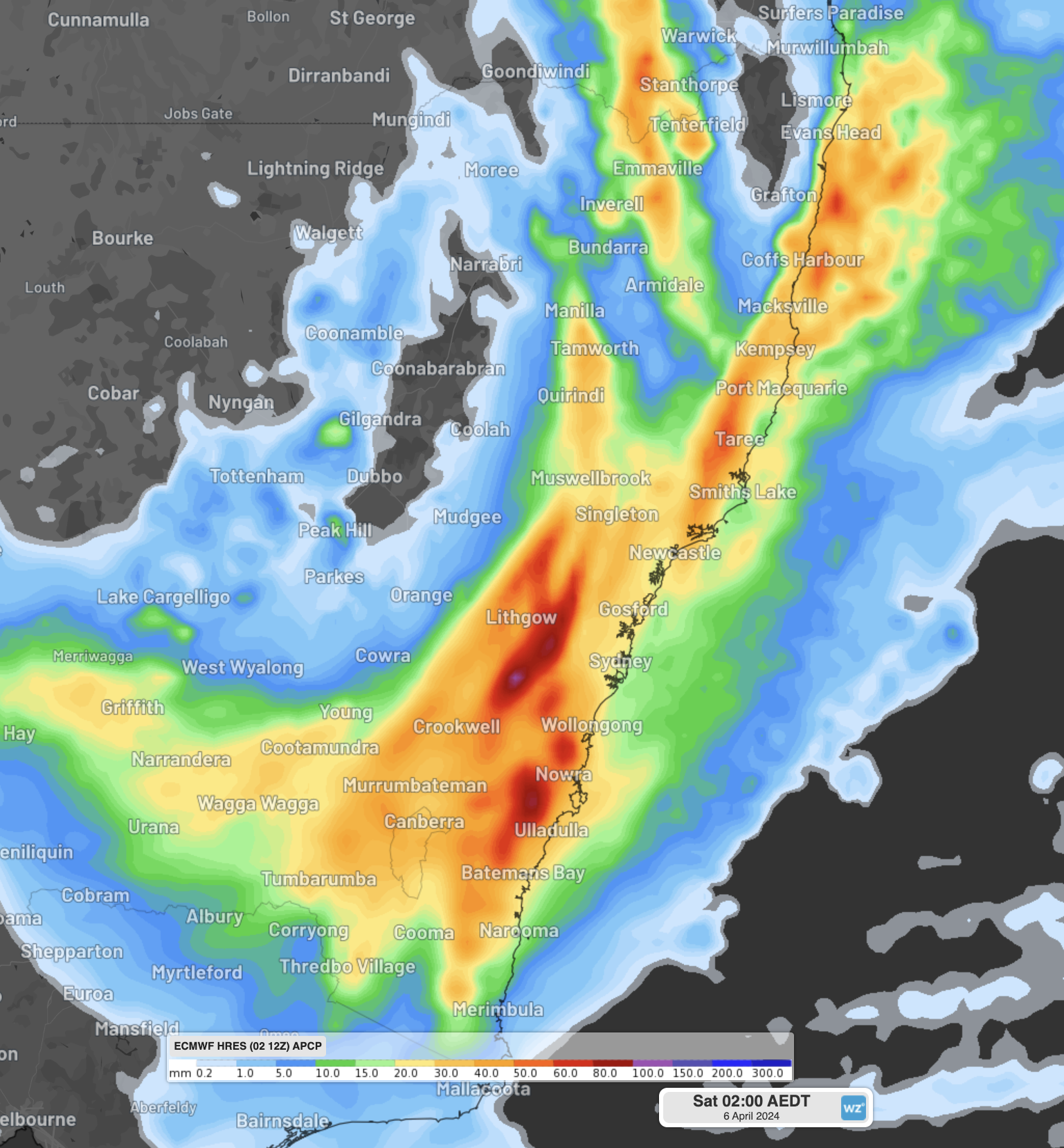
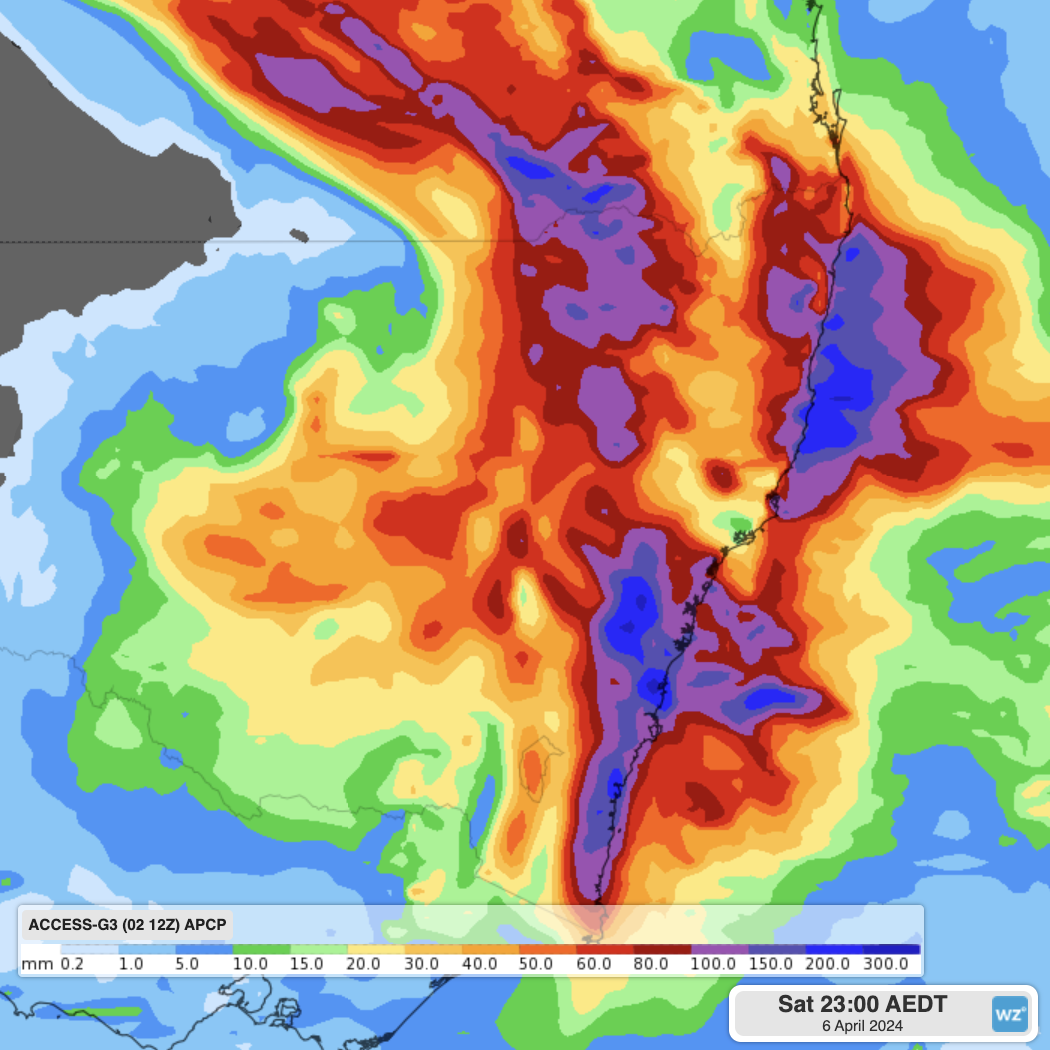
Image: Forecast 6-hourly rainfall on Friday night and Saturday morning from ECMWF. The red and purple patches show areas with intense rainfall forecast, with heavy rain in the yellow and orange shading.
Other expected impacts
In addition to the heavy rainfall and flooding potential, this system brings the risk of:
- Waterspouts just off the coast, potentially an outbreak with several forming at the same time
- Thunderstorms, highest risk forming over the water and moving over the adjacent coast, as well as over the ranges in the Northern Rivers district.
- Damaging winds gusts of up to 100 km/h from the east/northeast, particularly along the coast.
- Powerful and erosive surf from the east/northeast. This direction can be problematic for locations that are less frequently exposed to powerful waves, such as Collaroy Beach. Waves of 4 to 5 metres are forecast for Saturday.
With these severe weather conditions forecast, stay up to date with the latest warnings here, and we will cover this event as it happens on the Weatherzone news feed.
Weatherzone Business provides a variety of weather of forecasting alerting, including flood forecasting and monitoring, to help your business prepare for extreme weather and know when it is safe. You can have access to live weather information, including warnings and company alerts direct to your employees mobile, through the Weatherguard App. To find out more about our products and services, please email us at business@weatherzone.com.au.