Another showery night in Perth has delivered enough rain to make this Perth’s first wetter-than-average month in more than one year.
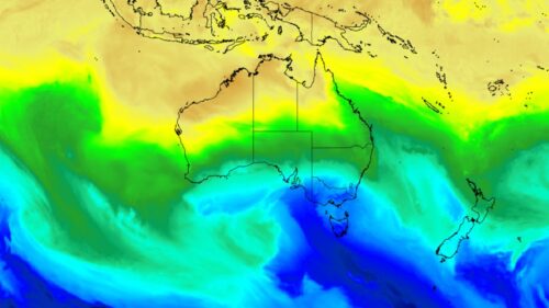
The animation below shows showers streaming over Perth and other areas of southwestern Australia late on Thursday. This wet weather was caused by persistent onshore winds along the west coast of WA, and the passage of a weak cold front in the state’s south on Thursday night.

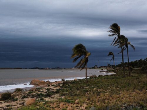
Video: Composite satellite and radar images showing rain in the southwest of WA on Thursday, July 25, 2024.
Some areas in the south and southwest of WA picked up around 10 to 25mm of rain in the 24 hours ending at 9am on Friday, including:
- 24 mm at Esperance, its heaviest daily rain since last August
- 20.4 mm at Bickley
- 16.2 mm at Mandurah
- 10.6 mm at Perth
The latest bout of rain has pushed Perth’s running monthly total for July up to about 146.4 mm as of 9am AWST on Thursday. This is higher than the July average of 146.3 mm at the Perth Metro weather station. It is also Perth’s first month of above average rain since June last year.
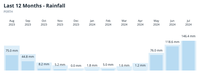
Image: Monthly rainfall observations in Perth over the past 12 months. The darker bars and values on the graph show the observed rainfall for the past 12 months, while the lighter blue bars represent average rainfall for each month.
Showers will ease in Perth on Friday and little if any rain is expected in or around the city on Saturday. However, this break from the rain won’t last long.
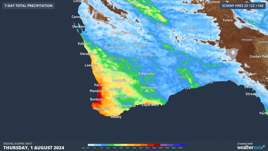
A series of rain bearing cold fronts will sweep over southwestern Australia between this Sunday and Thursday next week, delivering multiple rounds of rain, thunderstorms and blustery winds. The map below shows how much rain one forecast model is predicting over the region during the next seven days combined.
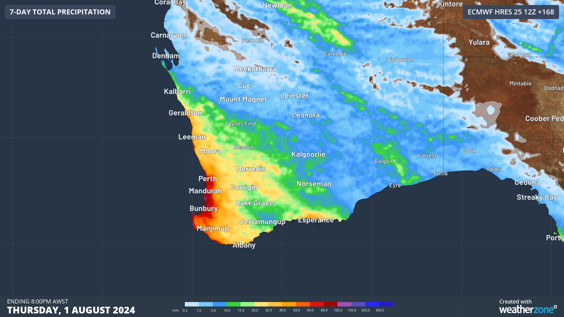
Image: Forecast accumulated rain during the 7 days ending at 8pm AWST on Thursday, August 1, 2024, according to the ECMWF-HRES model.
Severe weather and thunderstorm warnings may be issued in southwestern Australia next week, particularly with the front passing through on Wednesday into Thursday. Be sure to check the latest warnings and forecasts for the most up-to-date information.
Stormtracker is a severe weather solution that can assist you in observing, in real-time, any storm or event that has the potential to impact your business.
Embedded in Weatherzone Business’ industry interfaces, the system gives you a time advantage when monitoring conditions developing over your infrastructure and location.
Stormtracker is our Global Information System (GIS) tracking tool, providing multiple weather layers and zoom controls overlaid on a map of your location and infrastructure. You can choose a snapshot or full screen view, depending on your requirements. The maps allow you to monitor all weather, and specifically any systems likely to cause risk for your business. You also have the capacity to observe:
- real time lightning and thunderstorm alerts
- localised lightning strike frequency
- official warnings for storm, cyclone, wind, flood and fire
- sentinel hotspot fires and fire agency current incidents
Stormtracker’s radar imagery updates every 10 minutes, so you are always able to respond rapidly to changing conditions. You can customise alerting to notify you when your staff or infrastructure are under threat. With increased situational awareness, your ability to make informed decisions quickly is optimised.
Weatherzone Business’ experience and intelligence gives you a clear path through complex situations. Let us assist you, offering actionable insight when extreme weather poses risk to your business. To find out more, please visit our contact page or email us at business@weatherzone.com.au.