It’s going to be a wild week in Tasmania, with the potential for 180km/h winds, more than 200mm of rain and snow in the west, thunderstorms, hail and freezing temperatures.
Damaging winds have already begun across elevated areas on Monday, with Mount Wellington observing a mean wind speed of 100km/h and a gust of 129.6km/h at around 4pm.
The severe weather will worsen on Tuesday, as a strong cold front approaches and crosses the state during the evening. Behind this cold front a very deep low pressure system will sit over the Southern Ocean to the southwest of Tasmania from mid to late this week, directing a series of cold fronts and troughs and prevailing westerly winds over the region.
The image below shows the strong cold front and associated thick line of cloud extending thousands of kilometres from the Southern Ocean to the south of WA to the Indian Ocean.
Image: Himawari-9 satellite image at 8:40am AEST on Monday, August 26.
Damaging to locally destructive northwesterly winds will begin to impact the whole state of Tasmania from Tuesday morning, as the cold front approaches and crosses Tuesday evening.
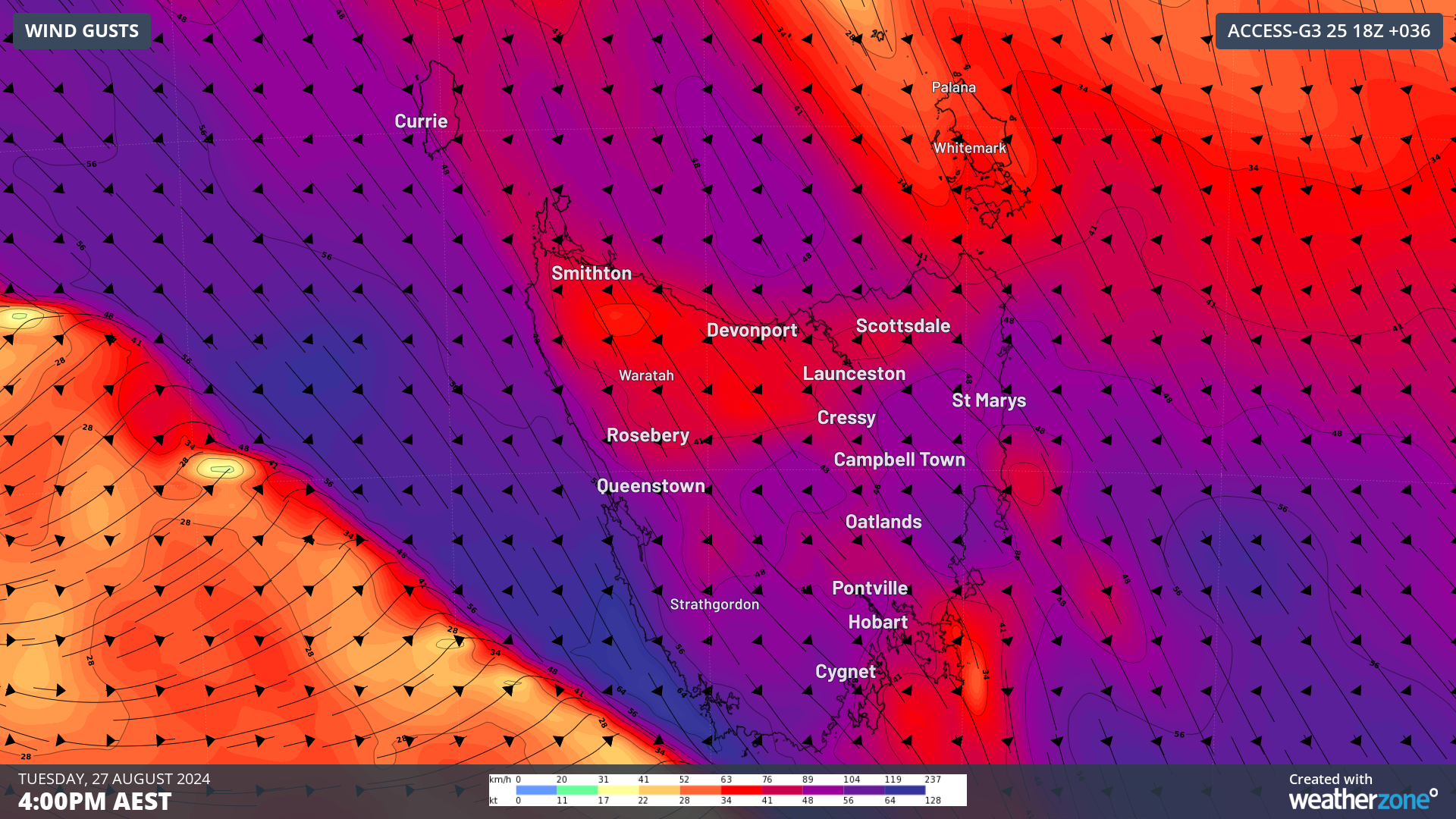
Hobart could see gusts of 100 to 120km/h, meanwhile Mount Wellington could see gusts reaching 140 to 180km/h during this period.
The images below show the forecast damaging to locally destructive winds (purple) impacting parts of Tasmania on Tuesday and Wednesday.

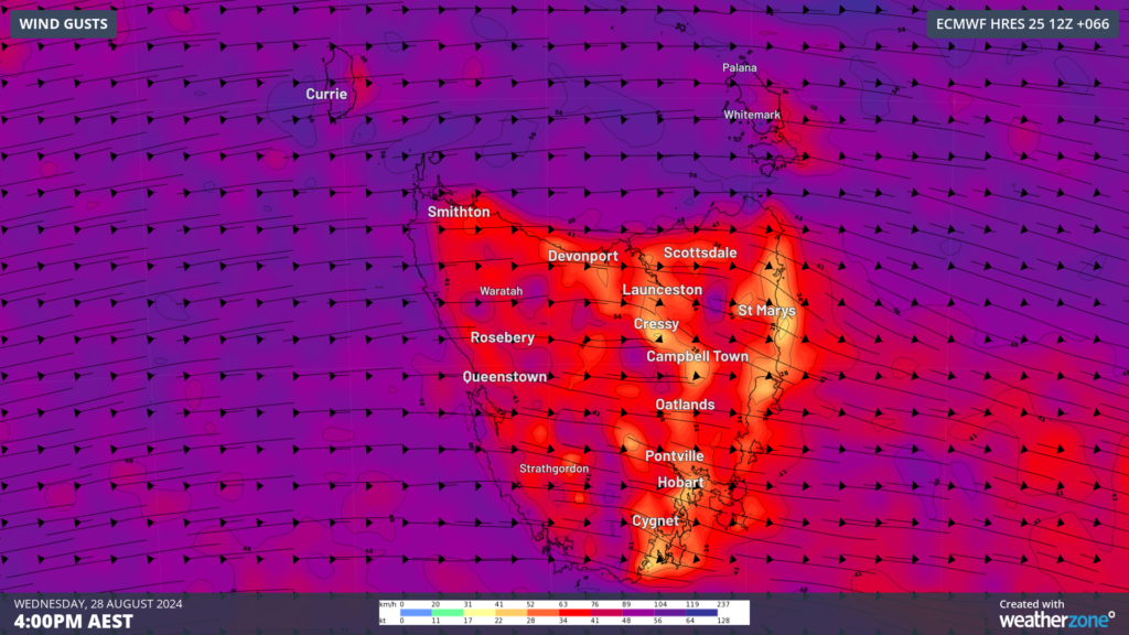
Images: Instantaneous wind gust forecast for 4pm on Tuesday (top) and Wednesday (bottom), August 28, according to ECMWF
These winds should ease on Thursday morning, before another strong pulse arrives later Thursday into Friday, and another on Saturday.
The first cold front of the series will bring the first burst of decent rain and snow on Tuesday night, with the falls continuing into Wednesday. There is also potential for this front to generate small hail, blizzards and thunderstorms on Tuesday and Wednesday.
Another front will move over the region later Thursday into Friday, before the next follows swiftly on Saturday morning with a cool airmass that will bring another bout of snow.
The western half of Tasmania and the northeast are forecast to see 100 to 200mm during the next week, with isolated falls up to 300mm. While southeastern Tas should see around 40 to 80mm this week.
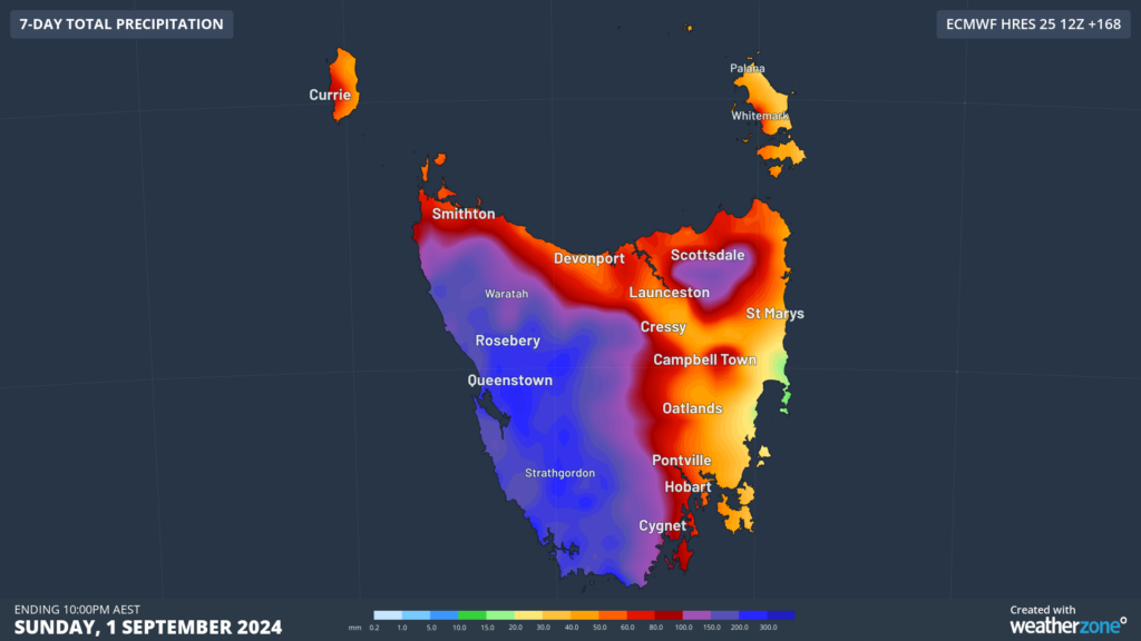
Image: Accumulated rain for the 7 days leading up to 10pm AEST on Sunday, September 1, according to ECMWF
The burst of wet and windy weather will also be accompanied by cold polar airmasses moving over the state this week. The coolest air is set to move over the state on Tuesday evening, with below average temperatures forecast on Wednesday, Thursday and Friday.
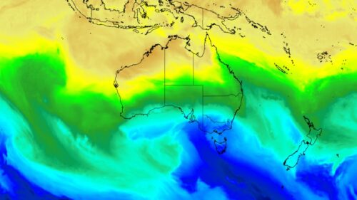
You can see on the image below that there is a huge contrast in temperatures this week between Tasmania and central parts of Australia, thanks to prevailing westerly winds.
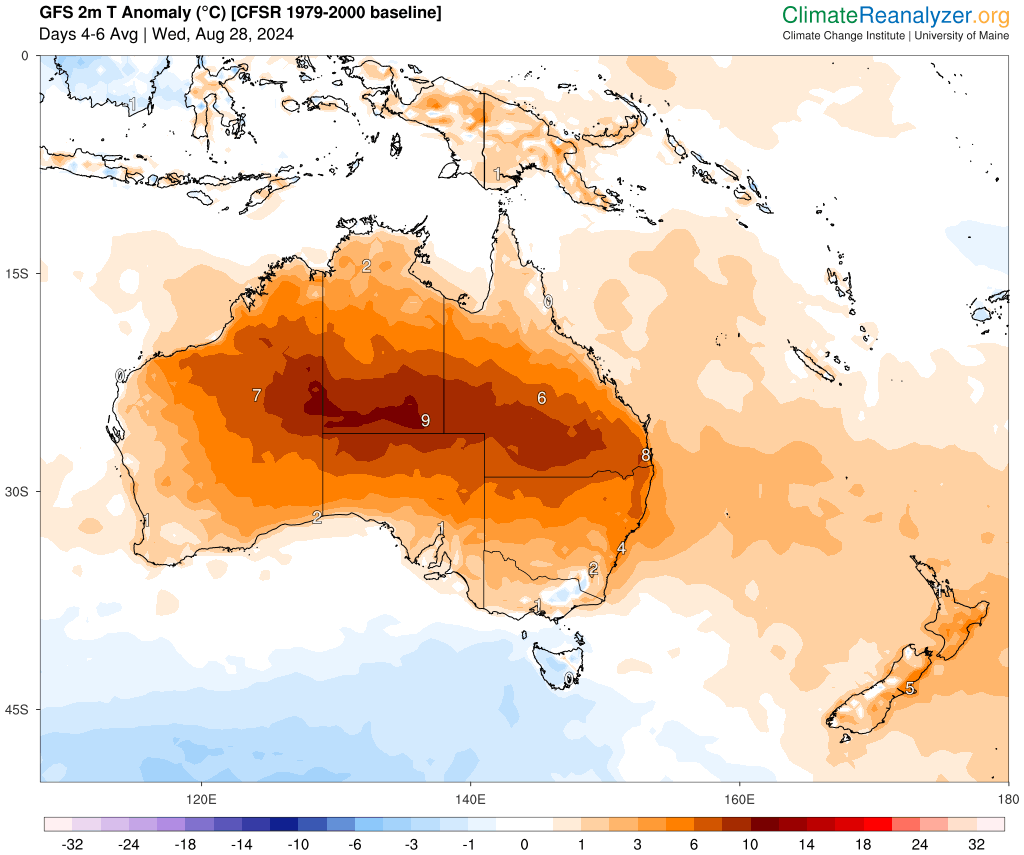
Image: 2 metre temperature anomalies (°C) on Wednesday, Thursday and Friday. Source: Climate reanalyzer
The coldest day looks like Wednesday, with temperatures dropping to freezing on the ranges, while much of rest of the state can expect temperatures between 5 to 12 °C.
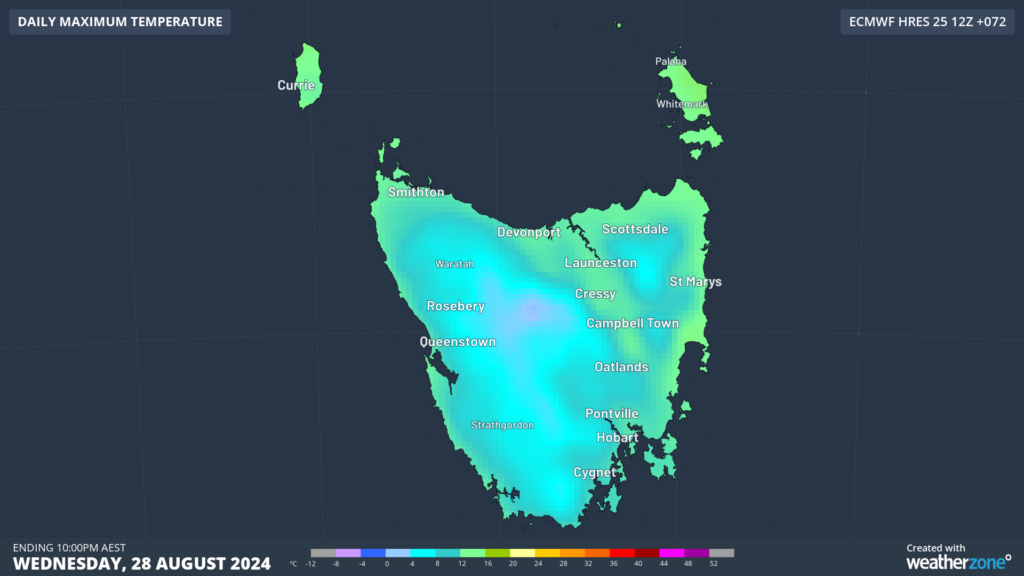
Image: Daily maximum temperature for Wednesday, August 28, according to ECMWF
The strong winds will also add to the ‘wind chill’ making these temperatures feel much colder than the actual temperature.
As this event unfolds, please keep an eye out for the latest warnings and forecasts.
We work hard to identify your operational pressures and tailor our services and products to meet your needs. Concise communication, giving you full situational awareness exactly when you need it, is our focus. We want to reduce weather risk in your operations, every day.
We deliver clear and comprehensive weather data, personalised risk assessments and briefings to you and your team, so that your critical decisions can be made with confidence.
We are available 365 days a year, so you always have the timely guidance you require, especially when severe conditions hit.
You have our insights to rely on to see you through complex situations, minimising potential loss of profit and maximising the safety of your staff and assets. To find out more visit our contact page or email us at business@weatherzone.com.au.