Australia’s climate is changing, with shifts in temperature, rainfall, wind, extreme fire weather and tropical cyclone activity being observed across the continent, according to the new State of the Climate report published this week.
The State of the Climate 2024 report was issued by the Bureau of meteorology and the CSIRO, which communicates the observed and predicted future changes in Australia’s climate.
Temperature
Australia’s warming over the entire year for both day and nighttime temperatures, with an increase in extreme heat events in recent years.
The report found that Australia on average has warmed by 1.51 +/- 0.23°C since 1910, with most of the warming occurring after 1950.
Australia has seen 8 out of 9 of its warmest years on record since 2013, with the hottest year recorded in 2019.
The graph below shows that the frequency of extreme heat events is increasing, where 40 days of extremely hot national temperatures were observed in 2019.

Image: Number of days each year where Australia’s area-average daily mean temperature was in the top 1% of historical records. Source: Bureau of Meteorology
The number of cold days and nights are also reducing in Australia, however the southeast and southwest of Australia has seen relatively unchanged frost numbers since the 1980s.
Rainfall
Southern Australia has seen a significant decrease in rainfall in recent decades, while the north has seen an increase despite natural variability caused by climate drivers such as La Niña. The warmer climate is also increasing the amount of water in the atmosphere leading to an increase in intense heavy rainfall events over northern Australia.
The report found that cool season rainfall (April to October) decreased by around 16% since 1970. The rainfall between May and July has decreased by 20% in the same region and period. Australia’s southeast has seen a decrease of around 9% for April-to-October rainfall and northern Australia recorded an increase of 20% in their wet season (October to April) since 1994.

Image: April to October rainfall deciles for the 30 years from 1994 to 2023 compared to 1900 to 1993. Source: Bureau of Meteorology
Northern Australia’s wet season rainfall has been very much above average during the last thirty years. The report also found that the intensity of short-duration extreme rainfall events has increased by 10% or more in some regions in recent decades, with the largest increase observed in the north.
Daily rainfall totals associated with thunderstorms have increased, particularly across northern Australia. Fewer low pressure systems over southern Australia has meant that the country’s south has seen a decline of sustained heavy rainfall events in recent decades.
Snow
The warming climate has meant that maximum snow depth, cover and the number of snow days have all decreased in the Australian regions since the late 1950s. Years with deep snow cover have also become very rare.
Low pressure systems and wind
Low pressure systems and fronts are becoming less frequent across southern Australia, with high pressure systems becoming more common and forcing these systems further south. Low pressure systems and fronts both bring cool season rainfall to southern Australia, which is why we have seen a decline in rainfall in this area in recent decades.
This trend is linked to the Southern Annular Mode (SAM) which has showed a positive tendency between 1950 and 2024, particularly in summer. When the SAM is positive, the westerly winds, cold fronts and low pressure systems are located further south than usual. A positive SAM during summer will usually:
Decrease the frequency of strong wind events across southern Australia
- Enhance the onshore flow of winds over eastern Australia
- Increase rainfall over eastern and southeastern Australia
- Decrease the likelihood of extreme heat in eastern and southeastern Australia
Tropical Cyclones
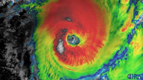
Australia has seen a noticeable downward trend in tropical cyclone activity in recent years, despite record warm ocean temperatures around the globe (tropical cyclones need waters above 26.5°C to form).
Cyclone numbers vary greatly year to year based on climate drivers such as La Niña and the Madden Julian Oscillation, however over recent decades there has been a noticeable downward trend in their overall numbers near Australia.
The average tropical cyclone numbers in the Australia region each season has decreased from 10 to 11 during 1981-2010 down to 9 to 10 during 1991-2020. The east and west region have seen a decrease in cyclone numbers in recent decades as well, while the north region has seen a small increase. 
Australia’s western and eastern tropical cyclone regions have seen a drop in cyclone numbers with wind shear (wind changing with direction and height in the atmosphere) increasing in these regions making it difficult for cyclones to form, despite the primed oceans. By contrast, wind shear has decreased in Australia’s northern region, resulting in increased tropical cyclone activity in recent decades.
Bushfires
Climate change is significantly changing rainfall, temperature and humidity across Australia, which is collectively influencing fire weather conditions and the landscape and fuel across Australia.
Across southeastern Australia, hot, dry and windy weather significantly increases fire danger in the region, while wetter conditions across northern and central Australia increase fire danger with abundant grass growth as fuel.
The map below shows that the change in dangerous fire danger days varies across different parts of Australia, however many regions have seen an increase in extreme fire weather since the 1950s.

Image: The change in the number of days per year (July to June) that the FFDI exceeds its 90th percentile of conditions observed from 1950–2024, between 2 periods: July 1950 to June 1987 and July 1987 to June 2024. Source: Bureau of Meteorology
This has led to a substantial increase in fire size and frequency, especially across southern Australia. The report also noted an earlier start to the southern fire season and that dry lightning causes a significant amount of bushfire ignitions each year.
While the full report can be found here, here is a summary of the key findings:
- Australia is becoming warmer, with more heatwaves, extreme heat and fewer cold days.
- Snowfall, snow cover and snow depths to continue decreasing
- Impacts from storms will be amplified by heavier rainfall and higher seas
- Positive SAM is becoming more frequent over southern Australia, reducing the frequency of strong wind events and rainfall over the region.
- Cool season rainfall is declining across southern and eastern Australia
- Heavy rainfall to become more intense
- Longer and more dangerous fire seasons.
The shifting climate is bringing increased complexity and greater risks to businesses worldwide. We are here for you, delivering trusted weather solutions to optimize your operations and profitability.
Weatherzone Business is a diverse team, with global forecasting, product development and analytics expertise. Couple this with extensive industry experience spanning Aviation to Energy, and we are primed to assist you in strengthening your response to weather
impact.
We work hard to identify your operational pressures and tailor our services and products to meet your needs. Concise communication, giving you full situational awareness exactly when you need it, is our focus. We want to reduce weather risk in your operations, every day.
We deliver clear and comprehensive weather data, personalised risk assessments and briefings to you and your team, so that your critical decisions can be made with confidence.
We are available 365 days a year, so you always have the timely guidance you require, especially when severe conditions hit.
You have our insights to rely on to see you through complex situations, minimising potential loss of profit and maximising the safety of your staff and assets.
For more information please visit our website or email us at business@weatherzone.com.au.
Thumbnail credit: Philip Thurston


