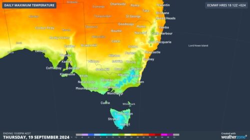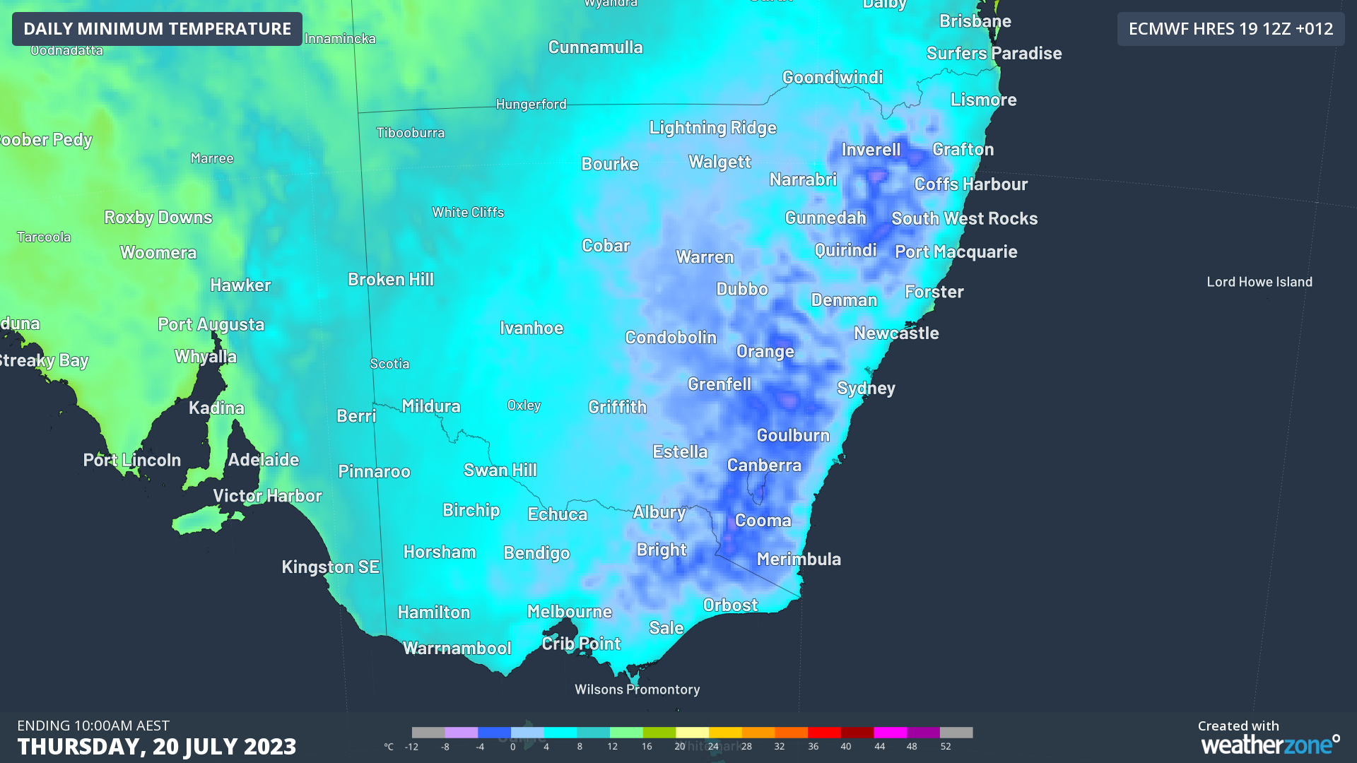
Temperatures plunged below -10ºC in northern NSW on Thursday morning as parts of eastern Australia experienced their coldest morning in years, and the coldest July morning in decades.
A slim high pressure ridge wedged between two cold fronts caused clear skies and light winds over a broad area of eastern Australia on Wednesday night. This clear and calm overnight weather combined with a cool and abnormally dry air mass to cause prolific cooling near the ground on Wednesday night into Thursday morning.
Temperatures dropped below 0ºC in parts of NSW, Vic, Tas, the ACT and Qld during what was one of the coldest nights in years for some places in eastern Australia.
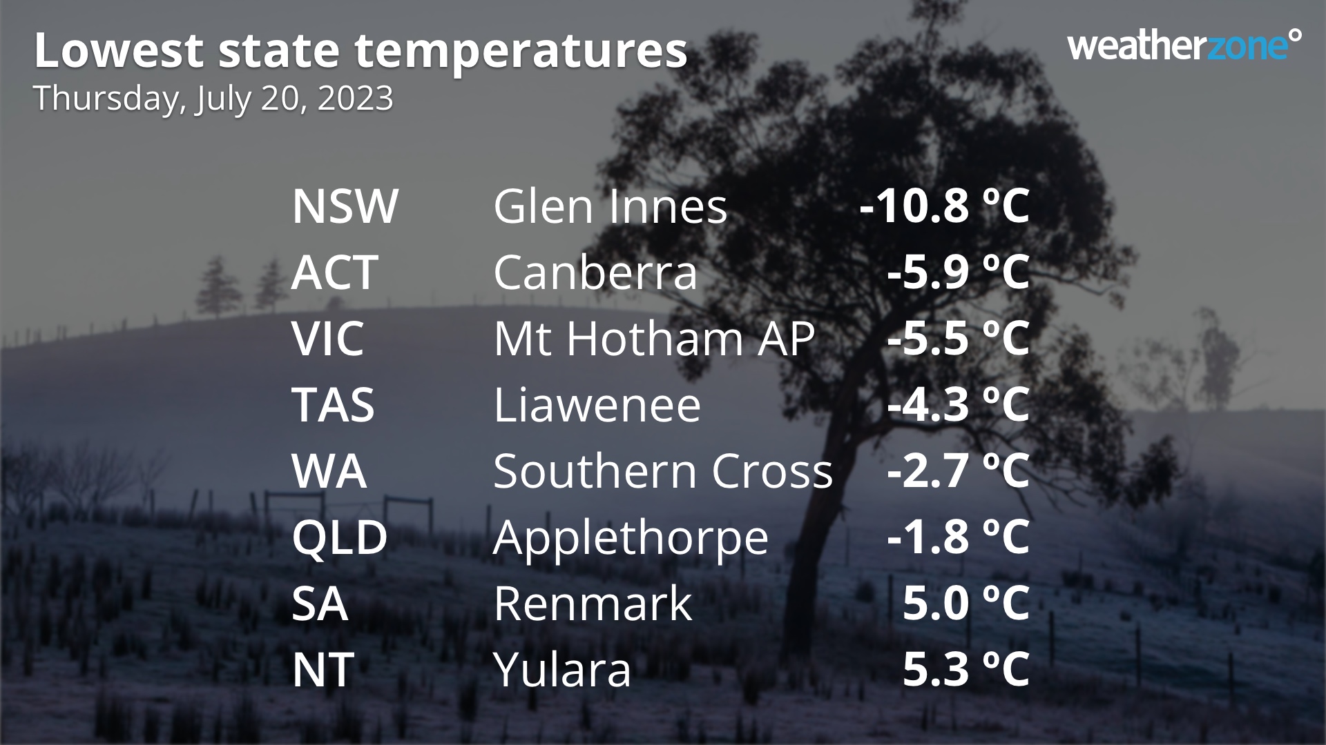
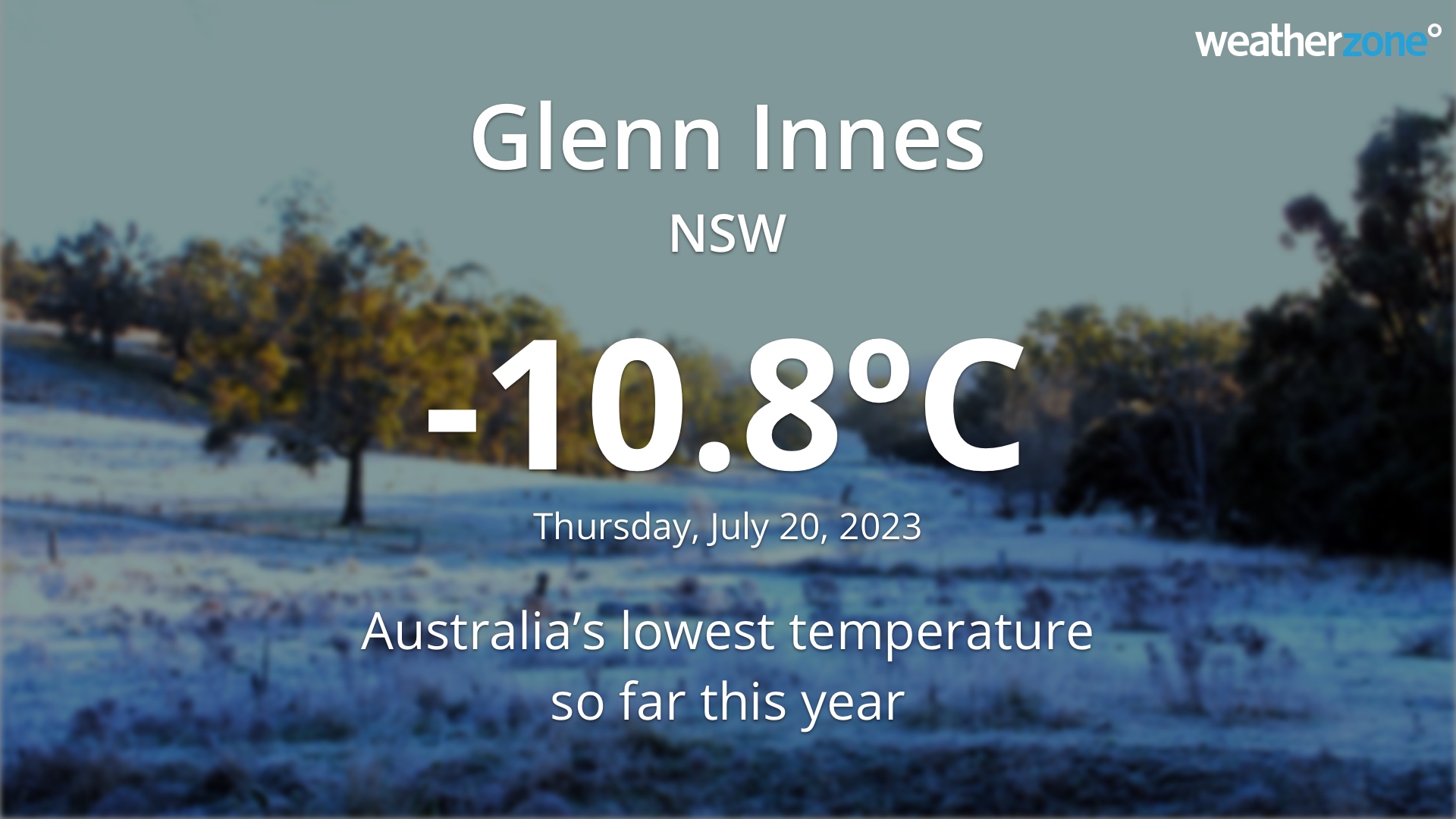
The lowest temperature recorded in Australia on Thursday morning was -10.8ºC at Glenn Innes Airport in northern NSW. This was Australia’s lowest temperature so far this year and the country’s lowest July temperature outside the Alps since 2019.
Other notable minimums from Thursday morning included:
- Scone’s -5.5ºC was its lowest temperature on record, with data dating back to 1965
- Bombala’s -8.1ºC was its coldest morning since 2015
- Moss Vale’s -5.7ºC was its lowest July temperature since the site opened in 2001
- Condobolin (-5.4ºC) and Nyngan (-3.0ºC) had their coldest morning since 2017
- Holsworthy (-1.2ºC), Coonamble (-3.0ºC), Forbes (-5.2ºC), Walgett (-4.8ºC), West Wyalong (-3.9ºC), Goulburn (-8.1ºC) and Wedding Cake on Sydney Harbour (6.9ºC) all had their coldest morning since 2018.
- Orbost’s 0.4ºC was its lowest temperature since 2020
The clear skies that caused Thursday morning’s frost will bring a mostly sunny day to large areas of NSW and Qld, allowing fields, animals and humans to thaw out.
Further south, a cold front will cause cloud, wind and showers to increase across southeastern Australia on Thursday, with severe weather warnings in place for parts of Tas and Vic.
Looking ahead, Friday morning won’t be as cold as Thursday morning for most of eastern and southeastern Australia, due to slightly stronger winds and an increase in atmospheric moisture and cloud cover.
Weatherzone Business can provide super-rapid forecast updates every 5 minutes so you can stay ahead of the competition. To find out more, please visit our website or email us at business@weatherzone.com.au.