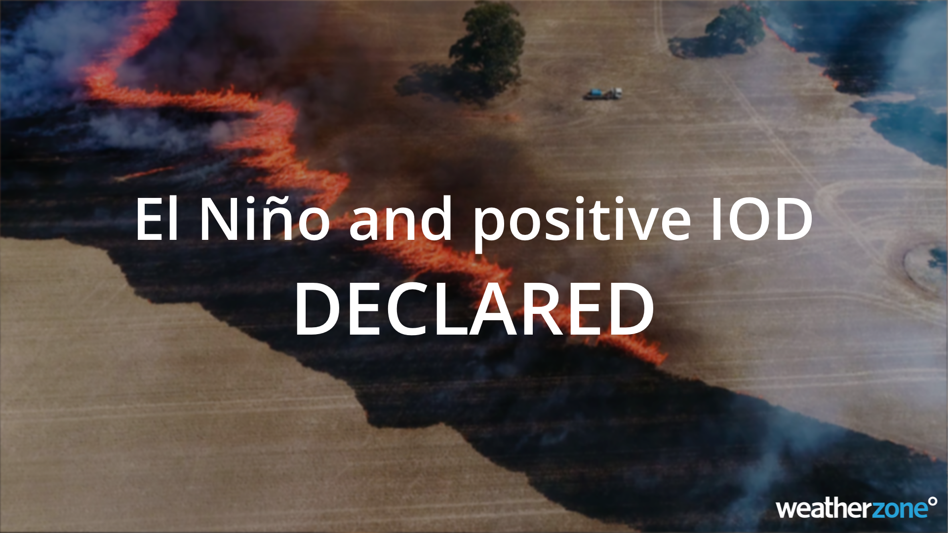
The Bureau of Meteorology has today declared the arrival of El Niño and a positive Indian Ocean Dipole (IOD), a climate driver double-up that significantly increases the likelihood of unusually warm and dry weather across large areas of Australia in the second half of 2023.
The Bureau made the El Niño and positive IOD declarations in its latest climate driver update, which was published on Tuesday afternoon.
This announcement brings the Bureau into line with the World Meteorological Organization, the U.S. National Oceanic and Atmospheric Administration, and the Japan Meteorological Agency, who all declared El Niño back in June and July.
The Bureau’s hesitation to declare El Niño in recent weeks has been due to the atmosphere above the tropical Pacific Ocean being reluctant to shift into an El Niño-like pattern, despite the underlying ocean being in a clear El Niño state.
However, the atmosphere has started responding to the underlying ocean, and the Bureau’s criteria for declaring a fully-fledged El Niño have now been met.
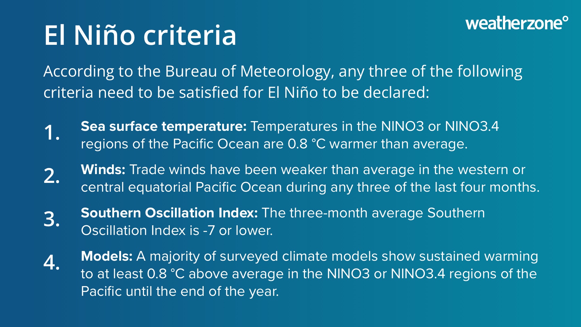
Image: Bureau of Meteorology criteria for declaring El Niño.
According to the Bureau’s records, this is the first El Niño since 2015/16 and the third in the last 16 years. It is also the first positive IOD since 2019. The last time El Niño and a positive IOD coincided was in 2015.
Forecast models suggest El Niño will last until at least the end of the upcoming Australian summer, while the positive IOD is expected to last through spring and possibly into early summer.
What does this mean for Australia’s weather?
No two El Niño or positive IOD events are the same, which makes it difficult to predict exactly how this year’s paring will affect Australian weather at the local scale. However, there are some types of weather that will be more likely in the Australian region over the coming months.
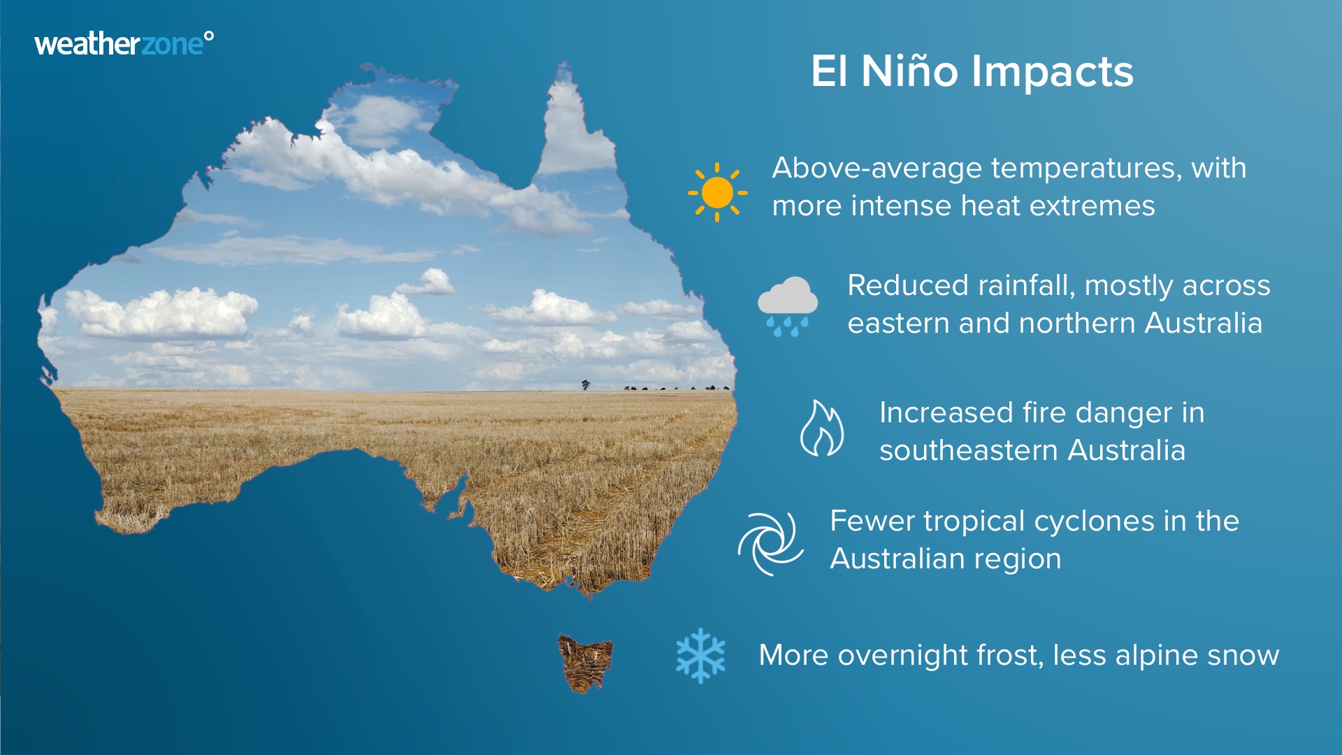
Image: Typical El Niño impacts in Australia.
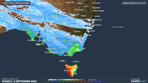
- El Niño and positive IOD events typically cause below-average rain and reduced chances of flooding over large areas of Australia.
- They also promote above-average daytime temperatures over most of Australia, while also increasing the likelihood of more intense heat extremes.
- While days are usually warmer during El Niño and positive IOD events, clearer nights (less cloud) often cause an increased frost risk during spring.
- Both El Niño and positive IOD events are known to increase fire danger in some parts of the county, especially southeastern Australia.
- The presence of El Niño often means a late onset of the monsoon and can also reduce tropical cyclone activity in the Australian region.
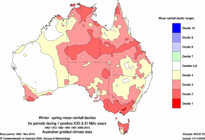
Image: Observed average winter-spring rainfall deciles during 7 combined positive IOD and El Niño years. Source Bureau of Meteorology
Learn more in our comprehensive El Niño Guide: What is El Niño and how does it affect Australia?
You can see the warm and dry influence of El Niño and the positive IOD in the rainfall and temperature outlooks below. Most of Australia is expected to see below average rainfall and above average maximum temperatures in October and November.
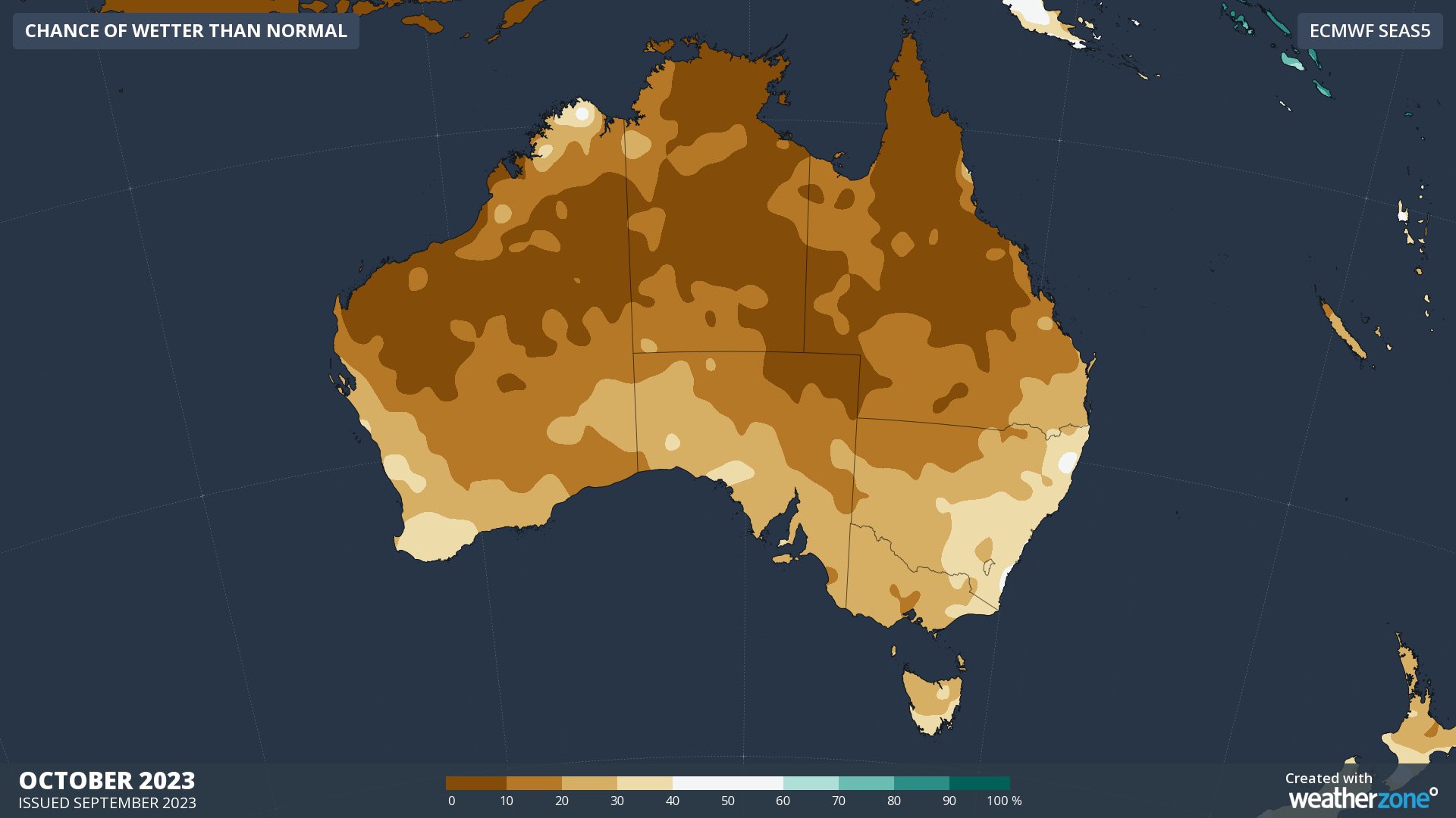
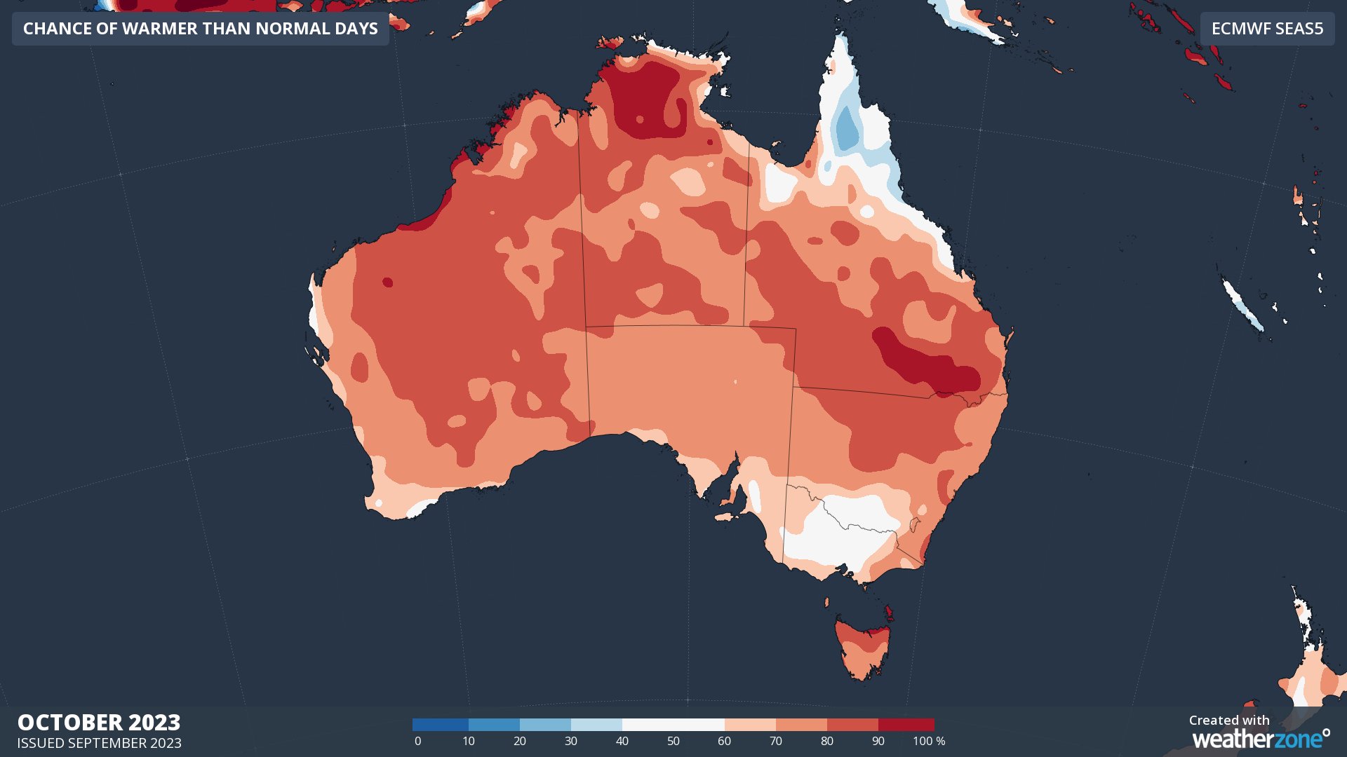
Images: Outlooks for rainfall (top) and maximum temperature (bottom) in Australia during October 2023.
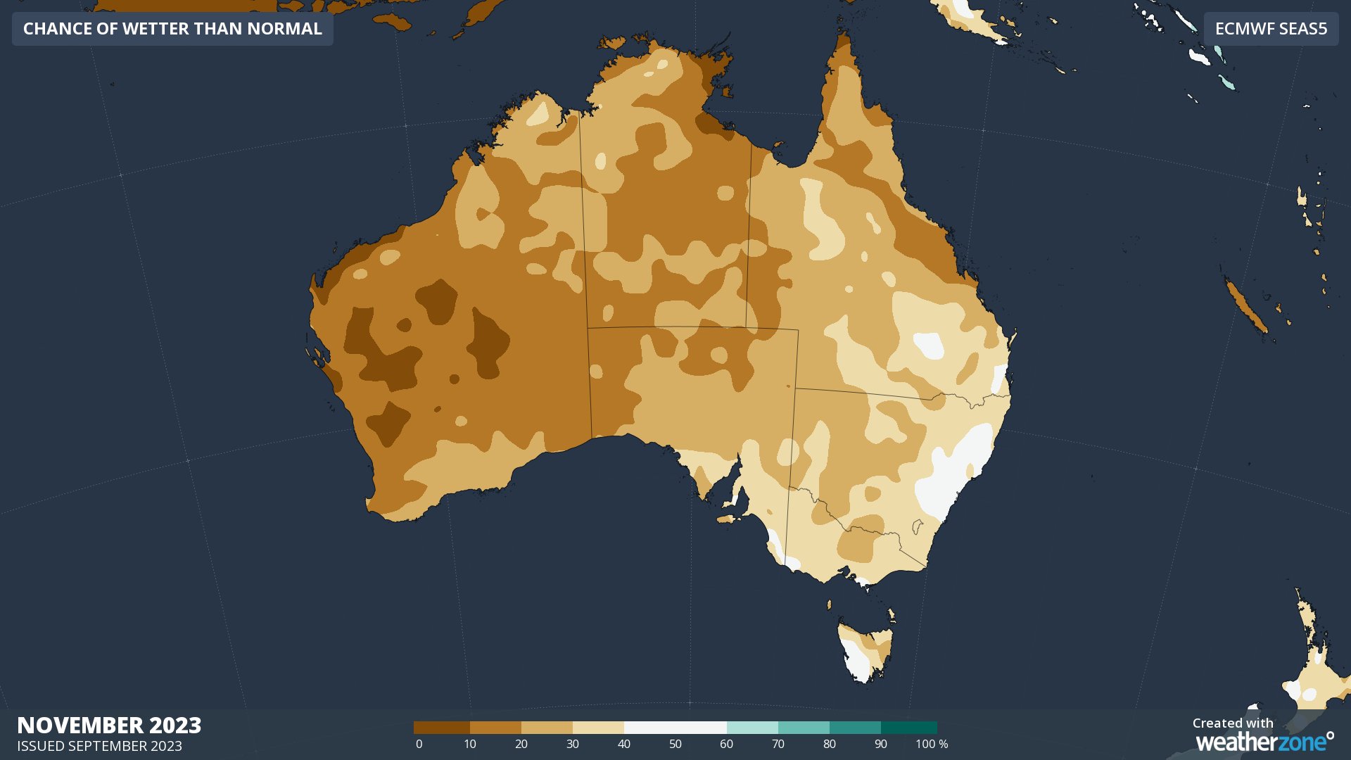
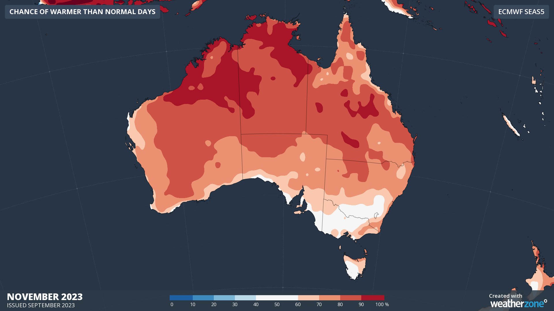
Images: Outlooks for rainfall (top) and maximum temperature (bottom) in Australia during November 2023.
The presence of El Niño also increases the likelihood that global ocean and atmospheric temperatures will continue to challenge records during the rest of this year and into the start of next year.
Weatherzone Business can provide tailored climate briefings to your business to alert you of the most likely weather conditions and hazards to look out for during the upcoming season. Now is a good time to get a good look at the forecast for summer and a look into 2024. To find out more or to book a presentation, please email business@weatherzone.com.au.