Sydney is basking in spring-like warmth today, with the potential for the mercury to reach the high 20’s early next week. This early spring warmth will also reach several other states and territories this week with the potential for August warmth records to tumble.
Wednesday morning felt very pleasant to many Sydneysiders, with no signs of bitter cold winter air. The temperature overnight only dropped down to 15.5°C, which is nearly 6°C above average. With a great head start, Sydney Observatory Hill’s temperature crept up to 21.7°C by 9:30am, with ample sunshine set to bring a warm maximum temperature this afternoon.
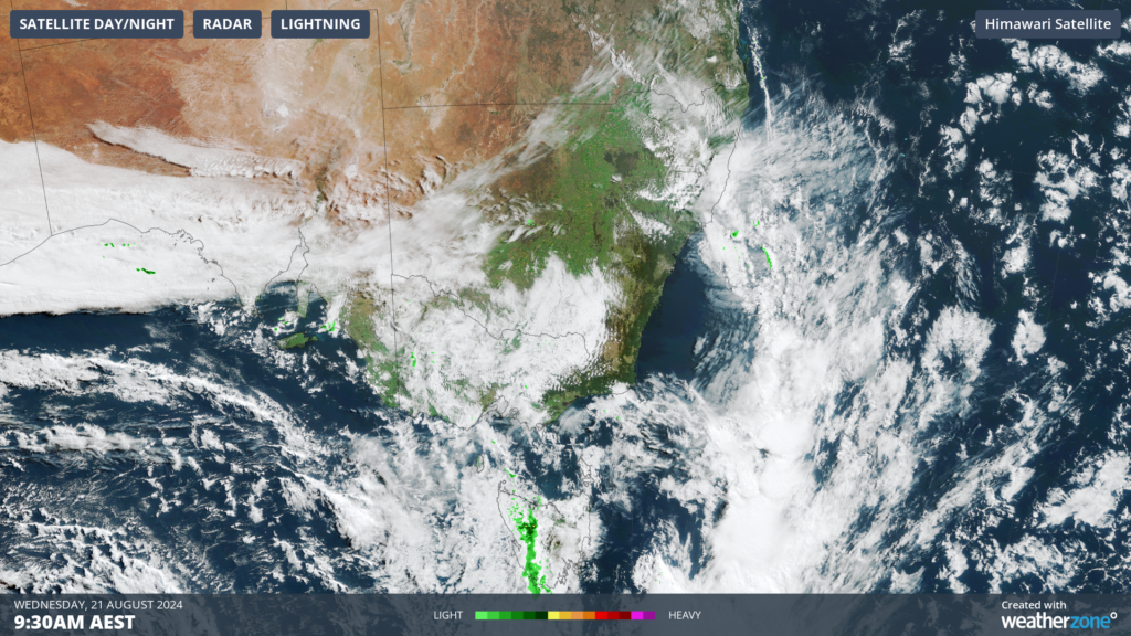
Image: Himawari-9 satellite image at 9:30am on Wednesday, August 21.
Today’s warmth comes as Sydney experiences prevailing warm and dry northwesterly winds and clear skies as a cold front sweep across the far south of the country. This pattern is set to continue for much of the next week, with Sydney’s temperature likely remaining in the 20’s all week, with no cold air masses reaching the city.
The map below shows that during the 3 days starting from this Friday, much of Australia is forecast to be warmer than average, particularly central Australia.
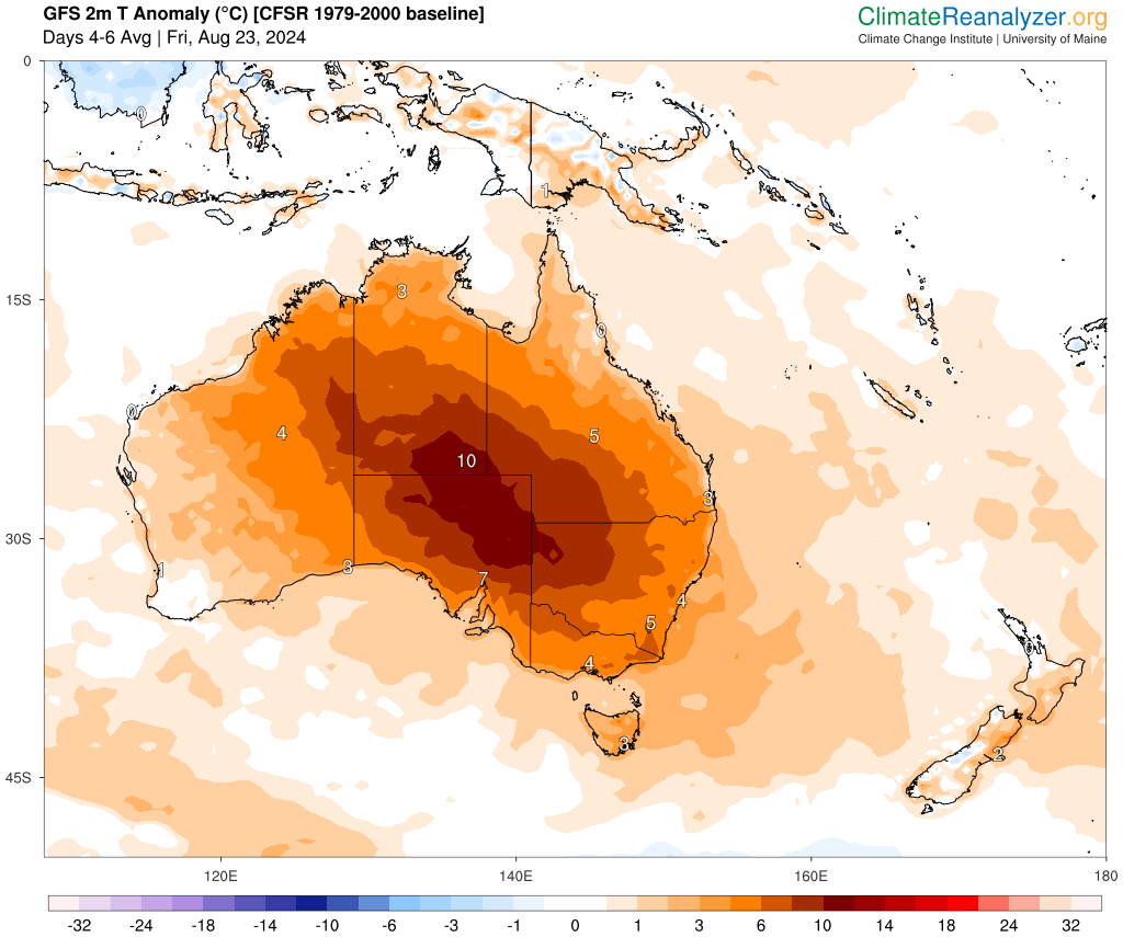
Image: 2m temperature anomaly (°C) for the 3 days starting on Friday, August 23. Source: Climatereanalyzer.org
Sydney’s maximum should reach 26°C on Wednesday, which is around 6 to 7°C above average, before cloud comes in tomorrow with a maximum of 22°C forecast. While the warmth is peaking in Sydney, Melbourne’s maximum is forecas to reach 19°C and Hobart’s 16.2°C, around 2 to 3°C above average.
The next surge of warmth is forecast late this week into early next week, with the potential for a couple of August warmth records to tumble. The warmth in SA late this week will spread northeastward over the weekend into NSW and Qld as a strong cold front sweeps across the region.
Temperatures in parts of NSW and Qld could reach around 10 to 15°C above average on Monday, August 26.
The capital cities should also see temperatures reach around 6 to 10°C above average late this week into early next:
- Sydney’s temperature is forecast to reach the high 20’s, possibly low 30’s on Monday, however there is some uncertainty on the cold change timing and therefore temperature.
- Sydney’s minimum may only drop to 18 to 20°C early Monday morning, so there will be no need for extra rugs
- Adelaide’s daytime temperature should be around 24 to 25°C on the weekend, with the minimum only dropping to 16°C early Sunday morning.
- Melbourne should see a 24°C day on Sunday, with a minimum of 15°C early Sunday morning.
- Hobart’s temperature should reach 18°C on Sunday.
- Brisbane is forecast to see a couple of days in the high 20’s or low 30’s early next week, with a few15°C minimums.
Looking ahead, temperatures should drop around 3 to 5°C in a few hours behind the cold front passing the region early to mid next week. However, the airmass behind it at this stage does not look particularly cold, with temperatures forecast to remain above average well into next week.
OpticastTM V5 is Weatherzone’s cloud-based, consensus forecasting solution that delivers precise weather data to your business, both nationally and globally.
Independently verified to significantly outperform other industry models, Opticast gives you a strategic advantage if weather impacts your enterprise. Armed with the most accurate nowcasting and forecasting data, you can mitigate operational and safety risks, and plan to make the most of severe weather windows.
Opticast is powered by machine learning, intelligently adapting to the local conditions of your site area. Gain a world-leading forecasting system that rapidly responds to changing conditions.
We give you the foresight to make quick and powerful decisions when you need to protect your valuable team and assets, and ensure maximum productivity. To find out more visit our contact page or email us at business@weatherzone.com.au.