NSW and Qld shivered through its coolest morning of the year on Tuesday, driving up energy demand in the National Electricity Market (NEM).
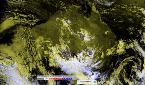
The satellite image below shows cloud free skies across the northern half of Australia early Tuesday morning, which allowed temperatures to drop below freezing in some places.
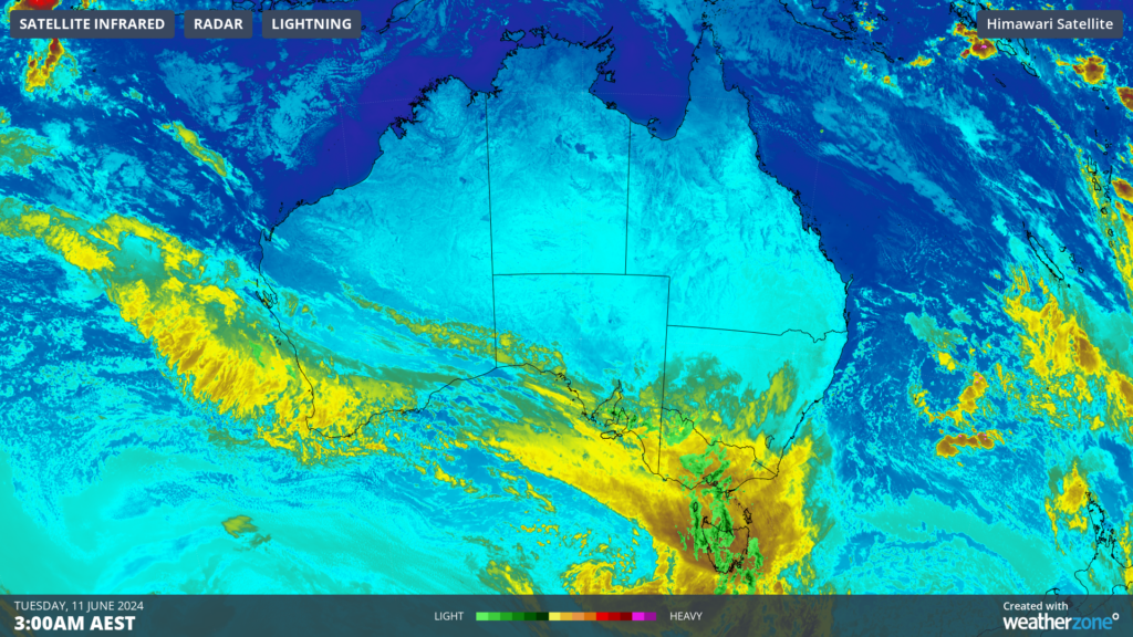
Image: Himawari-9 infrared satellite image at 3am on Tuesday, June 11
Some notable observations across NSW and Qld early Tuesday morning were;
- Armidale’s overnight temperature dropped to -1.8 °C, the coolest temperature in nine months.
- -4.7 °C at Perisher Valley was the coolest minimum in NSW
- Sydney Observatory hill dropped to 8.1 °C, the coolest morning since September 2023
- Kiama’s minimum was 8.8 °C, the coolest temperature in 11 months.
- Qld’s coolest minimum was -2°C at Stanthorpe
- Oakey’s temperature dropped to –1.2 °C
- Applethorpe’s minimum was -1.6 °C, coolest morning in 11 months
- Tambo saw the coolest night in a year, with the overnight temperature dropping to 0.1 °C
These temperatures drove up energy demand on Monday evening and Tuesday morning in the NEM, with demand peaking at 29,314 MW at 9:30am on Tuesday morning. This is particularly high for a morning peak.
However, the high demand has been partially offset by wind power increasing across southeastern Australia on Monday afternoon into Tuesday.
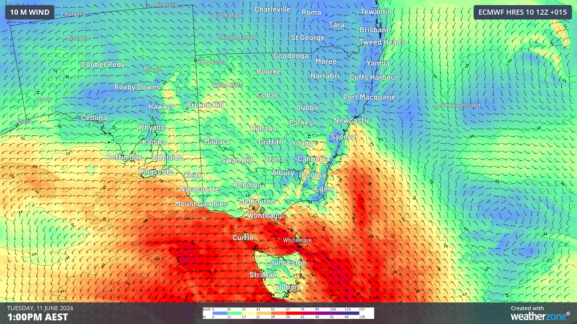
These elevated winds are being caused by a strong cold front sweeping across southeastern Australia on Tuesday.
The image below shows that wind power peaked at 10am on Tuesday, June 11 in the NEM, with 6501 MW produced, which contributed 22 percent to generation.

Image: Wind power contribution to generation over the past seven days (MW). Source: OpenNEM
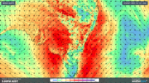
This cold front has produced some damaging wind gusts on Tuesday morning in Vic and Tas.
In Vic, Cape Otway recorded a mean wind speed of 76 km/h at around 11:50am, while Mount Buller recorded a 94.5km/h wind gust. Melbourne airport also battled through mean wind speeds of 63km/h and a gust of 81.5 km/h at around 3am on Tuesday, June 11.
Maatsuyker Island lighthouse in Tas, recorded a gust of 142km/h at around 11:50 am Tuesday, meanwhile Swan Island recorded a mean wind speed if 78 km/h.
These damaging winds are set to continue across parts of Tas, Vic, NSW and the ACT on Tuesday and Wednesday
While strong winds are usually great news for wind farms, the wind speeds on Tuesday and Wednesday could be too strong. There is a sweet spot when it comes to wind power.
Wind gusts above 90km/h (25m/s) can damage the wind turbines and the propellers if they are spinning in these winds.
Most wind farms turn off the turbines if the wind speed reaches the ‘cut off’ wind speed of 90km/h (25m/s) to prevent damage to the turbines.
Unfortunately, if the propellers are turned off on the turbines due to high winds, wind power is not being harnessed. During these periods of intense winds, wind power capacities will be reduced if the turbines remain turned off.
The fierce winds will likely exceed the criteria of 90km/h forcing some wind farms to turn the propellers off and reducing the capacity in these states.
Weatherzone Business delivers industry-leading weather and power generation forecasting and real-time alerting to inform your critical decision-making. Together we can keep your staff and assets safe, and efficiency high.
With lightning strikes, severe weather, flood and fire posing risk to wind farms across Australia, we have tailored solutions that can significantly improve your oversight and response.
Weatherzone’s Total Lightning Network comprises of regional and global sensors to detect intra-cloud (IC) and cloud-to-ground lightning (CG) strikes within your proximity thresholds. It provides unparalled detection accuracy (<200m) and real-time lightning alerts to any device across your operations team.
Your customizable Energyzone interface and Weatherguard app will provide access to the Total Lightning Network as well as centralized data from state and territory fire agencies, the Bureau of Meteorology, and over 30 national and international private and state organisations. This enables full situational awareness of weather conditions and fire risk, as well as severe weather alerting via text, email and phone call, so your staff can respond effectively when required.
For more information please contact us at business@weatherzone.com.au.