A burst of heavy rain and blustery winds will continue to batter eastern NSW over the next three days, with the state’s northeast coast set to see a particularly dangerous mix of rain, wind and surf on Friday and Saturday.
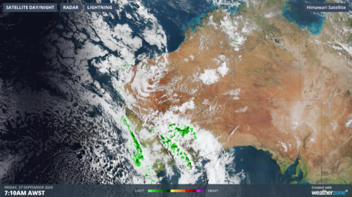
An upper-level trough interacting with a feed of tropical moisture caused rain to spread across a broad area of NSW over the last couple of days. The satellite images below show the cloud and rain associated with this system over the last 12 hours.
Video: Enhanced water vapour satellite and radar images showing cloud and rain over NSW on Wednesday night and Thursday morning.
In addition to this rain, a brisk southerly change has been making its way up the NSW coast on Thursday morning, whipping up huge waves and causing temperatures to plummet:
- According to observations from waverider buoy near Sydney’s Northern Beaches, maximum wave heights jumped by 5.5 metres in seven hours on Thursday morning.
- Sydney’s 8-day run above 24°C has also come to a bleak end. Most of Thursday morning has been feeling like 7 to 9°C in the city and the temperature is only forecast to reach 15°C in the afternoon.
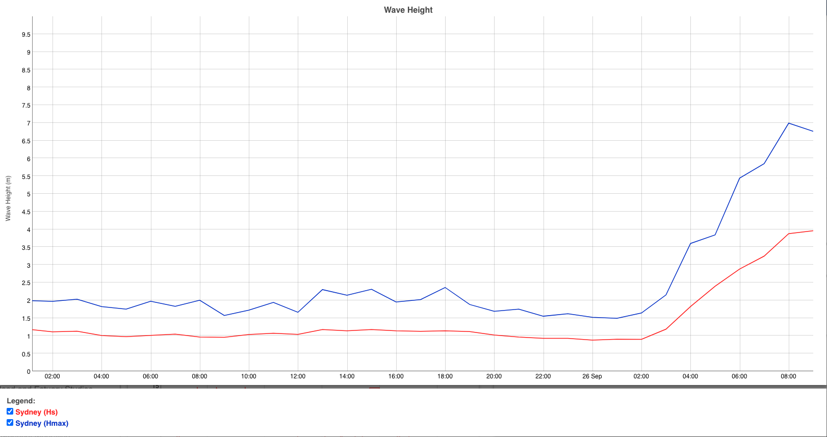
Image: Sydney wave height observations, showing a rapid increase in wave heght on Thursday morning. Source: Manly Hydraulics.
Rain will continue to soak northern and eastern districts of NSW and parts of southern Qld on Thursday, before contracting towards northeast NSW and southeast Qld on Friday and Saturday as a low pressure trough deepens near the coast. Powerful winds and large waves will also persist along the NSW coast between now and Saturday.
There are also signs that a low pressure system could form off northeast NSW on Friday and linger near the coast on Saturday. If this low does form, it will cause heavy rain, potentially damaging winds and large waves in northeast NSW on Friday and Saturday. If the low moves far enough north, rain, wind and surf will also increase in parts of southeast Qld.
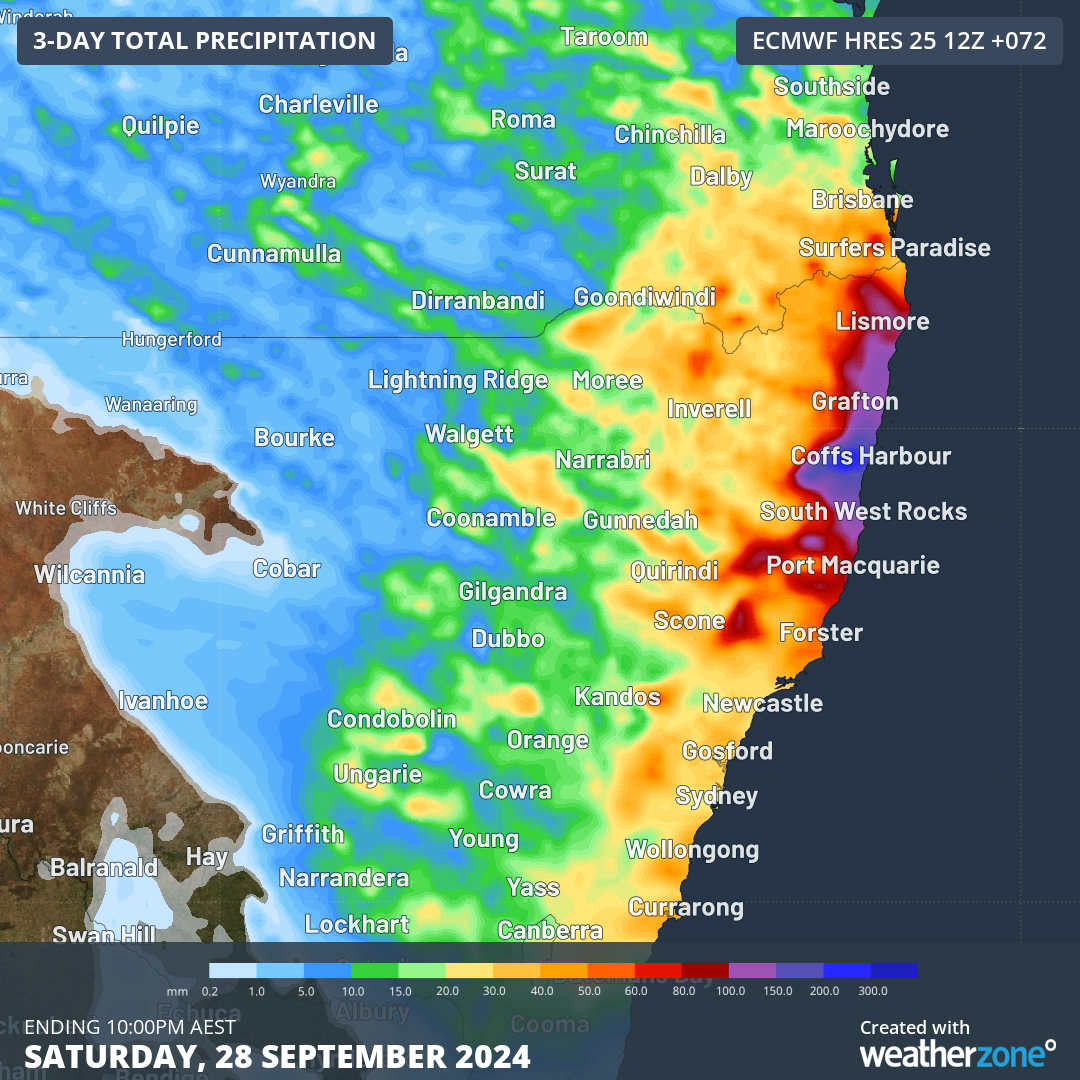
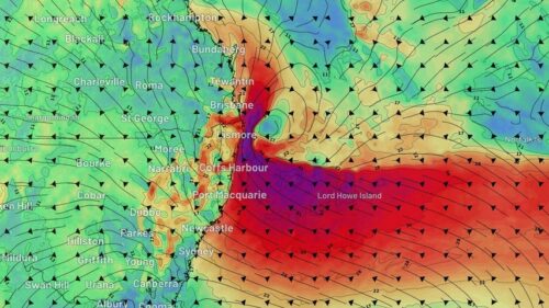
Image: Forecast accumulated rain between Thursday and Saturday, according to the ECMWF-HRES model.
Most forecast models expect the low to weaken on Sunday, which would allow wind and rain to ease in NSW and Qld.
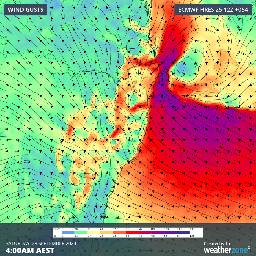
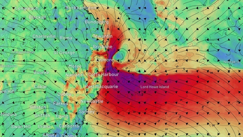
Image: Forecast wind gusts early on Saturday morning, according to the ECMWF-HRES model.
It is worth noting that there is some uncertainty regarding the strength and position of this low pressure system, so forecasts may change over the next 48 to 72 hours. This system will be closely monitored by meteorologists and severe weather warnings will be issued if flooding or damaging winds are anticipated.
Be sure to check the latest forecasts and warnings over the next few days to stay up to date with the most accurate information.
Weatherzone Business, a DTN company, can assist during severe weather events such as this with our expert insights and daily briefings, helping to reduce the disruptive delays across the network.
We specialise in building customised weather monitoring and alerting solutions. These guide transport operators to plan and respond effectively. We tailor our data and analytics to your exact requirements. The following tools help the transport and rail sector daily.
- Weatherzone’s Total Lightning Network- Precise lightning detection which pinpoints where your personnel need to prepare and respond.
- Stormtracker- visualise adverse weather conditions impacting your network, with multiple weather and alert layers which animate over your infrastructure.
- Nowcasting, forecasting and severe weather alerting services to help coordinate your team, limiting downtime and scheduling maintenance in optimal weather windows.
We provide customised weather intelligence to keep your transport business moving. Please visit our website or email us at business@weatherzone.com.au.