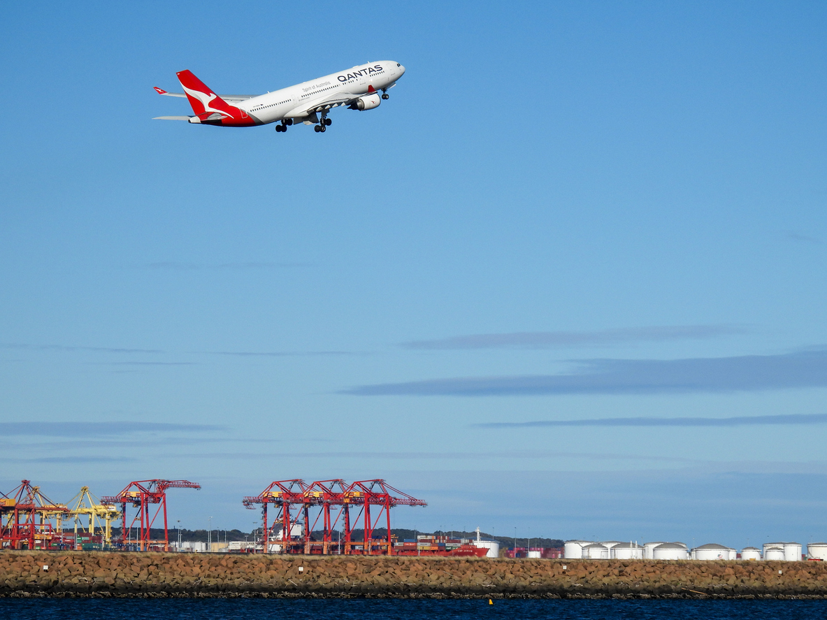
Gale force west to northwesterly winds are creating havoc at Sydney airport on Wednesday afternoon, with all six landing and takeoff options impacted by very strong cross winds.
Sydney airport saw gale force west to northwesterly mean wind speeds of 65km/h at 12:30pm, while the site has been gusting up to 82km/h.
These winds are too strong for all three runways (six landing and takeoff options) to be used safely, airport traffic typically peaks during light winds. The image below shows that two of Sydney Airport’s parallel runways are orientated from north to south, and one single runway runs from west to east.
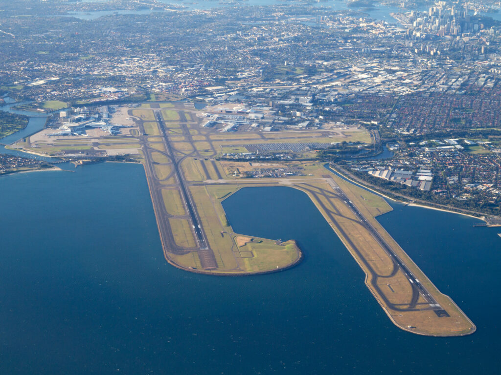 Image: Sydney Airport runway orientation showing two parallel runways running north/south and one west/east, Source: Sydney Airport
The west-east runway is the longest and can accept the largest aircraft, the A380. The gale force west to northwesterly winds on Wednesday are causing around 25 knots of crosswind on each of the six runway options.

Image: Weatherzone’s cross wind calculator in our Aviation Dashboard showing cross wind or X wind of 24 to 25 knots.
The term ‘crosswinds’ refers to winds that blow perpendicular to the runway, which can generate a significant lateral force on the aircraft, making it difficult for pilots to maintain a stable trajectory. The strong crosswinds can cause the plane to drift off course, posing a serious risk to both the aircraft and its passengers.
Sydney Airport typically changes runways when there’s sustained crosswind gusts above 20 knots (37km/h).
However, on Wednesday crosswinds are affecting all runways, meaning that aircraft are often opting to use the two north-south runways to increase traffic. This has meant that some flights have tried twice to land in these difficult conditions.
It is very rare for crosswinds to impact all runways and therefore this event is causing significant disruptions at the airport on Wednesday.
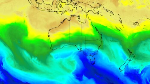
This event is not isolated to the Sydney area, numerous severe weather warnings for gales and damaging and/or destructive winds are in place across four states and the ACT, as a strong cold front lashes Tasmania and southeastern parts of the continent.
Some other notable sustained wind speeds and wind gusts recorded overnight on Tuesday into Wednesday morning have been remarkable:
NSW
- A 128 km/h gust at Australia’s highest weather station, Thredbo Top Station in NSW, just after midnight. Combined with temps that stayed above zero all night, this was devastating for the snow after a week that has already been warm, windy and wet.
- A 104 km/h gust at Port Kembla, in the city of Wollongong, an hour south of Sydney, just after 11 am.
TAS
- A 156 km/h wind gust at Mount Read, in northwestern Tas, at 5:08am Wednesday morning. This was the equal-highest gust on record (the site opened in 1996).
- A 143 km/h gust was recorded kunanyi/Mt Wellington, just above Hobart, at 8:48am.
- A 141 km/h gust occurred at Maatsuyker Island (on the southern tip of Tasmania and invariably one of the state’s windiest places in these sort of systems) at 7:37am today.
- A 137 km/h gust lashed Low Rocky Point, in southwest Tas, at 6:56am.
VIC
- A 128 km/h gust at the Victorian ski resort of Mount Buller, Vic, at 2:48am. Sustained winds of 96km/h were also reported there. All natural snow has now melted there and it’s still winter.
- A 124 km/h gust at Cape Otway, Vic, at 4:24am. The record is 137 km/h with data back to 1989.
- A 119 km/h gust at mainland Australia’s southernmost weather station, Wilsons Prom (Vic), at 8:08am.
Normally after the passage of a cold front, winds tend to abate a little. However extremely strong winds have persisted into Wednesday afternoon, due to the extreme pressure gradient between a colossal low pressure system near the fringes of Antarctica which is pushing against a ridge of high pressure above Australia.
As Weatherzone meteorologist Ben Domensino explained this week, the large, multi-centred low pressure complex has a central pressure below 940 hPa which makes it comparable to the strongest categories of tropical cyclones on the Australian scale.
As you’d expect, multiple trees are down in several states, with the Victorian SES receiving more than 630 requests for help overnight, with around 500 relating to fallen trees and 90 for building damage.
So when will these winds die down?
Conditions will ease somewhat by Wednesday evening, but not before the Sydney airport peak hour between 5 and 7pm. Winds will intensify again on Friday and into the weekend as further fronts whip through southern parts of the country.
Aviation Watch is Weatherzone’s customisable delivery system – painting the full weather and aviation picture – purpose-built to meet the unique requirements of the airline industry.
Aviation specific information, your operational inputs, lightning and severe weather alerting, and forecasting are all seamlessly integrated on Aviation Watch’s easy-to-visualise interface.
Quick view GIS maps show the real-time and forecast conditions of every aviation port in the world. Each port’s status is shown based on the TAF/METAR conditions relative to your specific minima for ceiling and visibility.
You have access to unique timelines that effectively decode the TAF/METAR data into a visual time band – relative to the minima for that port – giving you a clear overview of how conditions are forecast to change.
You have these parameters at your fingertips, with further options available, as you customise your own dashboard:
- Temperature/precipitation/relative humidity/QNH/pressure
- Dangerous thunderstorm and lightning proximity alerting
- TAF/METAR/SIGMET data
- ATSAS
- ATIS data
- Wind calculator and wind shear tool
- Dangerous Thunderstorm and Lightning Proximity Alerting
- Skew-T and meteogram generation
- Vertical profile route cuts
Serving the needs of pilots, ground crew and support staff, Aviation Watch provides critical intelligence, in a format that enables quick decision making.
The efficiency and safety of your operations are fully supported by the most accurate data available. With this foresight you can assess flight paths, fueling and staffing needs with ease, and protect your passengers, staff and bottom line. To find out more visit our contact page or email us at business@weatherzone.com.au.