
Weatherzone Business, a DTN company, offers precise weather intelligence and alerting to protect your utilities network when severe weather, floods and fires threaten.
Over 80% of Australian transmission and distribution networks already rely on our proven nowcasting and forecasting out to 15 days. You can rest assured yours is protected by market-leading analysis. With this foresight you can gain lead time to prepare for possible outages, reduce risk and protect your people and profits.
You will never be left in the dark when conditions suddenly worsen. We deliver reliable, up-to-the-minute weather forecasts and analytical tools that give you the power to enhance your operational management and response to weather risk. Our Total Lightning Network is a globally proven solution that accurately identifies and alerts you to lightning strikes within your defined thresholds, supporting the safety of your team.
Your customisable interface has GIS mapping, showing multiple weather layers over your utilities network and offering full situational awareness. You can quickly recognise any threat to your assets in real-time. 24-hour asset monitoring allows you to track lightning, bushfires and other severe weather systems that approach your service territory.
Advanced and actionable analytics allow you to act decisively and improve your planning and outage response strategy.

Over 30 customisable and easily visualised parameters are offered on your Energyzone interface. We tailor directly to your operational requirements and offer 24 hour meteorological and IT support for any complex conditions that arise. Maximised efficiency ensures your operation adheres to regulatory statutes.
We are there for you: rain, hail or shine.
Armed with OpticastTM, the most precise solution for nowcasting and forecasting data at down to 5-min granularity out to 15 days, you can mitigate operational and safety risk.
Advanced and actionable analytics, using a sophisticated, machine learning approach, provide quantitative predictions that support a more prepared response.
Powerful forecast modules are coupled with briefings from our team of expert energy meteorologists, allowing you to understand the risk in the forecasts.

We thrive on challenge, next-generation science and customised service and are dedicated to helping you stay ahead of the game.
Opticast is Weatherzone’s cloud-based forecasting solution that can deliver precise, hyper-local weather data to your business.
Independently verified to significantly outperform other industry models, Opticast gives you a strategic advantage when facing weather impacts. Opticast intelligently adapts to the local conditions of your site area ensuring the most accurate data for your network.
With our advanced alerting mechanism for lightning – the Total Lightning Network – and severe weather events including flooding and bushfires, you will have the best lead time possible to assess and respond. Our team provide analytical support, 24/7, and pave the way for quick and effective critical decision making.
We work to bring you full situational awareness so you can mitigate risk and maximise profits.
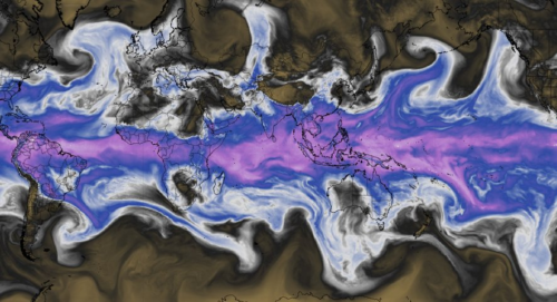
Earth just had its most moisture-laden April on record as unrivalled air and ocean temperatures caused atmospheric moisture content to surge across the planet. It has been known since the 1800s that rising global air temperature allows Earth’s atmosphere to hold more moisture. This phenomenon is explained by the Clausius–Clapeyron relation, which shows that the […]
Solar output in the east has taken a hit recently, with more cloud to come, but the wind has picked up, keeping renewable penetration stable in the market. The image below shows thick cloud over the eastern half of the country on Thursday afternoon. Image: Himawari-9 satellite image at 12pm AEST on Thursday, May 9. […]

Widespread rain and thunderstorms will spread over Australia’s eastern inland over the next few days, before drenching already sodden parts of the NSW coast this weekend. The atmosphere above eastern Australia is being loaded with moisture this week thanks to the influence of a stubborn high pressure system centred to the south of the country. […]
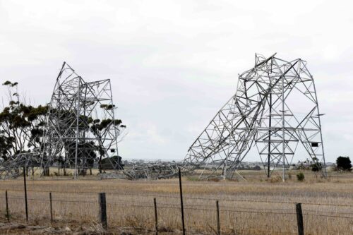
Earlier this year destructive thunderstorms and winds equivalent to a category two cyclone lashed Victoria, bending towers and toppling trees and poles. So, how can thunderstorms damage energy infrastructure, and are these events getting worse? This event occurred during mid-February 2024, when a strong cold front generated severe thunderstorms and localised wind gusts of 130km/h […]
