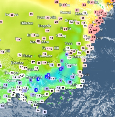
Another burst of early spring warmth has begun across south-eastern Australia, with temperatures set to peak from Friday through to Monday.
A high-pressure system sitting over NSW is responsible for the warm, dry and settled weather that we will see over the next few days. This high-pressure system is squeezing cold fronts further south, with warm northwesterlies prevailing for the eastern states.
The warm north-westerly winds are set to strengthen from Friday for most of the capital cities, ahead of a stronger cold front expected on the weekend.
Temperatures are likely to reach the mid-to-high twenties across most of SA, NSW, VIC and QLD during the next 4 days. Even the southern capital cities are going to be feeling the early-season warmth:
- Sydney could hit 30ºC on both days of the weekend, which is about 9ºC warmer than average for this time of year.
- Brisbane’s maximum temperature peaks on Friday, with 29ºC on the forecast, which is just over 3ºC the September average.
- Adelaide’s predicted top of 27ºC on Friday would be almost 9ºC above average for September
- Melbourne’s forecast of 25ºC on Saturday is around 7ºC above average for this early in spring.
While the forecast of 28-30ºC for Sydney over the weekend seems like it could be a record for early spring, Sydney’s highest recorded September temperature was 34.6ºC on September 26, 1965.
After this early-spring warmth, temperatures will plummet as a cool change sweeps through between Saturday and Monday.
The change should reach Adelaide on Saturday evening, Melbourne Sunday morning, Sydney Sunday evening and Brisbane by Monday evening. Temperatures are likely to drop by around 6-12ºC in the wake of this change.
Looking ahead, temperatures will stay on the cooler side early-to-mid next week, with cool southerly winds, cloud, and showers all on the forecast. Daytime maximums will stay 2-5ºC below average for the south-eastern capital cities for about three days following the cool change.
Weatherzone provides our clients with temperature forecasts out to 14 days, for more information, get in touch at business@weatherzone.com.au.


