A tropical low pressure system near the Cocos Keeling Islands has the potential to develop into a cyclone in the Australian region on Tuesday.
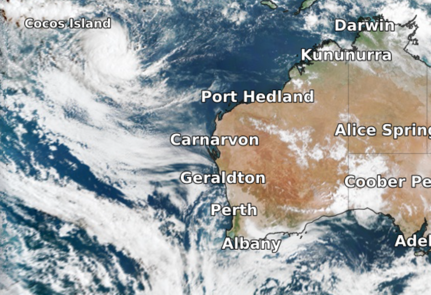
This map below shows cloud encircling the low sitting to the southeast of Cocos Islands on Monday.
Image: Visible satellite image at 8:50am WST on Monday, March 14 showing the low to the southwest of Cocos Island.
The low will move southwest in the coming days and may gradually intensify into a tropical cyclone during Tuesday. If it does develop into a tropical cyclone inside the Australian Region, it will be named Billy.
The low is currently moving away from Christmas Island and is forecast to pass well to the south of the Cocos (Keeling) Islands during Tuesday, with little impact expected on these Islands.
Fortunately, this system will also stay away from the Australian mainland and is unlikely to have any direct impact on WA.
Unexpectedly quiet cyclone season
Despite La Niña, Australia has been having a relatively quiet tropical cyclone season so far. Since the start of the cyclone season in November, there have only been six tropical cyclones named inside Australia’s area of responsibility. This is well below the seasonal average of 11-12.
The last tropical cyclone named in the Australian region was Anika, which impacted the Kimberley in late-February.
Billy would become the seventh cyclone named in the Australian region this tropical cyclone season.
There are also signs that another low may form in the Arafura Sea later this week. Models are suggesting this low could move to the west-southwest into the Western Region. While there is only a low risk of this system developing into a tropical cyclone at this stage, it could still enhance rainfall and thunderstorm activity across northern WA later this week.
Our team of highly skilled or knowledgeable meteorologists at Weatherzone will continue to watch as weather systems evolve. Providing detailed risk analysis and impact advice to our business clients or to you and your business. For more information, please contact us at business@weatherzone.com.au.


