Hordes of Australians flock to the snow every winter to go skiing and snowboarding in the Alps. But snow plays another important role in Australia by providing electricity to households and businesses across the National Electricity Market (NEM).
What is hydropower?
Hydropower is a renewable source of energy that converts fast running or falling water into electricity. This water is first diverted into lakes or dams and stored, until it is needed to make hydropower for the National Electricity market (NEM).

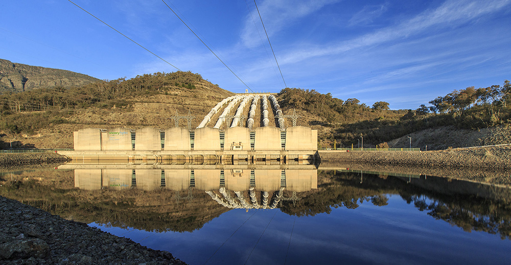
Image: Tumut 3 Power Station. Source: Snowy Hydro
How is snow used for Hydropower?
Snow accumulates in the Australian Alps between about June and October each year, with a peak depth typically occurring around August. This seasonal snow is closely monitored, both while it is on the ground and after it has melted and drained into lakes, for use in generating hydro-electric power.
According to Snowy Hydro, operator of the Snowy Scheme, “The relationship between snow on the ground and inflow is complex, and the snow depth only tells part of the story.”
Snow melt and rainfall in the Snowy Mountains region are captured by the Snowy Scheme’s complex network of aqueducts, trans-mountain tunnels and reservoirs. This water is then channeled to nine power stations to produce hydro-electric power.

Image: Lake Jindabyne. Source: Snowy Hydro
How is snow measured?
Snow depths are routinely measured throughout the snow season at three different elevations in the NSW Snowy Mountains:
- Spencers Creek (1,830m elevation)
- Deep Creek (1,620m elevation)
- Three Mile Dam (1,460m elevation)
“Each snow course consists of multiple sampling points where manual measurements are made using a Federal sampler, effectively a hollow tube used to extract a vertical core from the snowpack.
“The core is weighed to obtain a value for the water content of the snowpack which, together with snow depth, can be used to calculate density,” said Snowy Hydro.
These snow depths are used primarily to forecast spring runoff from the snowpack.

Image: Snowy Hydro measuring the snow depth at the Spencers Creek Snowcourse.
Snow Hydro also monitors lake levels continuously to track the volume of water stored within the Snowy Scheme. This year has been a big year for storages, with Lake Jindabyne currently sitting at its highest level for this point in the year since records began in 1998.
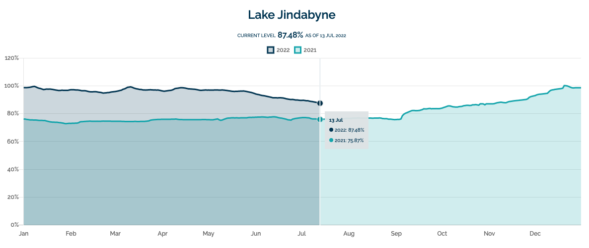
Image: Current level of Lake Jindabyne compared to 2021. Source: Snowy Hydro
In 2021, 15,809 GWh of hydro-electricity was produced, which accounted for 7.58 percent of the total annual generation in the NEM.
Hydro operators can more accurately predict hydro plant output and manage water flows through accurate long-term catchment rainfall and snowfall forecasts. Rainfall forecasts from one hour to six months ahead are crucial for effective management of hydro assets. For more information, please contact us at business@weatherzone.com.au.