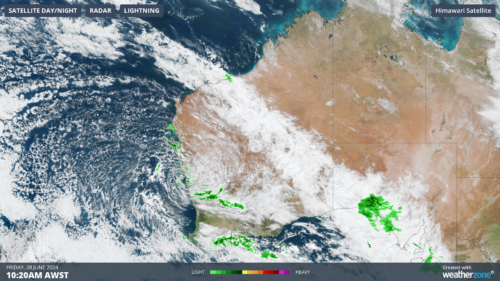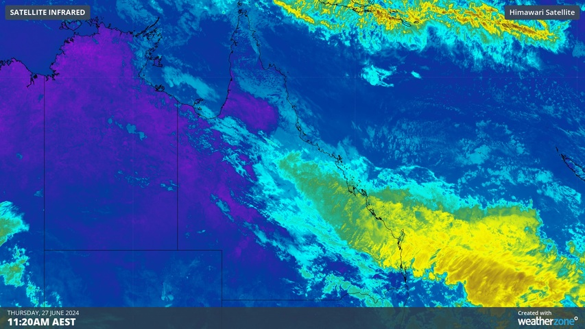
Parts of central Queensland received more than 100 mm of rain in the last 24 hours, with some towns picking up their best June rain in eight years. The thick cloud and rain has reduced solar output across the state over the past day or so.
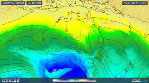
A multi-day soaking is targeting central Qld this week as a near-stationary low pressure trough draws in moisture-laden air from the Coral Sea.
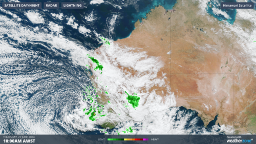
Parts of the state’s central coast received more than a month’s worth of rain in 24 hours on Tuesday into Wednesday morning. This drenching rain then continued through Wednesday into Thursday morning, delivering more than 100 mm to parts of the state’s Central Highlands and Coalfields district.
Some of the standout falls in the 24 hours to 9am on Thursday included:
- 115 mm at Convicts Crossing, near Dysart
- 106 mm at Dysart
- 99 mm at Middlemount
- 97 mm at Melrose
- 92 mm at Logan Creek
- 74 mm at Yeppoon
- 42 mm at Clermont
- 42 mm at Rockhampton
- 31 mm at Emerald
This latest deluge was equivalent to around 1-2 months’ worth of rain falling in the space of 24 hours in central Qld. For Rockhampton, Yeppoon, Emerald and Clermont, it was the wettest June day in eight years.
The image below shows that solar plummeted to 1437MW at 11am on Thursday, June 27 in response to this cloud and rain.
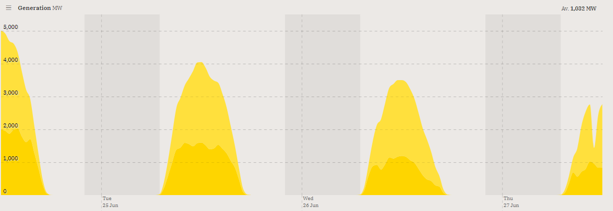
Image: Rooftop and solar contribution to generation during the last three days showing a drop on Thursday morning. Source:OpenNEM
A band of steady rain will linger over Qld’s central inland and adjacent coastal regions today, with showers also extending into parts of the state’s southeast and north. Thick cloud and rain will also keep maximum temperatures several degrees below average today.
The rain will ease tonight leaving more isolated and lighter showers in the state’s east from Friday into the weekend.
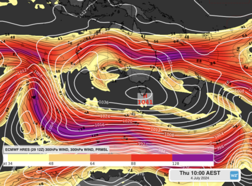
Looking further ahead, another band of rain is expected to drift over southern Qld from Sunday and possibly focus on the state’s southeast early next week reducing solar output again in the region. Some of this rain will also affect northern NSW.
The two rainbands affecting QLD over the coming week should see more than half of the state collecting some useful rain.
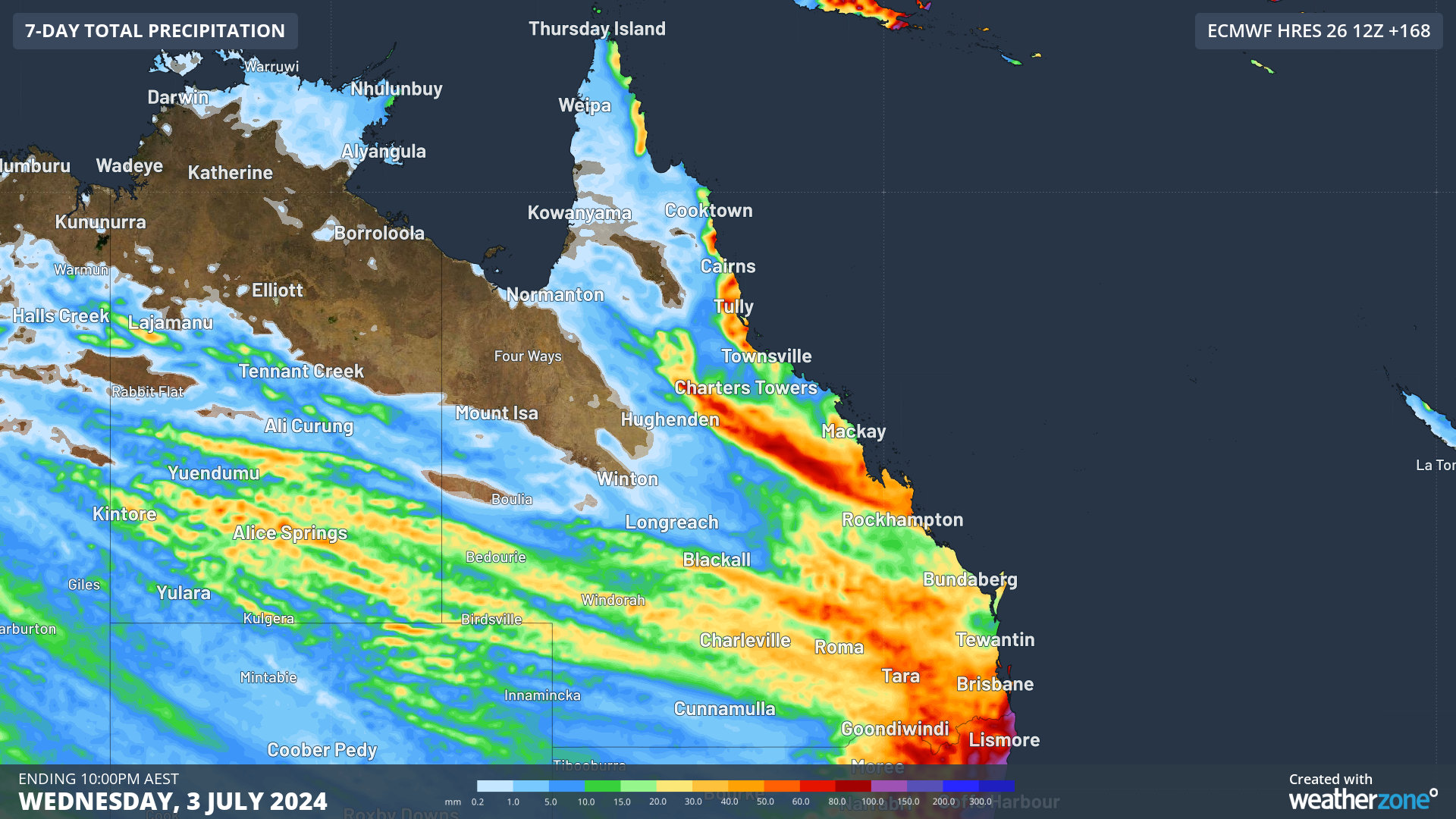
Image: Forecast accumulated rain during the seven days ending at 10pm AEST on July 3, according to the ECMWF-HRES model.
This week’s rain will bring relief to some areas in central Qld that received below average rain during autumn. The map below shows that some places received less than 20 percent of their average seasonal rainfall over the last three months.
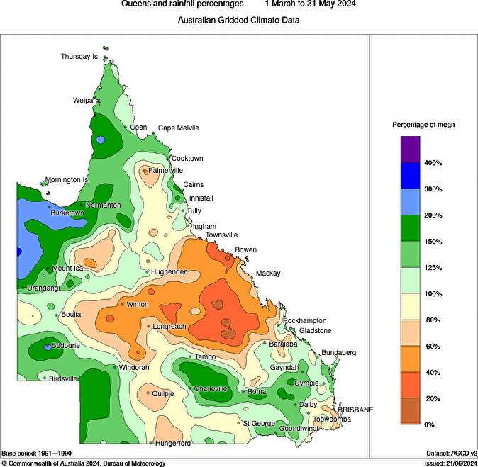
Image: Observed rainfall percentages during autumn 2024. Source: Bureau of Meteorology
Brisbane is unlikely to see much rain in the next few days, although the city has the potential to receive more substantial rain early to mid-next week.
Weatherzone Business and Solcast are a market-leading partnership delivering highly specialised solar data to the Australian renewable energy industry.
Designed for utility scale solar sites, we offer you a globally proven solution.
With low upfront CAPEX and powerful cloud-based information systems, you can access a complete suite of irradiance and weather data to ensure forecast accuracy and improve site efficiency.
Solcast is the world leader in real-time actuals and rapid-update solar forecasts. This solution utilises Solcast’s centralised Amazon Web Services’ (AWS) cloud infrastructure for all complex algorithmic processes and data plumbing. You will gain the power of AWS to interpret and deliver your data at top speed, providing real-time, historical and forecasting estimates direct to your API.
Receive monitoring and support from the Weatherzone and Solcast teams, 24/7. To find out more, please contact us at business@weatherzone.com.au.