Australia’s tropical cyclone season will be affected by one of the strongest El Niño events in recent decades. So, how many tropical cyclones will Australia see this season?
Australia’s official tropical cyclone season runs from November until April. While tropical cyclones can form in or near the Australian region at any time of year, the vast majority form during this six-month period, with a peak frequency in late summer and early autumn.
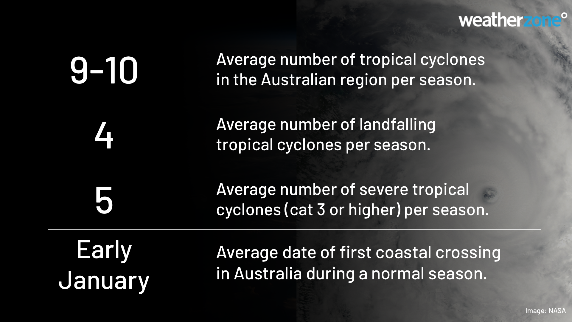
In average season, we usually see around 9 to 10 tropical cyclones inside Australia’s area of responsibility. Of this total number, about five become severe tropical cyclones and four make landfall in Australia.
This season’s forecast
Australia’s 2023-24 tropical cyclone season will be influenced by El Niño, a decaying positive Indian Ocean Dipole (IOD) and the background influence of climate change. These drivers are all likely to play a role in the season ahead.
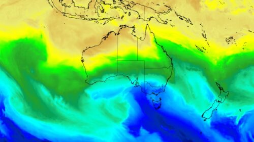
The Pacific Ocean is currently in an El Niño state that is expected to further strengthen into summer, with forecast models suggesting this will be one of the strongest El Niño events of the last 20 years.
El Niño typically causes cooler ocean temperatures and changes in surface pressure near Australia. Both these effects heavily impact tropical cyclone formation, so less tropical cyclones tend to form near Australia in El Niño years. Since 1980, El Niño years average 37% fewer tropical cyclones compared to non-El Niño years.
El Niño also typically reduces the overall number of tropical lows in the Australian region, delays the first coastal crossing, and causes fewer coastal crossings overall per season.
The graph below shows seasonal tropical cyclones numbers since 1980. The red and blue shaded boxes highlight seasons that coincided with El Niño and La Niña events, respectively.
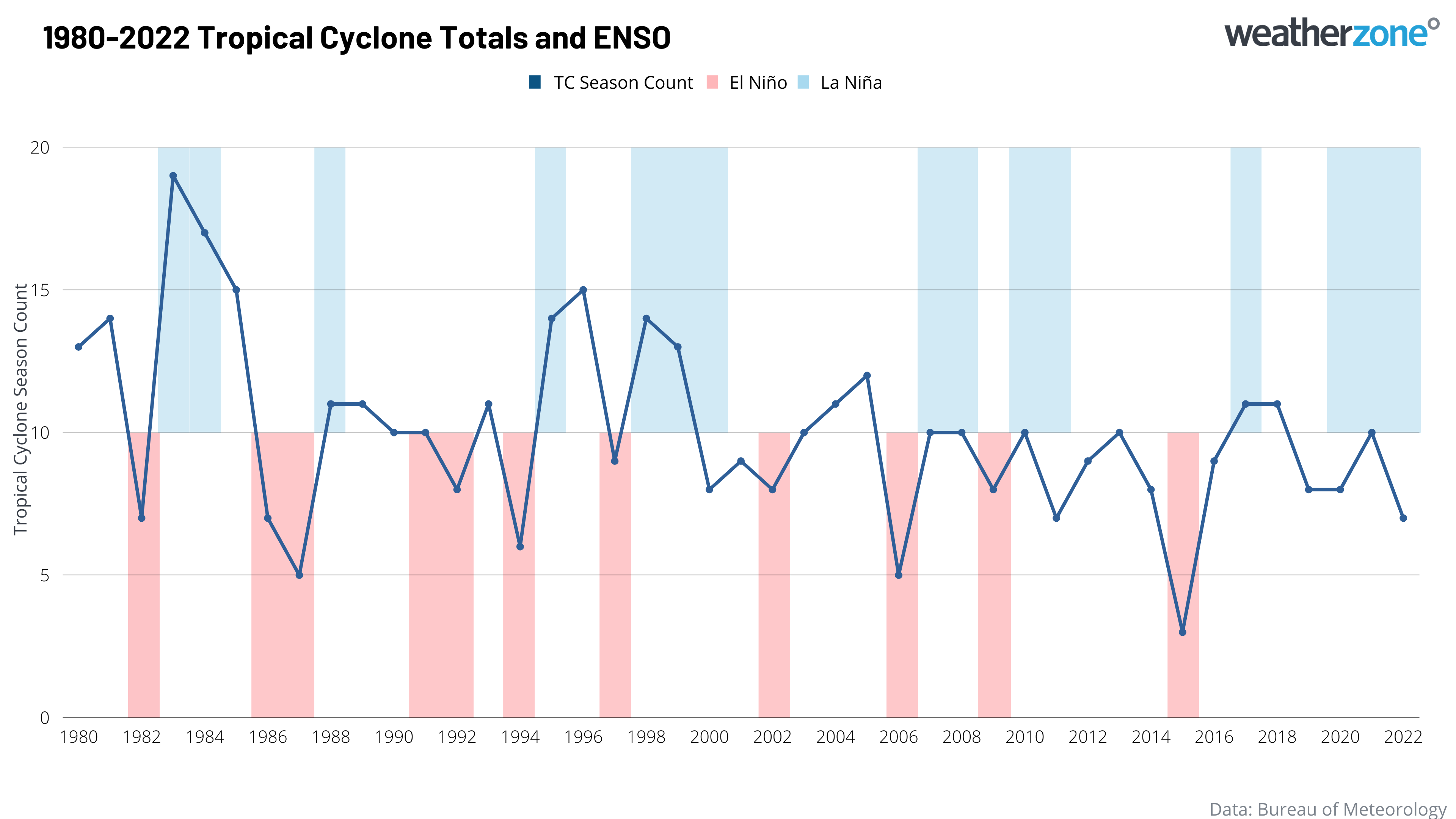
Image: Number of tropical cyclones per season between 1980 and 2022, with El Niño (red) and La Niña (blue) year highlighted.
The graph above shows that El Niño events are very well correlated with the quietest seasons on record, like in 1987-88, 2006-07, and 2015-16. The relationship is not quite as strong with La Niña, but many of the most active seasons, including 1983-84, 1995-96, and 1998-99, occurred during La Niña years.
In addition to El Niño, a positive Indian Ocean Dipole (IOD) may also influence the start of the 2023-24 tropical cyclone season.
A positive IOD event is currently underway to the northwest of Australia and is predicted to persist until early summer. Positive IOD events typically cause a delayed start to Australia’s northern wet season and can hinder the development of early-season tropical cyclones.
It’s worth noting that the 2015-16 season, which was Australia’s quietest cyclone season on record, was impacted by a strong El Niño and a positive IOD.
While this season also has El Niño and a positive IOD at play, ocean temperatures around Australia are currently warmer than they were eight years ago. So, while we are likely to see a below average tropical cyclone season, it should be more active than 2015-16.
All tropical cyclones that form in Australia’s area of responsibility are given names by the Bureau of Meteorology. Tropical cyclones that form outside the Australian region are assigned names by other official organisations.
The first tropical cyclone that forms in the Australian region this season will be named Jasper, followed by Kirrily and Lincoln.
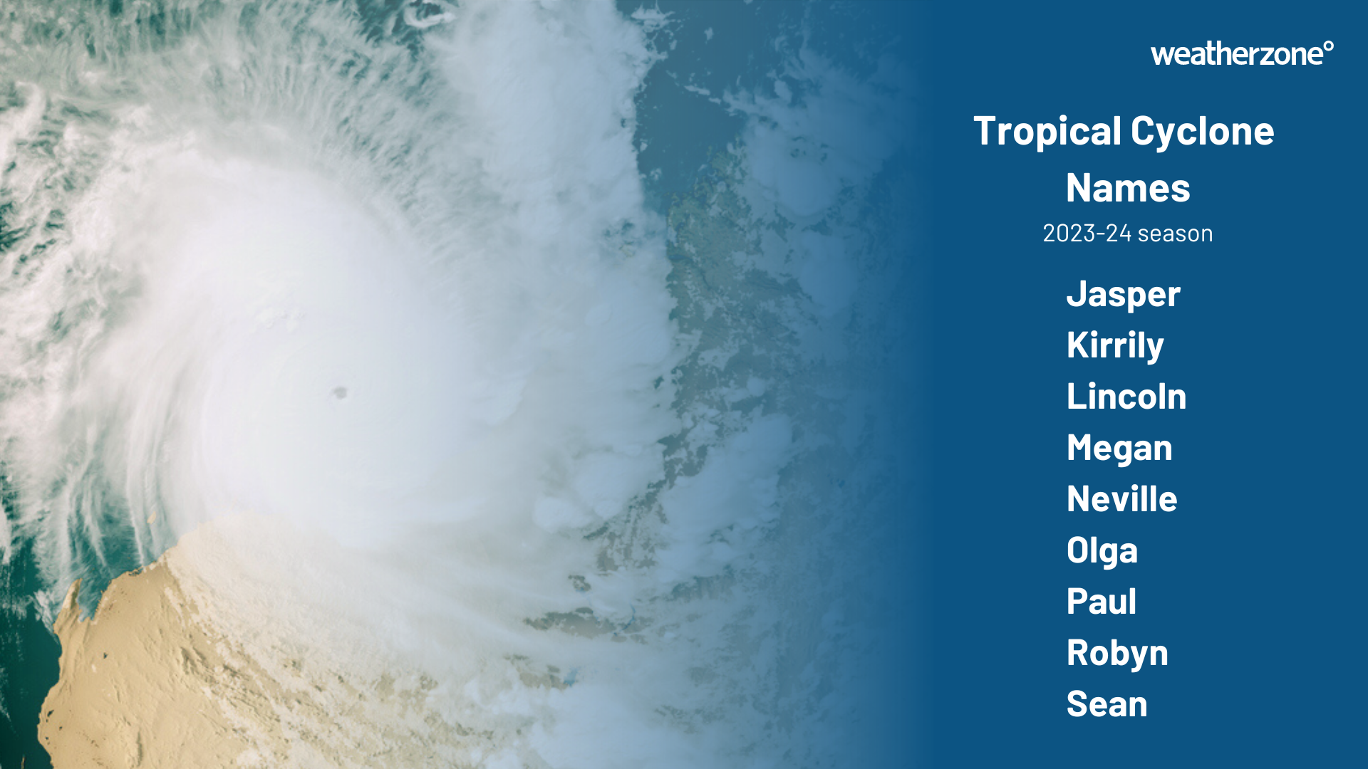
Image: Next nine names to be assigned to tropical cyclones that form in the Australian region.
For a detailed tropical cyclone briefing for your region, please contact us at business@weatherzone.com.au.