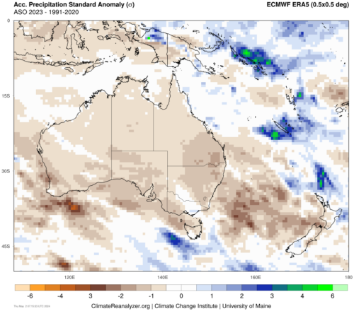
While the remainder of the country is experiencing cloudy and rainy conditions, Perth’s mercury is soaring this week.
A stubborn high-pressure system in the Bight is responsible for this heatwave, with hot and dry northeasterly winds prevailing over the west coast for a week.
Perth has already seen four consecutive days over 31 degrees to Tuesday, November 7, and there’s another three days on the forecast. In total, Perth is expected to reach seven consecutive days over 31 degrees.
The last time Perth saw a run of 7 consecutive days over 31 degrees this early in the season was 90 years ago, in 1931.
Tuesday’s temperature is forecast to top 37 degrees, while the peak of the heat is expected on Wednesday, with temperatures potentially reaching near 40 degrees. Wednesday’s heat is 10 degrees above the December average, and the hottest temperature Perth has seen in nine months.
The map below shows the heat across much of WA on Wednesday, December 8 at 2pm WST.
Unfortunately, there will be little relief Tuesday and Wednesday evening, with temperatures failing to drop below 21 degrees both nights. These overnight temperatures are 5-6 degrees above normal and are likely to have the people of Perth keeping their air conditioning on.
Severe heatwave conditions are also affecting northwestern WA for the next couple of days. Extremely hot and dry conditions over northern and central parts of the state are elevating fire danger in the area. The map below shows the Bureau of Meteorology’s 3-day heatwave forecast for Monday, Tuesday and Wednesday, December 8.
Severe Fire Danger is forecast for the following fire weather districts: East Pilbara Coast, West Pilbara Coast, East Pilbara Inland, Ashburton Inland, Gascoyne Inland and Inland Central West – North.
There is relief on the way Friday when a cool southwesterly change is forecast to arrive in Perth. On Friday and Saturday, the temperatures will remain at a pleasant 25 degrees.
For more information on Weatherzone’s 14 day temperature forecasting, including confidence interviews, risk of extreme heat and temperature profiles, please contact us at business@weatherzone.com.au.


