The rain-bearing low pressure trough that drenched central eastern NSW over the last four days will move further north during the next 24 to 48 hours with more flooding possible.
A near-stationary trough of low pressure near central NSW coast produced a lengthy spell of heavy rain in the Illawarra, Sydney and Hunter regions over the past four days.
Now, this trough is moving further north, with heavy rain and areas of flooding likely to spread over the state’s Hunter and Mid North Coast districts during the next 24 to 48 hours.
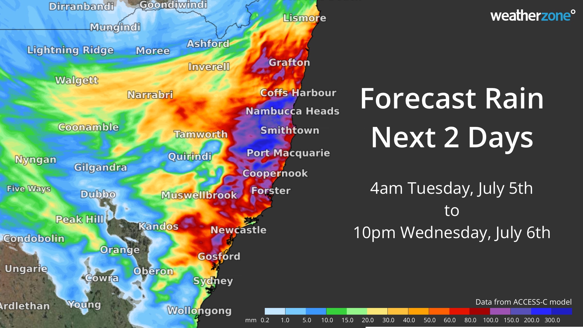
The map below shows how much rain one computer model is predicting during Tuesday and Wednesday combined, with the potential for more than 100 mm of rain in some areas over the next two days.
Image: Forecast accumulated rain between 4am on Tuesday and 10pm on Wednesday (AEST), according to the ACCESS-C model.
As rain spreads further north over the next two days, there is potential that it may be enhanced by a Tasman Low drifting close to the NSW coast. If this happens, rainfall totals may exceed 200 mm in some areas.
At 2pm AEST on Tuesday, a severe weather warning was in place of heavy rain and flash flooding in parts of the Hunter and lower Mid North Coast. A flood warning is also in place for moderate to major flooding in the Wollombi Brook and Lower Hunter River, while a flood watch is in effect for parts of the Mid North Coast from Wednesday.
At this stage, rain should ease on Thursday as the low moves away from the coast. However, this is a dynamic system and forecasts may change over the coming days. Be sure to check the latest warnings and forecasts for the most up-to-date information. For more information on our heavy rainfall, rainfall and our seasonal forecast, please contact us at business@weatherzone.com.au.


