The longest lasting heatwave Melbourne has seen in a season is expected from late this week, with the heat and wind expected to increase fire danger in Vic.
After a relatively quiet December and January on the heat front, Melbourne’s temperature climbed to 37.5°C on Sunday, February 4. This first burst of summer heat was very short lived with the temperatures swiftly dropping to 19.9°C early this week.
A second and longer lasting burst of heat is expected from Sunday, with daytime temperatures forecast to reach the low to mid 30’s for three consecutive days. This run of days above 30°C will be the first Melbourne has seen since February 2023.
A strong cold front that is forecast to sweep across Vic on Tuesday will cause hot and dry northwesterly winds to flow across the state.
The map below shows the temperatures reaching the high 30’s to low 40’s in northwestern Vic and over much of SA.
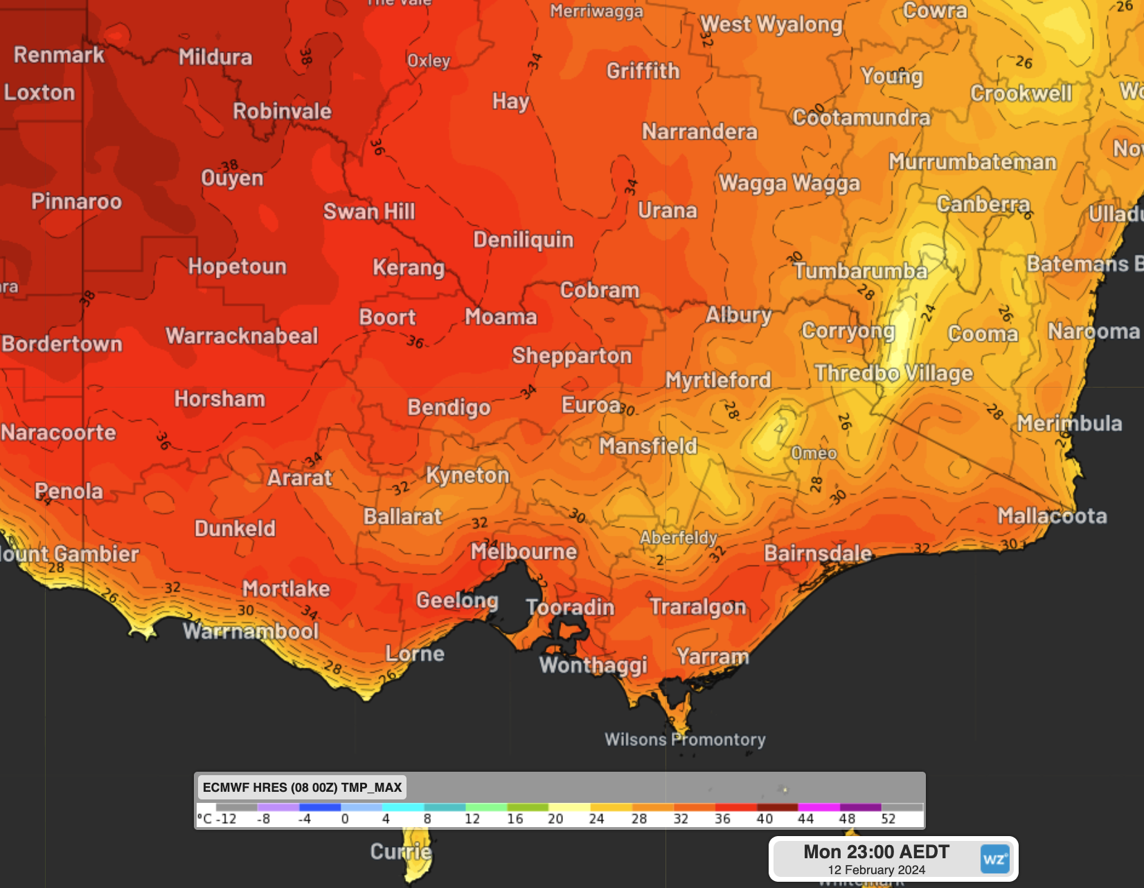
Image: Maximum temperature forecast on Monday, February 12, according to the ECMWF model.
While the heat will peak on Monday at around 35°C, a seabreeze should moderate temperatures in the afternoon and evening.
The overnight temperatures will also be warm on Sunday and Monday nights, with the temperature failing to drop below 21°C and 22°C respectively.
After a warm night, Tuesday’s temperature should climb rapidly into the 30’s as warm northwesterly winds strengthen ahead of a cold front.
These winds on Tuesday will be very strong and gusty, elevating fire danger in areas despite the recent rainfall in the state.
Thunderstorms and rain should increase in the afternoon and evening as the cold front sweeps across Vic. Warnings may be issued for thunderstorms and damaging winds, so keep an eye out here.
This cold front will bring a significant cool change, with temperatures plummeting to around 6°C below average on Wednesday.