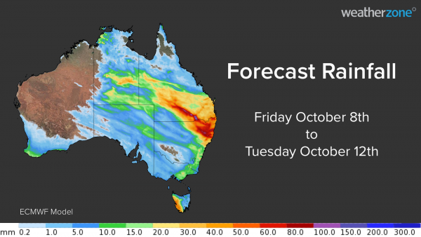
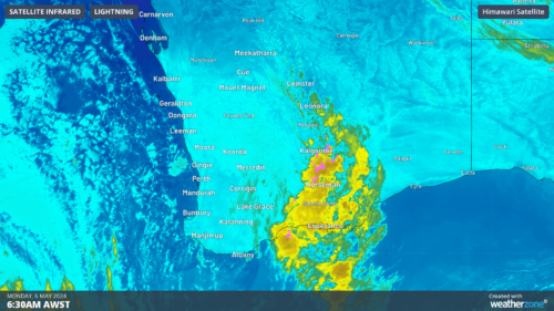
Australia’s wet October will continue over the next four days as a northwest cloud band delivers widespread rain and thunderstorms in parts of six states and territories. The map below shows how much rain one computer model is predicting between today (Friday) and Tuesday next week.
Rainfall totals of 5-15mm are likely over a broad area in central and eastern Australia, covering parts of the NT, SA, QLD, NSW, the ACT, VIC and TAS. Some areas in southern QLD and northern NSW could see more than 50mm during this event, with isolated pockets above 100mm possible, most likely with thunderstorms.
Showers and thunderstorms will start to develop over SA, VIC and TAS on Saturday as a cold front reaches southern Australia. Rainfall will mostly be light in the absence of thunderstorms. Rain will become more widespread over central and southeastern Australia on Sunday as a northwest cloud band starts to develop across the country. Several states will see rain on Sunday and thunderstorm activity will start to ramp up in central Australia.
On Monday, the cloud band will move further north and east and tap into increasing levels of moisture-laden air from the Coral Sea. This will result in widespread rain from the NT, across central and southern QLd, into northern and eastern NSW. Rain will be the main feature of this northwest cloud band on Monday, although some areas of the NT, southern QlLD and northern NSW could see thunderstorms.
On Tuesday, the rain will focus on southeast QLD and northeast NSW as the cloud band contracts towards the eastern seaboard. Models suggest that some areas will see heavy rain, with potential for more than 50mm on Tuesday alone.
The northwest cloud band is likely to reduce solar output across many states and territories from Sunday. Parts of NSW and QLD are likely to see thick cloud cover for two to three days, reducing solar output for longer periods in these areas. For more information on Weatherzone’s solar, rain thunderstorm forecasting services, please contact us at business@weatherzone.com.au.

