
Weatherzone Business offers a comprehensive suite of services, refined through years of collaboration with the marine, ports and offshore industries, to optimise the safety and efficiency of your operations.
We work with you to understand your intrinsic operational challenges and customise high-precision forecasting, metocean and aviation services to your exact location and operational scope.
When working offshore, our solutions can underpin planning and safe execution for offshore oil and gas enterprises and wind farms. Our data can support your exploration, development, rig moving, shuttle tanker operations, and production and decommissioning phases. Whether your crews are on-site, being transported to shore, or diving to perform maintenance, we deliver tailored weather risk briefings to ensure you choose the optimal time to proceed.
Weatherzone’s trusted nowcasting and forecasting system, OpticastTM, allows you to rapidly respond to changing conditions offshore, en route and in port. We take your port topography and berth orientation into account, ensuring site-specific forecasts. For offshore oil & gas, wind farms, ports and logistics, we have your weather situational awareness covered, no matter where you are. We deliver real-time severe weather and lightning alerts to your team via your integrated dashboard: Portzone, and our Weatherguard app.
Weatherzone’s Total Lightning Network (TLN) ensures you avoid hours of unnecessary downtime by providing the most accurate technology in lightning detection and alerting. Safeguard your teams and assets with lighting and Dangerous Thunderstorm Alerts (DTAs), customised to your existing parameters and delivered in real-time across all devices in your network. You gain full spatial awareness of developing severe weather systems, allowing you to plan ahead and, where needed, execute your shutdown and evacuation procedures.
With extreme conditions slowing production and affecting infrastructure, safety and transport, trust us to deliver Australia’s most precise weather data and tailored insight, giving you decisive confidence when it’s most needed.

We have developed Portzone – an interface that is tailored to your site, operations and weather risk, and is currently operational at most major ports and offshore facilities in Australia. Portzone delivers relevant and verified data in easily visualised formats, with tools and insights enabling you to make critical decisions quickly. High definition and easily viewed on phone, tablet, PC and large screen.
Gain both the awareness of local wind systems that are undetectable on general forecasting models, and the accuracy of our Total Lighting Network detection to <200m, with integrated alerting. Optimise your response to incoming severe weather.
Validated forecasting and real-time metocean data improve your marine safety and minimise unnecessary downtime. Gain the best visibility of any conditions that could potentially impact your supply chain and operations.
Our operational forecasts give you the foresight to plan effectively. Our data supports the safe and efficient execution of exploration, development, rig moving, production and decommissioning phases of your offshore oil and gas or wind project.

We thrive on challenge, next-generation science and customised service, and are dedicated to helping you stay ahead of the game.
Metocean Services
Our metocean services provide you with:
We customise to your exact requirements, and provide operation forecast summaries based on your marine infrastructure, both on and offshore.
Weatherguard App
Mobile access to areas of interest, forecasts, operational windows and alerting for severe weather and lightning is delivered via our Weatherguard App. Custom built to ensure the effective and timely communication of key data across your team, whether they are on-site, at sea or on shore.
We work to bring you complete situational awareness – offshore, in transit and in the air – so you can mitigate risk and maximise your productivity and profits.

Welcome rain is coming to the parched southwest WA this week, possibly including Perth and Bunbury which are both having their driest 7 months on record. Many locations in the southwest will see the driest April on record, with much of this rainfall likely to contribute to May’s totals, as a cold front approaches the […]
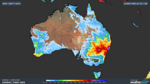
Rain and thunderstorms will soak parts of eastern and southwestern Australia this week, bringing drought relief in WA and a risk of flooding in NSW. A series of upper-level troughs and low pressure systems will trigger multiple days of rain and thunderstorms over Australia this week. In WA, showers and thunderstorms will develop over the […]

It’s been one of those days when Australia’s two largest cities could hardly have been more different in terms of weather. Never mind the tedious old arguments about the food, coffee, culture, sport, traffic, scenery and the rest of it in the two cities. On this autumn Wednesday, Melbourne feels like winter while Sydney feels […]

Rain will soak parts of WA over the coming week, although forecast models are struggling to agree on whether this burst of wet weather will bring much-needed rain to parched Perth. This rainfall will be caused by a low pressure trough extending from the Kimberley down to southwestern WA from late Thursday, with a low […]
