POWERING SMARTER WEATHER DECISIONS
Search

Flooding in outback Qld, NSW seen from space

Satellites have captured images of floodwaters filling rivers and lakes in southwest Qld and northwest NSW, following heavy rain from ex-Tropical Cyclone Kirrily.

Clouds, rain and thunderstorms have been a persistent feature over Australia’s eastern inland during the last fortnight. This late-summer soaking was caused by the overland journey of ex-Tropical Cyclone Kirrily, which made landfall near Townsville on January 25 before lingering over eastern Australia for around 12 days.

Flooding in outback Qld NSW seen from space

Flooding in outback Qld NSW seen from space

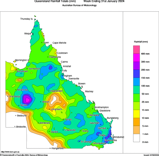
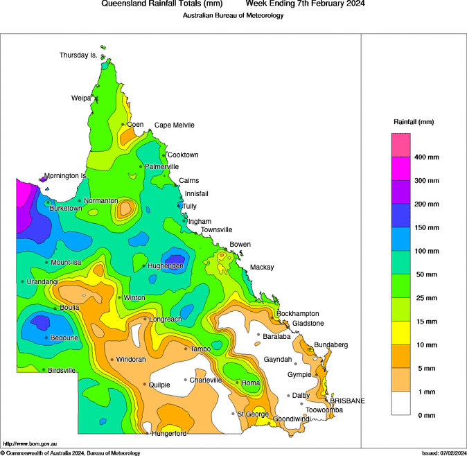
Images: Observed rainfall during the last week of January (top) and first week of February (bottom). Source: Bureau of Meteorology.

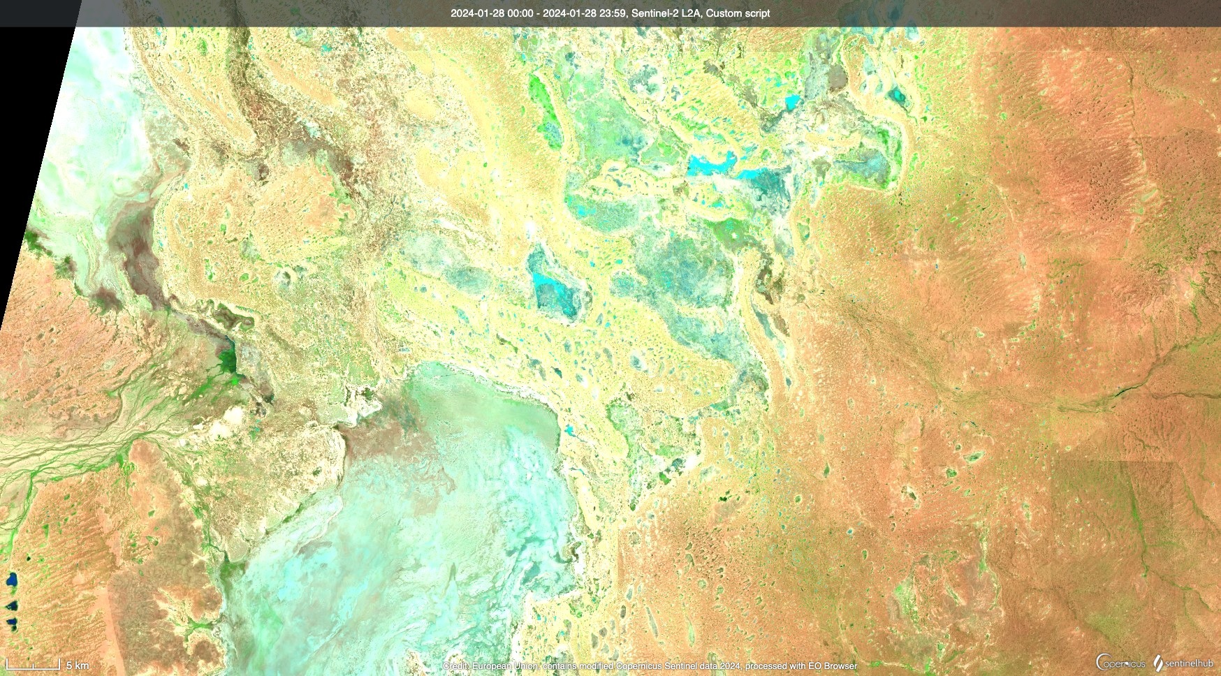
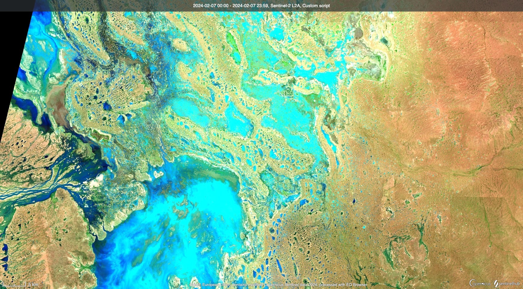
The rain delivered by Kirrily’s remnant low pressure system in the last couple of weeks has transformed the landscape across far western Qld and northwest NSW.

Once dry riverbeds are now flowing with water and large lakes have filled to produce what looks like inland oceans across the relatively flat landscape.

The satellite images below show the remarkable transformation that has occurred over the last couple of weeks.

Flooding in outback Qld NSW seen from space

Flooding in outback Qld NSW seen from space

Images: Enhanced infrared satellite images showing the Narriearra Caryapundy Swamp National Park area to the east of Tibooburra and south of the Qld-NSW border. Top image captured on January 28, 2024, and bottom image on February 7, 2024. Source: Sentinel Hub EO Browser

Flooding in outback Qld NSW seen from space

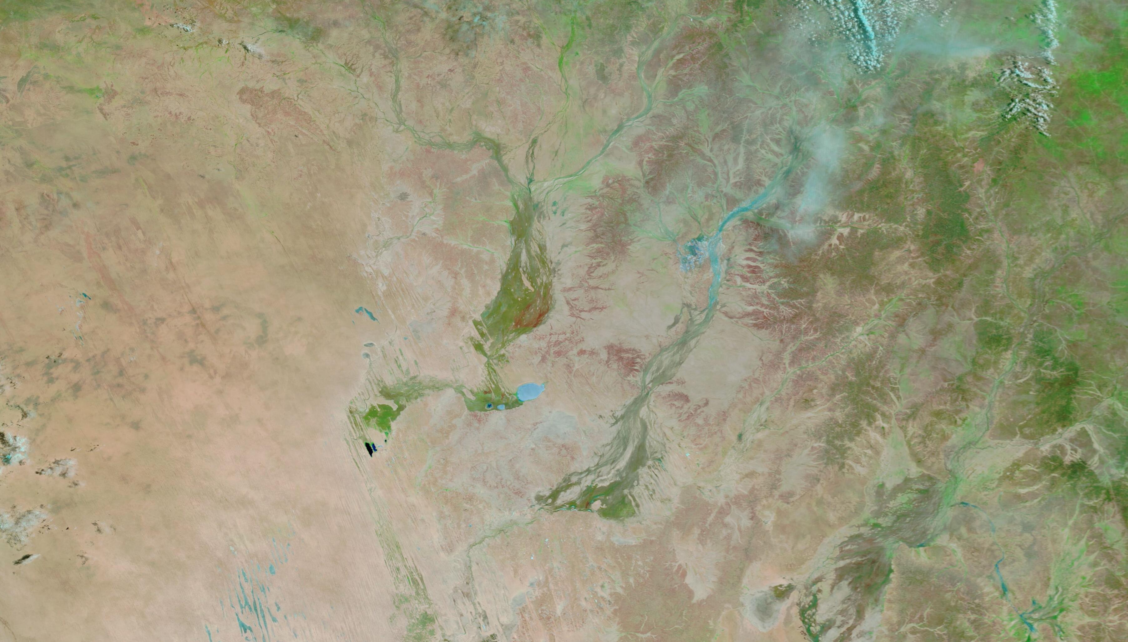
Images: Enhanced infrared satellite images showing the Diamantina River and Eyre Creek in southwest Qld. Top image captured on January 25, 2024, and bottom image on February 6, 2024. Source: NASA Worldview

You can check the latest flood warnings for the most up-to-date information on the ongoing flooding in Australia’s central and eastern interior. For more information on heavy rainfall and flood forecasts, please contact us a business@weatherzone.com.au.

Latest news

Satisfy your weather obsession with these news headlines from around the nation, and the world.

Perth’s first wetter-than-average month in more than a year

Another showery night in Perth has delivered enough rain to make this Perth’s first wetter-than-average month in more than one year. The animation below shows showers streaming over Perth and other areas of southwestern Australia late on Thursday. This wet weather was caused by persistent onshore winds along the west coast of WA, and the […]

Prolonged cold outbreak for southeastern Australia

A frigid airmass originating from Antarctica is on its way to Australia on Friday, with the southeastern states expected to shiver through a prolonged cold spell.  This airmass will arrive behind a cold front over the weekend and will linger over southeastern Aus well into next week.  The satellite image below shows the cold front […]

A stormy taste of spring for NSW and Qld

The weather is feeling quite spring-like over northern NSW and southern Queensland, with warm days, smoke from hazard reduction burns and even a chance of thunderstorms on Thursday and Friday. Northerly winds ahead of a trough and cold front are creating a very mild winter’s day, with temperatures 4-7 degrees above the July average across […]

Could Australia see a negative IOD in 2024?

A wet spring could be on the cards for large parts of Australia, with several models suggesting a negative Indian Ocean Dipole could develop in the Indian Ocean.  A negative Indian Ocean Dipole (IOD) refers to a pattern of sea surface temperatures in the tropical Indian Ocean that causes more moisture-laden air to flow towards […]