Even the fabled Fremantle Doctor has been running a fever as Perth gets close to racking up a record-challenging number of 35ºC this summer.
Perth suffered a pair of very hot days towards the end of last week, with temperatures reaching 42.0ºC on Friday and 42.3ºC on Saturday.
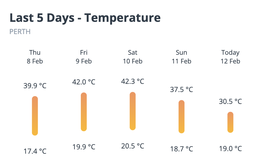
Image: Perth’s minimum and maximum temperatures over the last five days, as of 11:00am AWST on Monday.
On hot summer days like these, Perth locals await the cooling effect of the onshore winds that typically develop in the late morning or afternoon, known affectionately by locals as the Fremantle Doctor.
Unfortunately, the Fremantle Doctor wasn’t as relieving as it can be on the weekend. Despite winds blowing from the southwest at 4pm AWST on Saturday, the temperature was still up at 36.5ºC in Perth.
On Sunday, winds coming predominantly from the west or south were also unable to bring temperatures down too much for Perth. The city’s high of 37.5ºC on Sunday was about 6ºC above average for this time of year, and by 7pm AWST it was still over 30ºC.
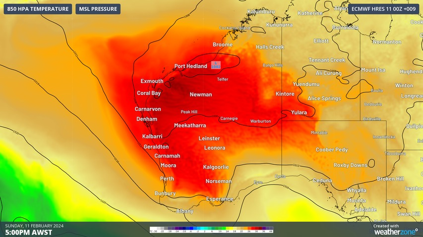
So, why are Perth’s onshore winds blowing warmer than usual? It’s due to a pool of warm air sitting near the coast, drawn into the region from the state’ Gascoyne and Central West districts.
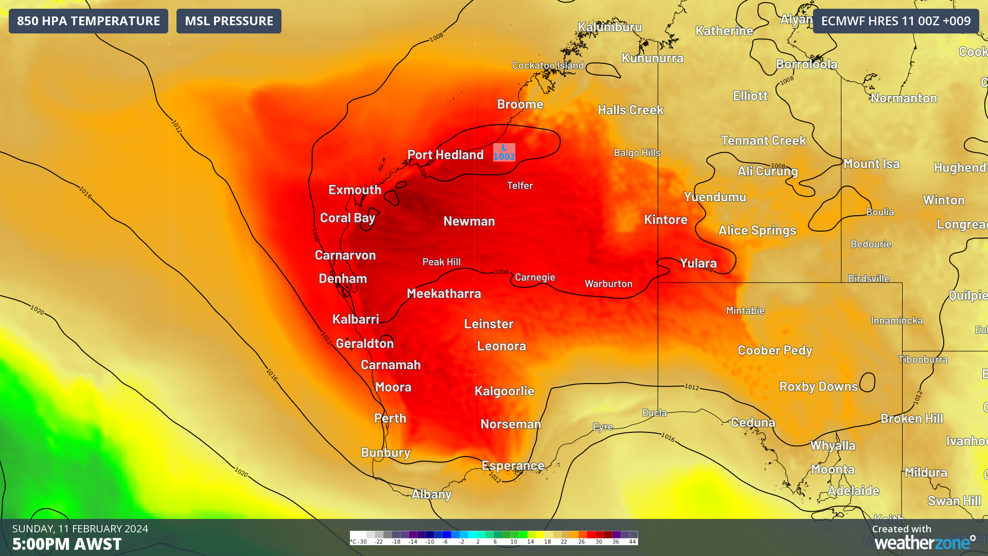
Image: Modelled 850 hPa temperatures, showing warm air sitting about 1.5 km above sea level on Monday.
Warmer than average sea surface temperatures off the southwest coast of WA are also adding to the abnormal warmth of the onshore winds.
Today, Monday February 12, will be Perth’s 22nd day at or above 35ºC so far this summer. With maximums forecast to reach or exceed the mid-thirties on most days this week, the city has a shot at racking up more 30 days above the 35ºC mark before the end of the season.
Based on data from Perth’s current Metro and old Regional Office weather stations, the city’s highest number of days at or above 35ºC during summer was 32 in the 2021-22 season.
You can’t control the weather, but you can gain precision insights to optimise your response. What lights us up is providing your energy business with tailored weather information to reduce your risk and keep you moving ahead of the curve.
Our services cover all aspects – from wind and solar generation to demand forecasts, wholesale markets to retail so, no matter where your company sits, we have solutions for you. We have worked closely with market participants to create products that meet the evolving needs of the sector, aiming to increase safety and profitability for our customers.
Benefit from the timely delivery of accurate weather information, allowing informed and effective decision-making. For more information, please contact us at business@weatherzone.com.au.