POWERING SMARTER WEATHER DECISIONS
Search

Another hot week in Perth


Perth could get close to 40ºC on each of the next five days as a Severe Heatwave grips Australia’s west coast.

A near-stationary high pressure ridge over WA and a persistent West Coast Trough will direct a stream of hot easterly winds over Australia’s west coast during the remainder of this week.

This synoptic setup is common in summer, and it’s known to produce lengthy heatwaves in Perth as hot offshore winds delay the Fremantle Doctor.

Maximum temperatures are likely to reach 38 to 40ºC in Perth every day between Tuesday and Saturday, and could hit around 34 to 37ºC each day from this Sunday until Wednesday next week.
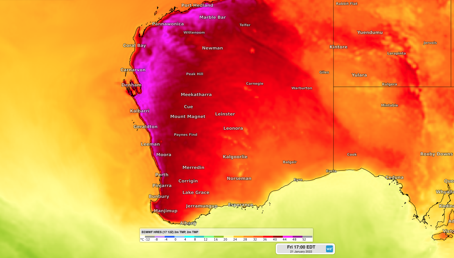
Image: Forecast surface air temperature along the west coast on Friday afternoon, according to the ECMWF model.

This week-long run of hot days continues a sweaty start to summer in the WA capital city.

Perth registered five days at or above 40ºC in December, which hasn’t happened since 1997. Four of these 40ºC days were consecutive, which is a feat that’s only happened on two other occasions in the records dating back to 1897.

This week’s heat will cause a Severe to locally Extreme Heatwave in western coastal districts of WA, from the Southwest Capes up to Exmouth.

This persistent heat will contribute to Very High to Extreme fire danger ratings over the coming week. For more information on Weatherzone’s temperature, extreme temperature and fire forecasting, please contact us at business@weatherzone.com.au.

Latest news

Satisfy your weather obsession with these news headlines from around the nation, and the world.

Heaviest May rainfall in 82 years recorded in WA town

Parched areas of southwest WA have finally seen some rain this week, with Wandering recording its highest May rainfall in more than 82 years and the most rainfall the town has seen in 13 months.   The rain event began on Wednesday, with Bunbury recording a 2-day total of 55 mm to 9am on Friday, […]

Rain and storms spreading across NSW

A three-day soaking has begun in NSW, with rain and thunderstorms expected to spread across most of the state over the next 72 hours. An upper-level cut-off low will pass over NSW from west to east between Friday and Sunday. As this upper low crosses NSW, it will interact with moisture-laden air to produce widespread […]

Will another positive Indian Ocean Dipole brew in 2024?

Signs are pointing to the second consecutive positive Indian Ocean Dipole (IOD) developing in the next few months. However, May is shaping up to be a time to make-or-break this event.  What is a positive IOD?  The IOD is a coupled ocean-atmosphere climate driver that changes the circulation patterns over the Indian Ocean. A positive […]

400km line of severe thunderstorms lashing southwest WA

A line of severe thunderstorms is moving onshore towards the southwest of WA, which could produce heavy rainfall and large hail on Thursday morning. These thunderstorms are forming on a trough offshore ahead of an approaching cold front and sweeping across the region. The image below shows a shelf cloud over Bunbury on Thursday morning. […]