
The shifting climate is bringing increasingly severe weather events, so it’s time to safeguard your business against the potential damage lightning can cause.
Our Total Lightning Network is the intelligent solution that goes above and beyond to increase your lead time before the storm hits.
We ultilise a vast global sensor network, created with our partner Earth Networks. Over 1200 sensors in 40+ countries provide a worldwide view of both intra-cloud (IC) and cloud-to-ground (CG) lightning strikes, enabling businesses to plan and respond with the most precise insight available.
Offering unsurpassed accuracy, with real-time detection to <200m, we integrate with your existing systems to keep your enterprise operating within your defined severe weather thresholds.
Leave nothing to chance. Be confident working outdoors with the most sophisticated lightning alerting system, delivering intelligence to any device across your business network.

The Total Lightning Network is a high precision solution to manage the threat of severe storm damage to your business. The highest density of sensors across Australia and the globe give you the edge.
Real-time detection and alerting enhance safety outcomes whilst also preventing costly shutdowns caused by inaccurate sensor data.
You will be supported by the dedicated Weatherzone Business team, who are driven to make your operational decisions easier.
Severe weather alerts are issued via our Weatherguard app to any device across your business, allowing everyone to plan and respond quickly.
Stormtracker, our Geographic Information System (GIS), plots live lightning strikes to enhance your immediate spatial visualisation of storms.
The Total Lightning Network is meticulously maintained, ensuring efficiency and accuracy, and a system uptime of 99.9%.

The Total Lightning Network is a key consideration across many industries. If your business or supply chain operates out in the open or in the air, your company could be at risk.
Visualise approaching storms as our customisable GIS system, Stormtracker, plots lighting strikes across your site and infrastructure. This enables enhanced understanding of the potential risk inherent in each severe weather system. Personal push notifications give users real-time severe weather and lightning alerts, based on their phone’s GPS position, enhancing their awareness of personal risk.
Lightning strike history is archived for over 5 years, enabling you to extract the reportable data required for risk assessments or insurance claims.

Welcome rain is coming to the parched southwest WA this week, possibly including Perth and Bunbury which are both having their driest 7 months on record. Many locations in the southwest will see the driest April on record, with much of this rainfall likely to contribute to May’s totals, as a cold front approaches the […]
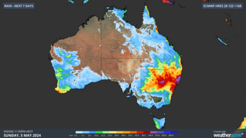
Rain and thunderstorms will soak parts of eastern and southwestern Australia this week, bringing drought relief in WA and a risk of flooding in NSW. A series of upper-level troughs and low pressure systems will trigger multiple days of rain and thunderstorms over Australia this week. In WA, showers and thunderstorms will develop over the […]

It’s been one of those days when Australia’s two largest cities could hardly have been more different in terms of weather. Never mind the tedious old arguments about the food, coffee, culture, sport, traffic, scenery and the rest of it in the two cities. On this autumn Wednesday, Melbourne feels like winter while Sydney feels […]

Rain will soak parts of WA over the coming week, although forecast models are struggling to agree on whether this burst of wet weather will bring much-needed rain to parched Perth. This rainfall will be caused by a low pressure trough extending from the Kimberley down to southwestern WA from late Thursday, with a low […]
