The remnants of Severe Tropical Cyclone Megan will carry heavy rain across the NT over the next few days as communities assess the damage in the powerful system’s wake.
Megan made landfall as a category three severe tropical cyclone on Monday afternoon, crossing the coast to the southeast of Port McArthur. The tropical cyclone caused powerful winds and torrential rain over the southwest Gulf of Carpentaria as it approached and crossed the coast.
Centre Island, which experienced the brunt of Megan’s severe weather, registered wind gusts of up to 170 km/h on Monday afternoon. It also received more than 500 mm of rain during the 48 hours ending at 8 am ACST on Tuesday, which is roughly half a year’s worth of rain for the island.
Residents in the town of Borroloola had to hunker down and ride out Megan’s ferocious weather, taking shelter in the police station and other buildings capable of withstanding a severe tropical cyclone.
Borroloola’s weather station received just over 300 mm of rain during the 24 hours ending at 3:05am ACST on Tuesday, which was more than a month’s worth of rain at this time of year.
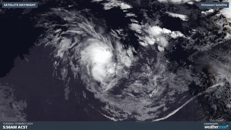
Video: Satellite images capture xx-Tropical Cyclone Megan moving over the NT on Tuesday morning.
The McArthur River at Borroloola exceeded the minor flood level on Monday night and has continued to rise throughout Tuesday morning. At 7:45 am AECT on Tuesday, the river was up to 11.76 m, which is 2 m below the moderate flood level.
Megan weakened quickly after making landfall and by 6:30 am ACST on Tuesday, the system had been downgraded to a tropical low as it moved inland to the south of Borroloola.
Ex-Tropical Cyclone Megan will continue to move inland over the NT’s Interior over the next few days. This has prompted a severe weather warning for heavy, locally intense rainfall and damaging winds, along with a flood watch.
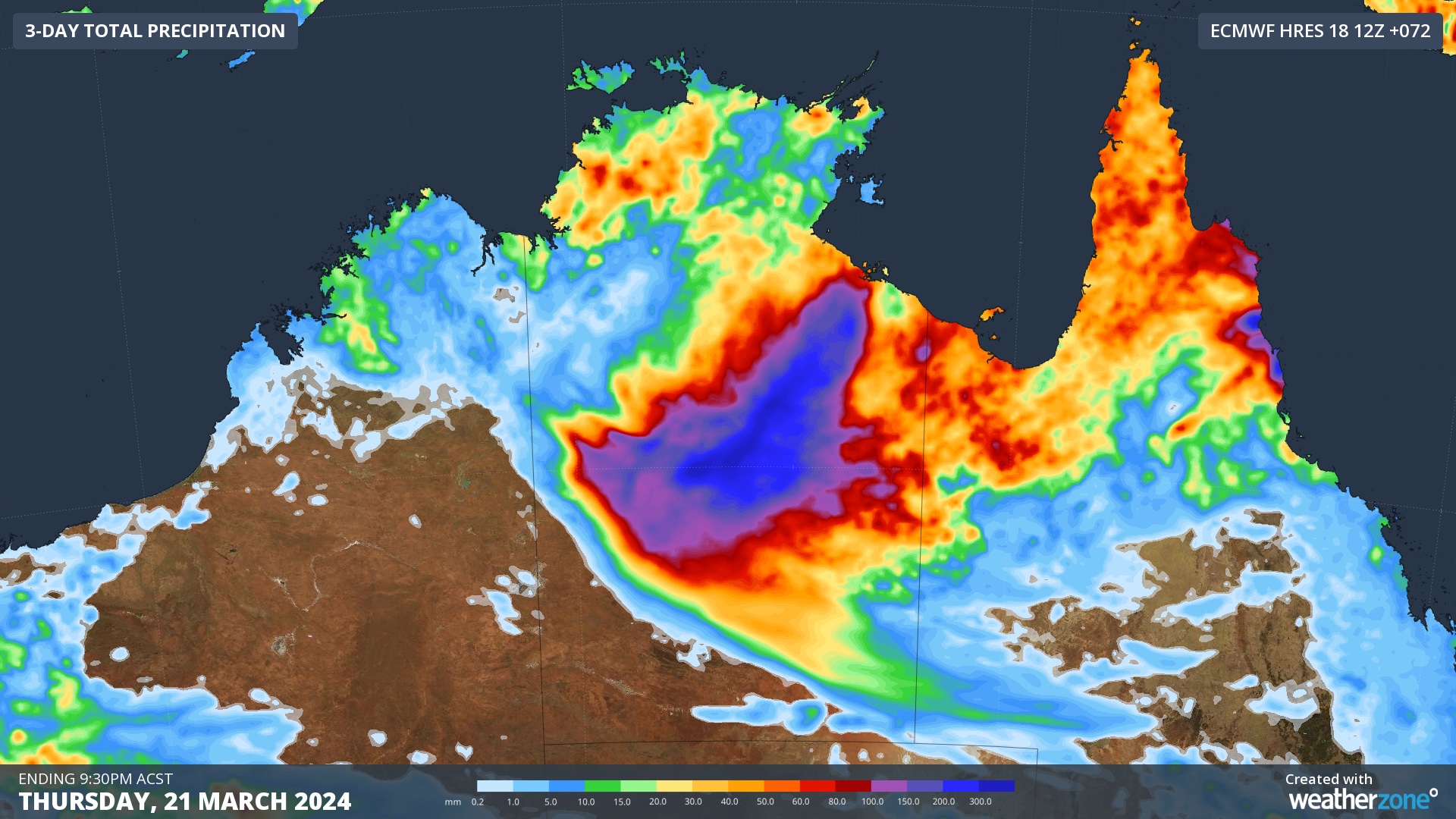
Image: Forecast accumulated rain during the 72 hours ending at 9:30am ACST on Thursday, March 21, 2024, according to the ECMWF-HRES model
This inland rain is going to be falling over areas that are still holding water from recent rainfall, meaning rivers remain elevated in some areas, which may exacerbate flooding. Some inland roads may be cut off by floodwater later this week, including primary highways, so be sure to check road conditions before travelling. For more information on our heavy rainfall forecasting, please contact us at business@weatherzone.com.au.